Frankfurt to San Jose Del Cabo is 6,133 miles (9,871 km), a flight of about 13 hours 30 minutes.
The Land's End arrival view on the right is one of the more dramatic coastal approaches in North America. While the Frankfurt left-side departure has good city views, the Cabo arrival on the right edges it out for sheer visual payoff. Sit right for the full flight if you want the best of both — you will also see Greenland's ice sheet and parts of the Canadian Arctic on the right side during the transatlantic crossing.
Flight Path
The route tracks northwest over the UK and Ireland, then crosses the North Atlantic near southern Greenland where the ice sheet edge is visible. The flight passes over the Canadian Maritime provinces and Quebec, then cuts southwest over the central United States — Great Plains states like Kansas and Oklahoma are visible — before crossing northern Mexico's Sonoran Desert and descending along the Baja California Peninsula over the Sea of Cortez.
Great circle distance and headings ›


Phase by phase
Takeoff from FRA
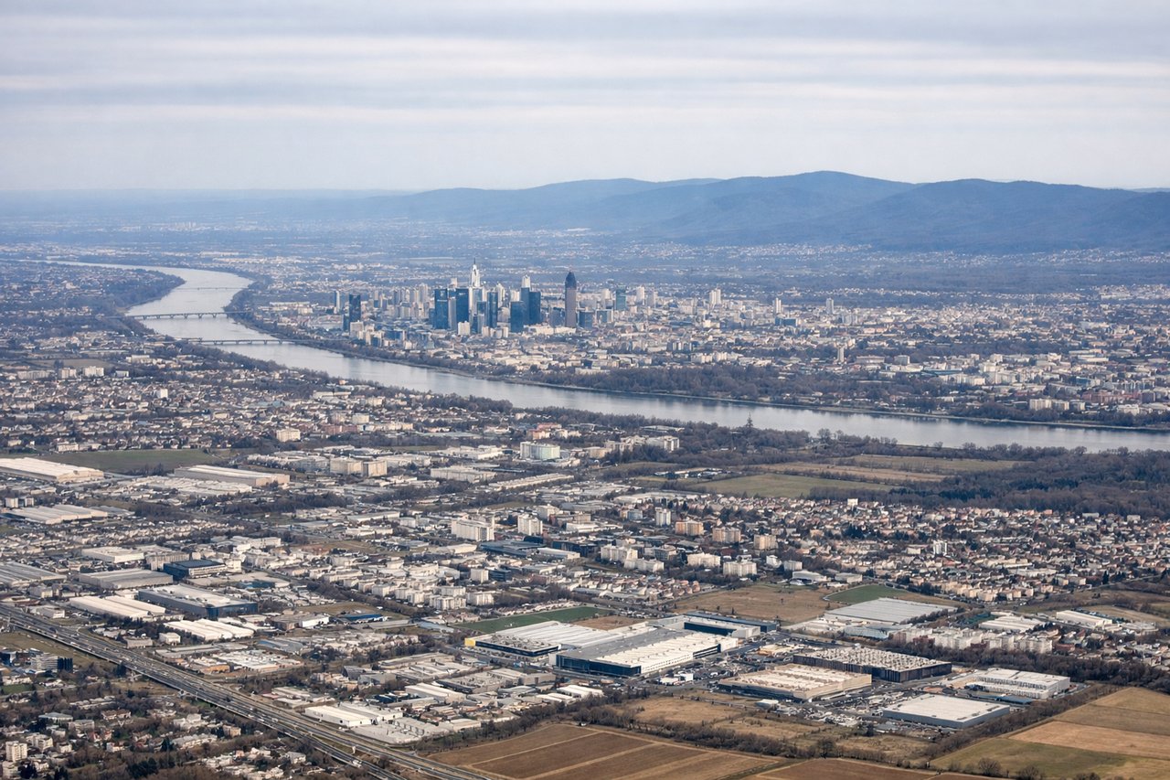
LEFTFrankfurt departures on runway 07L/07R head eastward before turning west-northwest toward the Atlantic. Left side gives you the Frankfurt city skyline and the Main River bending through the city. Right side faces industrial areas south of the airport.
Landing at SJD
RIGHTLos Cabos typically uses runway 16 for arrivals from the north, meaning the aircraft approaches from the north heading south. The right side faces west over the Pacific Ocean and the dramatic rocky tip of the Baja Peninsula at Land's End, while the left side looks inland over desert scrub.
Landmarks on this routeAll landmarks →
Will your flight be in sunlight?
Pick a date and time in the Sun Map to watch the sun move across your whole flight.
About This Route
Which side of the plane should I sit on flying from Frankfurt Main (FRA) to Los Cabos International (SJD)?
Sit on the Right side of the plane for the best views on flights from Frankfurt to San Jose Del Cabo. The Land's End arrival view on the right is one of the more dramatic coastal approaches in North America. While the Frankfurt left-side departure has good city views, the Cabo arrival on the right edges it out for sheer visual payoff. Sit right for the full flight if you want the best of both — you will also see Greenland's ice sheet and parts of the Canadian Arctic on the right side during the transatlantic crossing.
What can I see during takeoff from Frankfurt Main in Frankfurt?
During takeoff from Frankfurt Main (FRA), sit on the Left side for the best views. Frankfurt departures on runway 07L/07R head eastward before turning west-northwest toward the Atlantic. Left side gives you the Frankfurt city skyline and the Main River bending through the city. Right side faces industrial areas south of the airport. Notable sights include: Frankfurt Skyline (Bankenviertel skyscrapers), Main River curves, Taunus Hills to the north, Rhine River valley visible as you climb.
What can I see when landing at Los Cabos International in San Jose Del Cabo?
When landing at Los Cabos International (SJD), sit on the Right side for the best views. Los Cabos typically uses runway 16 for arrivals from the north, meaning the aircraft approaches from the north heading south. The right side faces west over the Pacific Ocean and the dramatic rocky tip of the Baja Peninsula at Land's End, while the left side looks inland over desert scrub. Notable sights include: Land's End rock arch at Cabo San Lucas, Pacific Ocean coastline, Sea of Cortez visible to the east on left side, Sierra de la Laguna mountains inland.
How long is the flight from Frankfurt to San Jose Del Cabo?
The flight from Frankfurt Main (FRA) to Los Cabos International (SJD) takes about 13 hours 30 minutes. The shortest flight path between them is 6,133 miles (9,871 km); winds and air traffic control usually add a few percent.
What does the Frankfurt to San Jose Del Cabo flight path pass over?
The route tracks northwest over the UK and Ireland, then crosses the North Atlantic near southern Greenland where the ice sheet edge is visible. The flight passes over the Canadian Maritime provinces and Quebec, then cuts southwest over the central United States — Great Plains states like Kansas and Oklahoma are visible — before crossing northern Mexico's Sonoran Desert and descending along the Baja California Peninsula over the Sea of Cortez.