Fukue to Tokyo is 657 miles (1,058 km), a flight of about 2 hours.
The right side captures the most visually distinctive features: the Goto Islands during departure and the approach to Tokyo Bay and surrounding terrain during descent. The left side offers Mount Fuji on landing, but the right provides more consistent scenic interest across both phases.
Flight Path
The flight path crosses the East China Sea and approaches the Kyushu-Honshu region. Notable midpoint geography includes the Tsushima Strait area (visible to the north), the transition from open water to the densely populated Kanto region, and the approach corridor over Chiba Prefecture before final descent into Haneda.
Great circle distance and headings ›

Phase by phase
Takeoff from FUJ
RIGHTRight-side seats offer views of Goto Islands and the East China Sea as the aircraft climbs northeastward from Fukue. The archipelago's rugged coastlines and scattered islands create distinctive visual patterns against the water.
Landing at HND
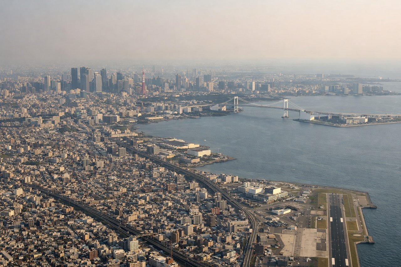
LEFTLeft-side seats provide excellent views during descent into Tokyo as the aircraft approaches from the southwest. Passengers see Mount Fuji (weather permitting) on the western horizon, followed by the Kanto Plain's urban sprawl and Tokyo Bay's distinctive geography.
Landmarks on this routeAll landmarks →
Will your flight be in sunlight?
Pick a date and time in the Sun Map to watch the sun move across your whole flight.
About This Route
Which side of the plane should I sit on flying from Fukue (FUJ) to Tokyo International (HND)?
Sit on the Right side of the plane for the best views on flights from Fukue to Tokyo. The right side captures the most visually distinctive features: the Goto Islands during departure and the approach to Tokyo Bay and surrounding terrain during descent. The left side offers Mount Fuji on landing, but the right provides more consistent scenic interest across both phases.
What can I see during takeoff from Fukue in Fukue?
During takeoff from Fukue (FUJ), sit on the Right side for the best views. Right-side seats offer views of Goto Islands and the East China Sea as the aircraft climbs northeastward from Fukue. The archipelago's rugged coastlines and scattered islands create distinctive visual patterns against the water. Notable sights include: Goto Islands (immediate offshore), East China Sea, Kyushu's northwestern coastline, Nagasaki Prefecture terrain.
What can I see when landing at Tokyo International in Tokyo?
When landing at Tokyo International (HND), sit on the Left side for the best views. Left-side seats provide excellent views during descent into Tokyo as the aircraft approaches from the southwest. Passengers see Mount Fuji (weather permitting) on the western horizon, followed by the Kanto Plain's urban sprawl and Tokyo Bay's distinctive geography. Notable sights include: Mount Fuji (western horizon), Kanto Plain urban grid, Tokyo Bay, Boso Peninsula.
How long is the flight from Fukue to Tokyo?
The flight from Fukue (FUJ) to Tokyo International (HND) takes about 2 hours. The shortest flight path between them is 657 miles (1,058 km); winds and air traffic control usually add a few percent.
What does the Fukue to Tokyo flight path pass over?
The flight path crosses the East China Sea and approaches the Kyushu-Honshu region. Notable midpoint geography includes the Tsushima Strait area (visible to the north), the transition from open water to the densely populated Kanto region, and the approach corridor over Chiba Prefecture before final descent into Haneda.