While the Guwahati departure offers immediate river and plateau scenery, the Navi Mumbai landing provides more distinctive visual variety: coastal estuary, mangrove ecosystems, port infrastructure, and distant metropolitan skyline. The landing sequence (3.0) outweighs the takeoff (2.5), and the right side captures both the approach drama and the urban-coastal transition better than the left side's flatter plains-dominated cruise segment.
Flown GAU to NMI? Did we get it right?
Flight Path
Guwahati to Navi Mumbai is 1,278 miles (2,057 km), a flight of about 3 hours 10 minutes.
The flight path crosses central India from northeast to southwest, passing over the Deccan Plateau region. Notable features include the Vidarbha plateau (eastern Maharashtra), the Godavari River basin (visible as a linear green corridor in the landscape), and the transition from forested uplands to the coastal plains approaching the Arabian Sea. The terrain gradually descends from ~2,000 feet elevation in the plateau to sea level at the coast.
Great circle distance and headings ›Phase by phase
Takeoff from GAU
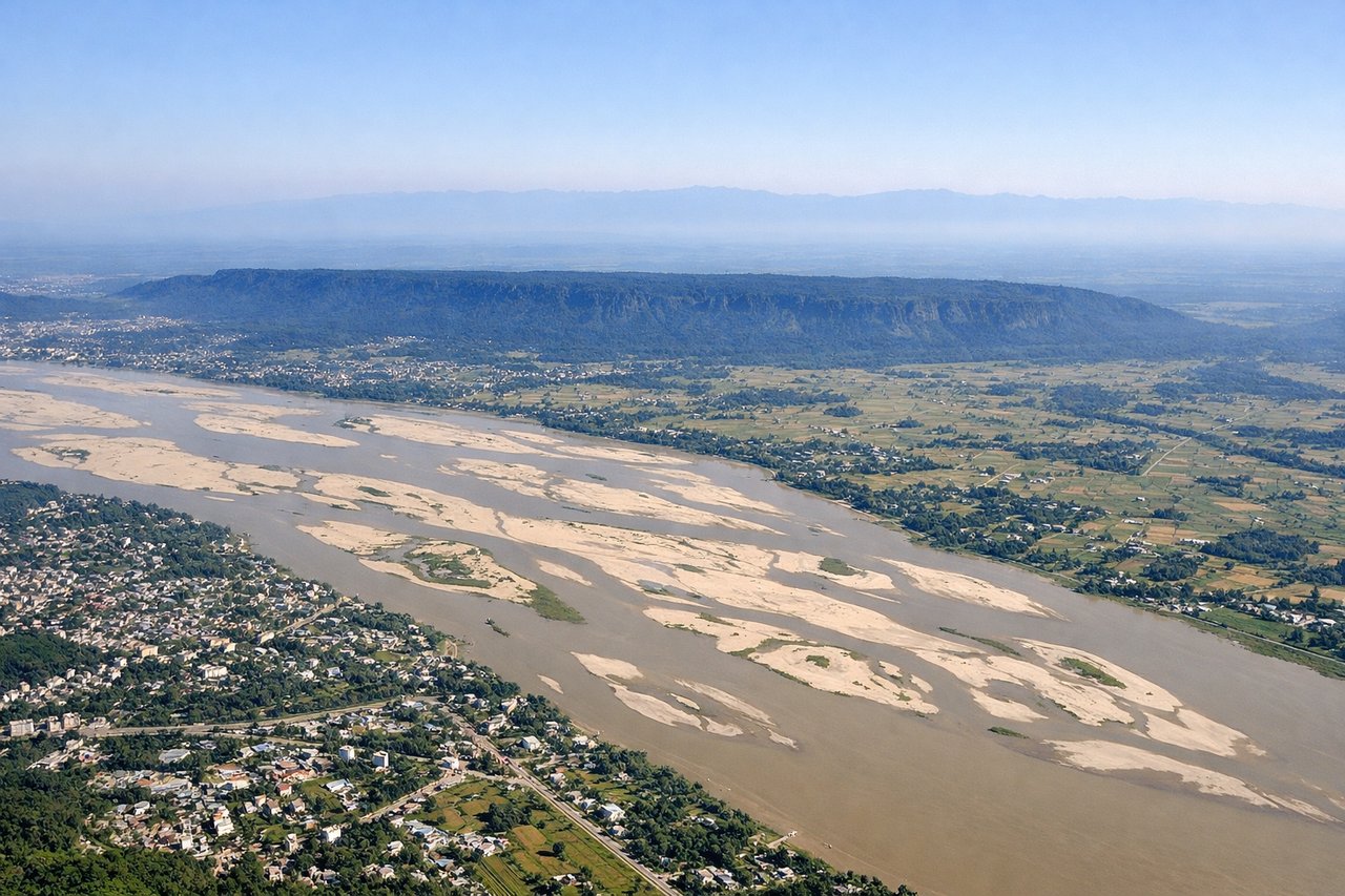
LEFTGuwahati sits on the Brahmaputra River with the Shillong Plateau rising to the south. Left-side departures capture the river valley and forested hills immediately after takeoff, offering more immediate terrain variation than the right side's flat Assam plains.
Landing at NMI
RIGHTNavi Mumbai's approach from the east crosses the Arabian Sea and enters the Thane Creek estuary system, offering coastal and harbor scenery. The right side captures the creek network, mangrove areas, and the industrial/port infrastructure of Navi Mumbai and Thane, plus views of the Mumbai metropolitan area across the water.
Will your flight be in sunlight?
Pick a date and time in the Sun Map to watch the sun move across your whole flight.
About This Route
Which side of the plane should I sit on flying from Lokpriya Gopinath Bordoloi International Airport (GAU) to Navi Mumbai International Airport (NMI)?
Sit on the Right side of the plane for the best views on flights from Guwahati to Navi Mumbai. While the Guwahati departure offers immediate river and plateau scenery, the Navi Mumbai landing provides more distinctive visual variety: coastal estuary, mangrove ecosystems, port infrastructure, and distant metropolitan skyline. The landing sequence (3.0) outweighs the takeoff (2.5), and the right side captures both the approach drama and the urban-coastal transition better than the left side's flatter plains-dominated cruise segment.
What can I see during takeoff from Lokpriya Gopinath Bordoloi International Airport in Guwahati?
During takeoff from Lokpriya Gopinath Bordoloi International Airport (GAU), sit on the Left side for the best views. Guwahati sits on the Brahmaputra River with the Shillong Plateau rising to the south. Left-side departures capture the river valley and forested hills immediately after takeoff, offering more immediate terrain variation than the right side's flat Assam plains. Notable sights include: Brahmaputra River (wide, meandering), Shillong Plateau escarpment (southern horizon), Guwahati city sprawl along riverbanks, forested foothills of Meghalaya.
What can I see when landing at Navi Mumbai International Airport in Navi Mumbai?
When landing at Navi Mumbai International Airport (NMI), sit on the Right side for the best views. Navi Mumbai's approach from the east crosses the Arabian Sea and enters the Thane Creek estuary system, offering coastal and harbor scenery. The right side captures the creek network, mangrove areas, and the industrial/port infrastructure of Navi Mumbai and Thane, plus views of the Mumbai metropolitan area across the water. Notable sights include: Thane Creek and estuary mangroves, Navi Mumbai port and industrial zones, Mumbai skyline across the water (distant), Arabian Sea coastline.
How long is the flight from Guwahati to Navi Mumbai?
The flight from Lokpriya Gopinath Bordoloi International Airport (GAU) to Navi Mumbai International Airport (NMI) takes about 3 hours 10 minutes. The shortest flight path between them is 1,278 miles (2,057 km); winds and air traffic control usually add a few percent.
What does the Guwahati to Navi Mumbai flight path pass over?
The flight path crosses central India from northeast to southwest, passing over the Deccan Plateau region. Notable features include the Vidarbha plateau (eastern Maharashtra), the Godavari River basin (visible as a linear green corridor in the landscape), and the transition from forested uplands to the coastal plains approaching the Arabian Sea. The terrain gradually descends from ~2,000 feet elevation in the plateau to sea level at the coast.