Left side wins both ends of the flight. At takeoff you get the full Grand Cayman reef and beach panorama, and on approach into JFK you track over Jamaica Bay with the Manhattan skyline visible in the distance. The right side faces open ocean for most of the approach.
Flown GCM to JFK? Did we get it right?
Flight Path
Georgetown to New York is 1,542 miles (2,481 km), a flight of about 3 hours 40 minutes.
The route tracks northeast over the western Caribbean, crossing Cuba's central highlands (Sierra del Escambray visible on clear days), then over the Bahamas archipelago with its distinctive shallow turquoise banks and cays clearly visible from altitude, before crossing the Florida Straits and tracking up the US East Coast over the Carolinas and Mid-Atlantic states. The Gulf Stream's color contrast with surrounding Atlantic water is sometimes visible from high altitude over the Florida Straits.
Great circle distance and headings ›


Phase by phase
Takeoff from GCM
LEFTOwen Roberts typically departs eastbound on runway 08, so the left (north) side gives you a final look back over Seven Mile Beach and the full western coastline of Grand Cayman as the aircraft banks northeast. The turquoise shallows of the North Sound are clearly visible against the deeper Caribbean blue.
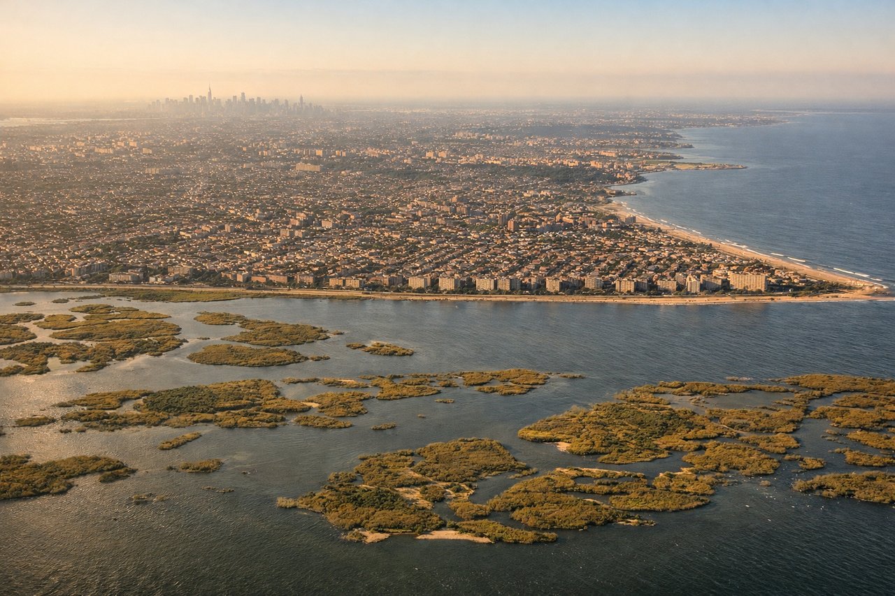
Landing at JFK
LEFTJFK primarily uses runways 31L/31R for northwesterly departures and 22L/22R for arrivals from the south, but inbound from the Caribbean the aircraft typically approaches from the south or southeast on runway 13L/13R or swings around for 22L. On the standard approach from the south, the left side tracks over Jamaica Bay, the Rockaways, and then gets a clear view of Lower Manhattan and the Brooklyn waterfront. Right side faces the Atlantic Ocean for most of the approach.
Will your flight be in sunlight?
Pick a date and time in the Sun Map to watch the sun move across your whole flight.
About This Route
Which side of the plane should I sit on flying from Owen Roberts International (GCM) to John F Kennedy International (JFK)?
Sit on the Left side of the plane for the best views on flights from Georgetown to New York. Left side wins both ends of the flight. At takeoff you get the full Grand Cayman reef and beach panorama, and on approach into JFK you track over Jamaica Bay with the Manhattan skyline visible in the distance. The right side faces open ocean for most of the approach.
What can I see during takeoff from Owen Roberts International in Georgetown?
During takeoff from Owen Roberts International (GCM), sit on the Left side for the best views. Owen Roberts typically departs eastbound on runway 08, so the left (north) side gives you a final look back over Seven Mile Beach and the full western coastline of Grand Cayman as the aircraft banks northeast. The turquoise shallows of the North Sound are clearly visible against the deeper Caribbean blue. Notable sights include: Seven Mile Beach, North Sound lagoon, George Town harbor, the shallow reef shelf surrounding Grand Cayman.
What can I see when landing at John F Kennedy International in New York?
When landing at John F Kennedy International (JFK), sit on the Left side for the best views. JFK primarily uses runways 31L/31R for northwesterly departures and 22L/22R for arrivals from the south, but inbound from the Caribbean the aircraft typically approaches from the south or southeast on runway 13L/13R or swings around for 22L. On the standard approach from the south, the left side tracks over Jamaica Bay, the Rockaways, and then gets a clear view of Lower Manhattan and the Brooklyn waterfront. Right side faces the Atlantic Ocean for most of the approach. Notable sights include: Jamaica Bay Wildlife Refuge, the Rockaways barrier beach, Lower Manhattan skyline on the horizon, Brooklyn waterfront and Verrazano-Narrows Bridge.
How long is the flight from Georgetown to New York?
The flight from Owen Roberts International (GCM) to John F Kennedy International (JFK) takes about 3 hours 40 minutes. The shortest flight path between them is 1,542 miles (2,481 km); winds and air traffic control usually add a few percent.
What does the Georgetown to New York flight path pass over?
The route tracks northeast over the western Caribbean, crossing Cuba's central highlands (Sierra del Escambray visible on clear days), then over the Bahamas archipelago with its distinctive shallow turquoise banks and cays clearly visible from altitude, before crossing the Florida Straits and tracking up the US East Coast over the Carolinas and Mid-Atlantic states. The Gulf Stream's color contrast with surrounding Atlantic water is sometimes visible from high altitude over the Florida Straits.