While takeoff offers good views from the right, the landing approach into Ontario provides more dramatic and sustained scenery. The San Gabriel Mountains and the visual contrast between desert and urban development on approach outweigh the Spokane valley departure views.
Flown GEG to ONT? Did we get it right?
Flight Path
Spokane to Ontario is 937 miles (1,508 km), a flight of about 2 hours 55 minutes.
The flight path crosses central California's interior: the Sierra Nevada range (distant, to the east around 1 hour into flight), the southern San Joaquin Valley (agricultural flatlands), and the Tehachapi Mountains (visible to the southeast as the aircraft descends into Southern California airspace). The Kern River valley and Bakersfield area pass to the southeast. No major bodies of water are directly on the route, but the flight transitions from the cooler, forested Pacific Northwest into the high desert and then the developed Inland Empire basin.
Great circle distance and headings ›

Phase by phase
Takeoff from GEG
RIGHTRight-side seats capture the Spokane valley floor and the Blue Mountains to the south immediately after departure. Spokane International typically departs runways 03/21 or 09/27; southbound departures on runway 03 or 21 will bank right, giving right-seat passengers the best view of the terrain.
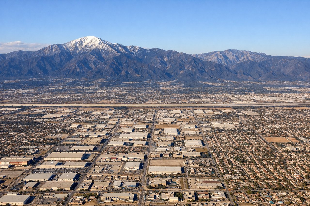
Landing at ONT
LEFTLeft-seat passengers get the best views during descent into Ontario. The approach typically uses runways 09L/27R or 09R/27L; eastbound approaches (runway 09) descend over the San Gabriel Mountains and Inland Empire sprawl. Left seats face the mountains and the dramatic transition from high desert to developed areas.
Will your flight be in sunlight?
Pick a date and time in the Sun Map to watch the sun move across your whole flight.
About This Route
Which side of the plane should I sit on flying from Spokane International (GEG) to Ontario International (ONT)?
Sit on the Left side of the plane for the best views on flights from Spokane to Ontario. While takeoff offers good views from the right, the landing approach into Ontario provides more dramatic and sustained scenery. The San Gabriel Mountains and the visual contrast between desert and urban development on approach outweigh the Spokane valley departure views.
What can I see during takeoff from Spokane International in Spokane?
During takeoff from Spokane International (GEG), sit on the Right side for the best views. Right-side seats capture the Spokane valley floor and the Blue Mountains to the south immediately after departure. Spokane International typically departs runways 03/21 or 09/27; southbound departures on runway 03 or 21 will bank right, giving right-seat passengers the best view of the terrain. Notable sights include: Spokane city grid and Spokane River valley, Blue Mountains (southern horizon), Rathdrum Prairie to the north, Coeur d'Alene Lake region (northeast, visible on clearer days).
What can I see when landing at Ontario International in Ontario?
When landing at Ontario International (ONT), sit on the Left side for the best views. Left-seat passengers get the best views during descent into Ontario. The approach typically uses runways 09L/27R or 09R/27L; eastbound approaches (runway 09) descend over the San Gabriel Mountains and Inland Empire sprawl. Left seats face the mountains and the dramatic transition from high desert to developed areas. Notable sights include: San Gabriel Mountains (north and northeast), Inland Empire urban sprawl (San Bernardino, Rancho Cucamonga), Cajon Pass corridor, Mojave Desert floor (eastern approach).
How long is the flight from Spokane to Ontario?
The flight from Spokane International (GEG) to Ontario International (ONT) takes about 2 hours 55 minutes. The shortest flight path between them is 937 miles (1,508 km); winds and air traffic control usually add a few percent.
What does the Spokane to Ontario flight path pass over?
The flight path crosses central California's interior: the Sierra Nevada range (distant, to the east around 1 hour into flight), the southern San Joaquin Valley (agricultural flatlands), and the Tehachapi Mountains (visible to the southeast as the aircraft descends into Southern California airspace). The Kern River valley and Bakersfield area pass to the southeast. No major bodies of water are directly on the route, but the flight transitions from the cooler, forested Pacific Northwest into the high desert and then the developed Inland Empire basin.