Spokane to Seattle is 223 miles (359 km), a flight of about 1 hour 5 minutes.
While the Palouse gives takeoff a scenic edge on the left, the right side delivers the flight's most memorable visuals during descent — Puget Sound, the Seattle skyline, and the Olympic Mountains — making it the stronger side overall.
Flight Path
Columbia River near Wenatchee, the Cascade Range foothills, and the Kittitas Valley along the flight path between Spokane and Seattle
Great circle distance and headings ›Phase by phase
Takeoff from GEG
LEFTDeparting GEG on Runway 21 climbs southwest, putting the rolling wheat fields of the Palouse region on the left, a distinctive patchwork of golden hills south of Spokane. The right side shows mostly the flatter, forested suburban fringe of Spokane, which is less visually striking.
Landing at SEA
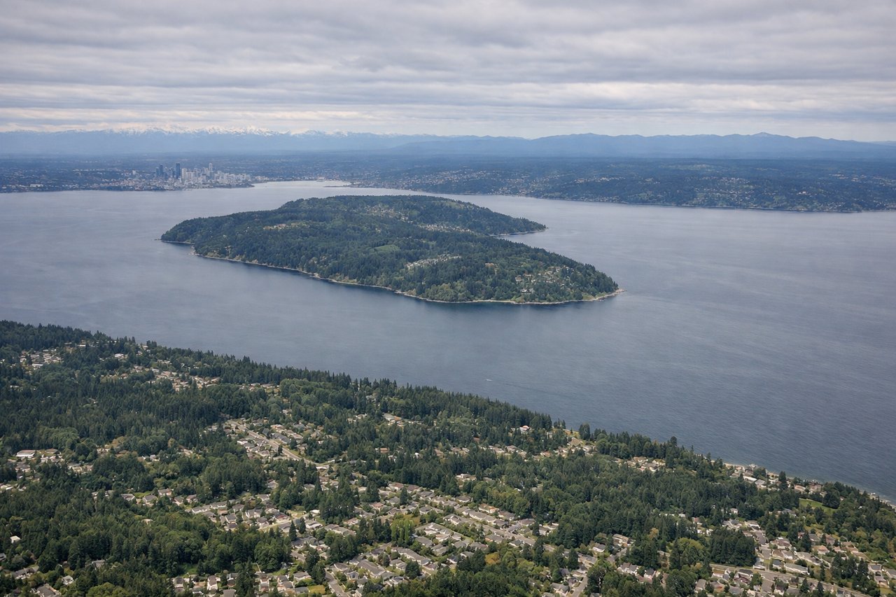
RIGHTOn approach into SEA, the turn to align with the north-south runways brings Puget Sound and downtown Seattle's skyline into view on the right side, including Elliott Bay and the waterfront. The left side mainly shows Lake Washington and the eastside suburbs, which is scenic but less iconic.
Landmarks on this routeAll landmarks →
Will your flight be in sunlight?
Pick a date and time in the Sun Map to watch the sun move across your whole flight.
About This Route
Which side of the plane should I sit on flying from Spokane International (GEG) to Seattle Tacoma International (SEA)?
Sit on the Right side of the plane for the best views on flights from Spokane to Seattle. While the Palouse gives takeoff a scenic edge on the left, the right side delivers the flight's most memorable visuals during descent — Puget Sound, the Seattle skyline, and the Olympic Mountains — making it the stronger side overall.
What can I see during takeoff from Spokane International in Spokane?
During takeoff from Spokane International (GEG), sit on the Left side for the best views. Departing GEG on Runway 21 climbs southwest, putting the rolling wheat fields of the Palouse region on the left, a distinctive patchwork of golden hills south of Spokane. The right side shows mostly the flatter, forested suburban fringe of Spokane, which is less visually striking. Notable sights include: Palouse rolling hills, Spokane River valley, scattered grain elevators and farmsteads.
What can I see when landing at Seattle Tacoma International in Seattle?
When landing at Seattle Tacoma International (SEA), sit on the Right side for the best views. On approach into SEA, the turn to align with the north-south runways brings Puget Sound and downtown Seattle's skyline into view on the right side, including Elliott Bay and the waterfront. The left side mainly shows Lake Washington and the eastside suburbs, which is scenic but less iconic. Notable sights include: Puget Sound, downtown Seattle skyline, Elliott Bay, Olympic Mountains on the horizon.
How long is the flight from Spokane to Seattle?
The flight from Spokane International (GEG) to Seattle Tacoma International (SEA) takes about 1 hour 5 minutes. The shortest flight path between them is 223 miles (359 km); winds and air traffic control usually add a few percent.
What does the Spokane to Seattle flight path pass over?
Columbia River near Wenatchee, the Cascade Range foothills, and the Kittitas Valley along the flight path between Spokane and Seattle