The right side captures the most distinctive scenery on both ends of this short flight — Seoul's river and skyline at departure, and the Ise Bay shoreline with Centrair's island runway at arrival — while the left side view is dominated by open water and less distinct terrain.
Flown GMP to NGO? Did we get it right?
Flight Path
Seoul to Nagoya is 588 miles (947 km), a flight of about 1 hour 35 minutes.
Korea Strait, Tsushima Island, and the open waters of the Sea of Japan (East Sea) dominate the cruise phase, with no major landmasses directly beneath the flight path at cruise altitude.
Great circle distance and headings ›Phase by phase
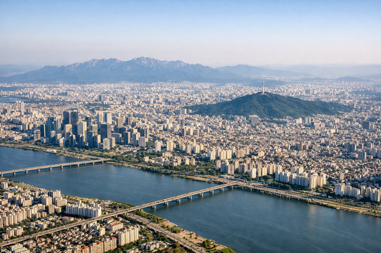
Takeoff from GMP
RIGHTDeparting GMP toward the southeast, the right side gives a good look back at Seoul's skyline, the Han River, and the Incheon coastline before the aircraft heads out over the Yellow Sea and Korea Strait. The left side mostly shows inland Gyeonggi terrain with less visual interest.
Landing at NGO
RIGHTOn approach into Centrair, the right side offers views of Ise Bay's shoreline, the reclaimed island airport itself, and the industrial Chubu coastline near Nagoya, giving a strong sense of arrival. The left side during descent mainly shows featureless open water or hazy inland plains.
Will your flight be in sunlight?
Pick a date and time in the Sun Map to watch the sun move across your whole flight.
About This Route
Which side of the plane should I sit on flying from Gimpo (GMP) to Chubu Centrair International Airport (NGO)?
Sit on the Right side of the plane for the best views on flights from Seoul to Nagoya. The right side captures the most distinctive scenery on both ends of this short flight — Seoul's river and skyline at departure, and the Ise Bay shoreline with Centrair's island runway at arrival — while the left side view is dominated by open water and less distinct terrain.
What can I see during takeoff from Gimpo in Seoul?
During takeoff from Gimpo (GMP), sit on the Right side for the best views. Departing GMP toward the southeast, the right side gives a good look back at Seoul's skyline, the Han River, and the Incheon coastline before the aircraft heads out over the Yellow Sea and Korea Strait. The left side mostly shows inland Gyeonggi terrain with less visual interest. Notable sights include: Han River, Seoul skyline, Incheon coastline, Korea Strait.
What can I see when landing at Chubu Centrair International Airport in Nagoya?
When landing at Chubu Centrair International Airport (NGO), sit on the Right side for the best views. On approach into Centrair, the right side offers views of Ise Bay's shoreline, the reclaimed island airport itself, and the industrial Chubu coastline near Nagoya, giving a strong sense of arrival. The left side during descent mainly shows featureless open water or hazy inland plains. Notable sights include: Ise Bay, Chita Peninsula, Nagoya port, Centrair island airport.
How long is the flight from Seoul to Nagoya?
The flight from Gimpo (GMP) to Chubu Centrair International Airport (NGO) takes about 1 hour 35 minutes. The shortest flight path between them is 588 miles (947 km); winds and air traffic control usually add a few percent.
What does the Seoul to Nagoya flight path pass over?
Korea Strait, Tsushima Island, and the open waters of the Sea of Japan (East Sea) dominate the cruise phase, with no major landmasses directly beneath the flight path at cruise altitude.