The left side delivers the best views at both ends of the flight — São Paulo's urban geography on departure and the Blue Ridge horizon on approach to Dulles. During the cruise over the Amazon basin and Caribbean, both sides are broadly similar, but the left side edges ahead for the bookend moments.
Flown GRU to IAD? Did we get it right?
Flight Path
Sao Paulo to Washington is 4,753 miles (7,649 km), a flight of about 9 hours 30 minutes.
The flight path typically tracks northwest over the Brazilian interior and Amazon basin, crossing the wide brown Amazon River and its tributaries visible from altitude as massive meandering waterways through dense green jungle canopy. The route then crosses the Caribbean Sea — deep blue open water with scattered island chains including the Lesser Antilles visible as small green dots. Over Cuba and the Bahamas, the shallow turquoise waters of the Bahama Banks are strikingly vivid from cruise altitude. The flight then crosses the Florida Straits and tracks up the US East Coast before turning inland toward Dulles.
Great circle distance and headings ›


Phase by phase

Takeoff from GRU
LEFTGRU typically departs on runways 09R/27L or 09L/27R. Northbound departures toward IAD often involve a left turn after takeoff, putting the left side over the Serra da Cantareira hills and giving a clear view back over greater São Paulo's urban sprawl. The Tietê River valley and the dense metropolitan grid are clearly visible on the left as the aircraft climbs northwest.
Landing at IAD
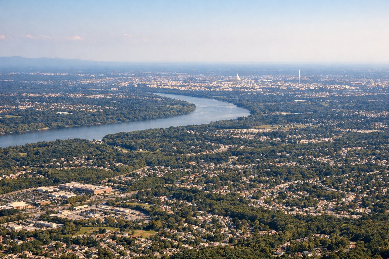
LEFTIAD typically lands on runways 01R/19L or 01C/19C, with approaches often from the south or southwest. On a standard ILS approach to runway 01R heading north, the left side faces west-northwest toward the Blue Ridge Mountains in the distance and the Virginia Piedmont below, while also offering views of the Dulles Access Road corridor and suburban Loudoun County. The right side faces toward the denser DC suburbs but is less dramatic geographically.
Will your flight be in sunlight?
Pick a date and time in the Sun Map to watch the sun move across your whole flight.
About This Route
Which side of the plane should I sit on flying from Guarulhos (GRU) to Washington Dulles International (IAD)?
Sit on the Left side of the plane for the best views on flights from Sao Paulo to Washington. The left side delivers the best views at both ends of the flight — São Paulo's urban geography on departure and the Blue Ridge horizon on approach to Dulles. During the cruise over the Amazon basin and Caribbean, both sides are broadly similar, but the left side edges ahead for the bookend moments.
What can I see during takeoff from Guarulhos in Sao Paulo?
During takeoff from Guarulhos (GRU), sit on the Left side for the best views. GRU typically departs on runways 09R/27L or 09L/27R. Northbound departures toward IAD often involve a left turn after takeoff, putting the left side over the Serra da Cantareira hills and giving a clear view back over greater São Paulo's urban sprawl. The Tietê River valley and the dense metropolitan grid are clearly visible on the left as the aircraft climbs northwest. Notable sights include: Serra da Cantareira hills to the north, Tietê River snaking through the metro area, São Paulo city center skyline to the southwest, Guarulhos urban grid directly below.
What can I see when landing at Washington Dulles International in Washington?
When landing at Washington Dulles International (IAD), sit on the Left side for the best views. IAD typically lands on runways 01R/19L or 01C/19C, with approaches often from the south or southwest. On a standard ILS approach to runway 01R heading north, the left side faces west-northwest toward the Blue Ridge Mountains in the distance and the Virginia Piedmont below, while also offering views of the Dulles Access Road corridor and suburban Loudoun County. The right side faces toward the denser DC suburbs but is less dramatic geographically. Notable sights include: Blue Ridge Mountains on the western horizon, Dulles Access Road corridor below, Loudoun County farmland and suburban grid, Potomac River visible to the northeast on final approach.
How long is the flight from Sao Paulo to Washington?
The flight from Guarulhos (GRU) to Washington Dulles International (IAD) takes about 9 hours 30 minutes. The shortest flight path between them is 4,753 miles (7,649 km); winds and air traffic control usually add a few percent.
What does the Sao Paulo to Washington flight path pass over?
The flight path typically tracks northwest over the Brazilian interior and Amazon basin, crossing the wide brown Amazon River and its tributaries visible from altitude as massive meandering waterways through dense green jungle canopy. The route then crosses the Caribbean Sea — deep blue open water with scattered island chains including the Lesser Antilles visible as small green dots. Over Cuba and the Bahamas, the shallow turquoise waters of the Bahama Banks are strikingly vivid from cruise altitude. The flight then crosses the Florida Straits and tracks up the US East Coast before turning inland toward Dulles.