The left side dominates because the cruise phase crosses the Bolivian Altiplano near Lake Titicaca and the high Andes around La Paz's Illimani peak, a dramatic and rare sight from cruising altitude, plus a strong São Paulo skyline view at takeoff. The right side's main highlight is the Pacific coastline during landing, which is attractive but brief compared to the sustained mountain scenery on the left.
Flown GRU to LIM? Did we get it right?
Flight Path
Sao Paulo to Lima is 2,159 miles (3,475 km), a flight of about 5 hours 15 minutes.
Pantanal wetlands near the Brazil-Bolivia border, the Bolivian Altiplano, Lake Titicaca and the Illimani massif near La Paz, and the high Andes crossing into Peru
Great circle distance and headings ›


Phase by phase
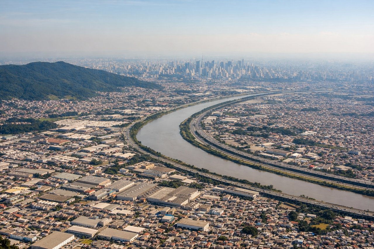
Takeoff from GRU
LEFTDeparting GRU to the west (runway 28), the climb-out banks the left side of the aircraft toward São Paulo's dense skyline and the Tietê River corridor, giving a sweeping view of one of South America's largest urban sprawls. The right side mostly shows the quieter green hills and reservoirs north of Guarulhos, which is far less visually dense.
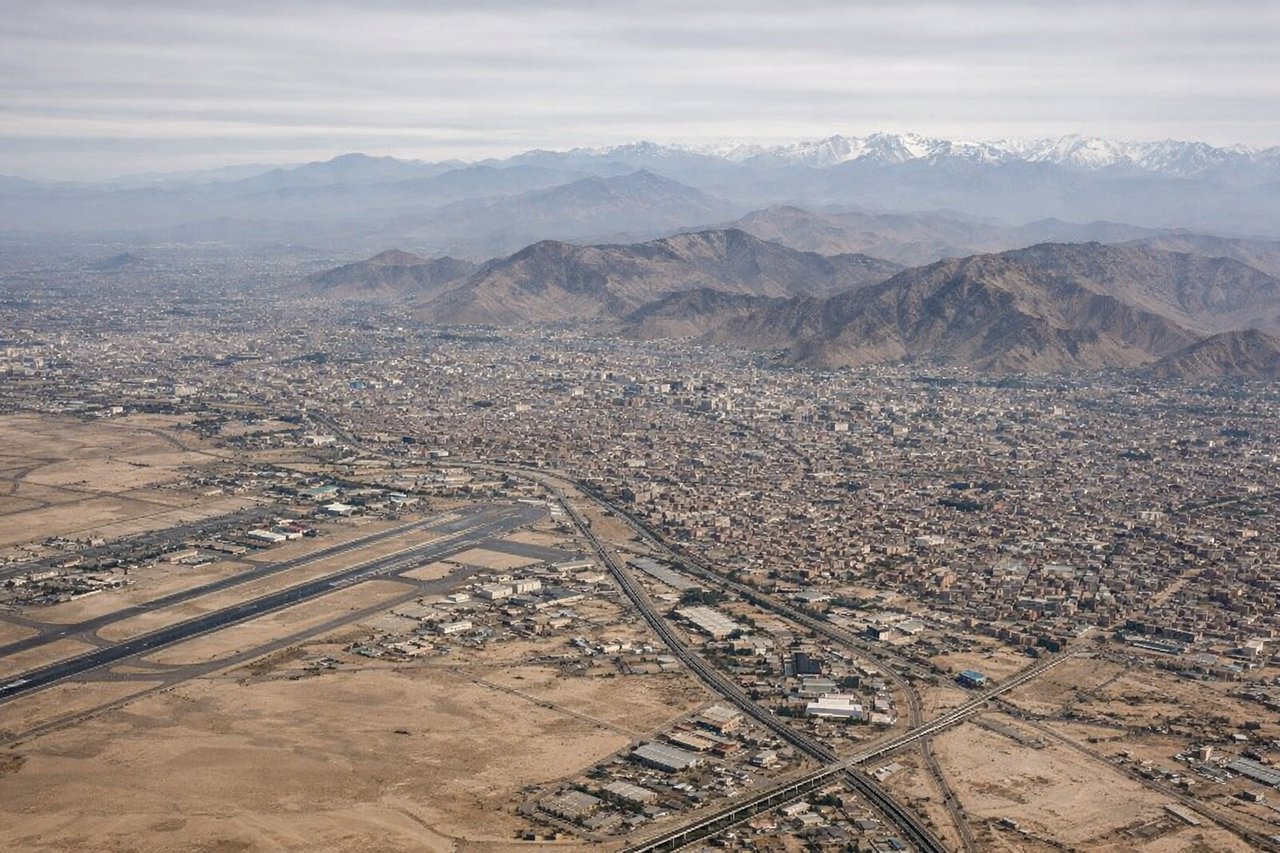
Landing at LIM
RIGHTLima's runway 16 approach typically swings arriving aircraft out over the Pacific before turning onto final, putting the ocean, Callao's port, and San Lorenzo Island on the right side of the cabin. The left side mostly shows Lima's arid, tan-colored urban sprawl backed by dry Andean foothills, which is scenic but less striking than the coastline.
Will your flight be in sunlight?
Pick a date and time in the Sun Map to watch the sun move across your whole flight.
About This Route
Which side of the plane should I sit on flying from Guarulhos (GRU) to Jorge Chávez International Airport (LIM)?
Sit on the Left side of the plane for the best views on flights from Sao Paulo to Lima. The left side dominates because the cruise phase crosses the Bolivian Altiplano near Lake Titicaca and the high Andes around La Paz's Illimani peak, a dramatic and rare sight from cruising altitude, plus a strong São Paulo skyline view at takeoff. The right side's main highlight is the Pacific coastline during landing, which is attractive but brief compared to the sustained mountain scenery on the left.
What can I see during takeoff from Guarulhos in Sao Paulo?
During takeoff from Guarulhos (GRU), sit on the Left side for the best views. Departing GRU to the west (runway 28), the climb-out banks the left side of the aircraft toward São Paulo's dense skyline and the Tietê River corridor, giving a sweeping view of one of South America's largest urban sprawls. The right side mostly shows the quieter green hills and reservoirs north of Guarulhos, which is far less visually dense. Notable sights include: São Paulo skyline, Tietê River, Guarulhos urban grid, distant Serra da Cantareira hills (right side).
What can I see when landing at Jorge Chávez International Airport in Lima?
When landing at Jorge Chávez International Airport (LIM), sit on the Right side for the best views. Lima's runway 16 approach typically swings arriving aircraft out over the Pacific before turning onto final, putting the ocean, Callao's port, and San Lorenzo Island on the right side of the cabin. The left side mostly shows Lima's arid, tan-colored urban sprawl backed by dry Andean foothills, which is scenic but less striking than the coastline. Notable sights include: Pacific Ocean, San Lorenzo Island, Port of Callao, Lima's coastal bluffs.
How long is the flight from Sao Paulo to Lima?
The flight from Guarulhos (GRU) to Jorge Chávez International Airport (LIM) takes about 5 hours 15 minutes. The shortest flight path between them is 2,159 miles (3,475 km); winds and air traffic control usually add a few percent.
What does the Sao Paulo to Lima flight path pass over?
Pantanal wetlands near the Brazil-Bolivia border, the Bolivian Altiplano, Lake Titicaca and the Illimani massif near La Paz, and the high Andes crossing into Peru