While takeoff favors the right, landing provides the more distinctive geography. The Río de la Plata estuary and Montevideo's coastal features on approach outweigh the Serra da Cantareira views on departure. Left-seat passengers get the better overall experience for this southbound route.
Flown GRU to MVD? Did we get it right?
Flight Path
Sao Paulo to Montevideo is 975 miles (1,570 km), a flight of about 2 hours 15 minutes.
The flight path crosses the Paraná River valley and enters the Mesopotamia region (Entre Ríos province). Around the midpoint, the landscape transitions from São Paulo's escarpment terrain to the flat, agricultural pampas of southern Brazil and Uruguay. The Paraná River itself may be visible as a wide, brown ribbon if flying at lower cruise altitudes or during descent. The terrain becomes progressively flatter and more open as the aircraft approaches the Río de la Plata basin.
Great circle distance and headings ›Phase by phase

Takeoff from GRU
RIGHTGRU typically departs runway 09L/27R or 09R/27L depending on wind. Westbound departures (runway 27) favor right seats, offering views of the Serra da Cantareira escarpment and the sprawling São Paulo metropolitan area receding southward. Eastbound departures show less dramatic terrain initially.
Landing at MVD
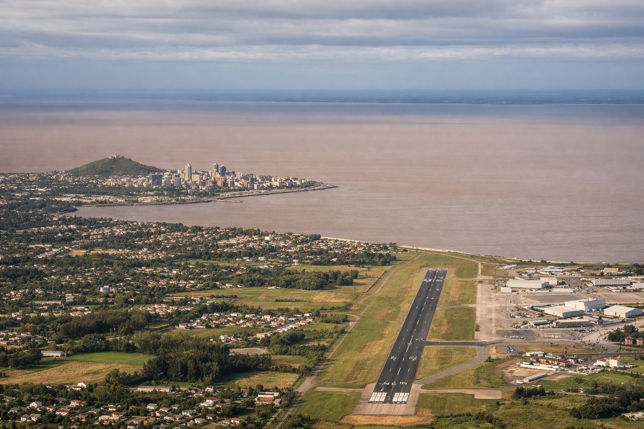
LEFTMVD's Carrasco airport (runways 26/08) typically receives aircraft from the northeast on approach to runway 26. Left-seat passengers descend over the Río de la Plata estuary and see the city's coastal geography, including the Cerro hill and the urban waterfront. Right seats face inland over flat pampas with less visual interest.
Will your flight be in sunlight?
Pick a date and time in the Sun Map to watch the sun move across your whole flight.
About This Route
Which side of the plane should I sit on flying from Guarulhos (GRU) to Carrasco International (MVD)?
Sit on the Left side of the plane for the best views on flights from Sao Paulo to Montevideo. While takeoff favors the right, landing provides the more distinctive geography. The Río de la Plata estuary and Montevideo's coastal features on approach outweigh the Serra da Cantareira views on departure. Left-seat passengers get the better overall experience for this southbound route.
What can I see during takeoff from Guarulhos in Sao Paulo?
During takeoff from Guarulhos (GRU), sit on the Right side for the best views. GRU typically departs runway 09L/27R or 09R/27L depending on wind. Westbound departures (runway 27) favor right seats, offering views of the Serra da Cantareira escarpment and the sprawling São Paulo metropolitan area receding southward. Eastbound departures show less dramatic terrain initially. Notable sights include: Serra da Cantareira (northern escarpment), Tietê River valley, São Paulo urban sprawl extending south and east, Guarulhos industrial zone.
What can I see when landing at Carrasco International in Montevideo?
When landing at Carrasco International (MVD), sit on the Left side for the best views. MVD's Carrasco airport (runways 26/08) typically receives aircraft from the northeast on approach to runway 26. Left-seat passengers descend over the Río de la Plata estuary and see the city's coastal geography, including the Cerro hill and the urban waterfront. Right seats face inland over flat pampas with less visual interest. Notable sights include: Río de la Plata estuary (wide, muddy-brown water), Cerro hill and old town district, Montevideo's coastal neighborhoods, Punta Carretas peninsula.
How long is the flight from Sao Paulo to Montevideo?
The flight from Guarulhos (GRU) to Carrasco International (MVD) takes about 2 hours 15 minutes. The shortest flight path between them is 975 miles (1,570 km); winds and air traffic control usually add a few percent.
What does the Sao Paulo to Montevideo flight path pass over?
The flight path crosses the Paraná River valley and enters the Mesopotamia region (Entre Ríos province). Around the midpoint, the landscape transitions from São Paulo's escarpment terrain to the flat, agricultural pampas of southern Brazil and Uruguay. The Paraná River itself may be visible as a wide, brown ribbon if flying at lower cruise altitudes or during descent. The terrain becomes progressively flatter and more open as the aircraft approaches the Río de la Plata basin.