Right side scores higher due to the Blue Ridge Mountains visible during departure and the Spring Mountains plus Las Vegas Valley visible during approach. The route offers more terrain variety and recognizable landmarks. Left side is dominated by flatter terrain and open desert with fewer distinctive visual features.
Flown GSP to LAS? Did we get it right?
Flight Path
Greenville/Greer/Spartanburg to Las Vegas is 1,846 miles (2,970 km), a flight of about 4 hours 15 minutes.
Tennessee River valley, Cumberland Plateau, Mississippi River crossing near Memphis, Arkansas River valley, Oklahoma panhandle, Texas Panhandle, New Mexico high desert, Arizona plateau approaching Nevada border
Great circle distance and headings ›


Phase by phase
Takeoff from GSP
RIGHTRight side captures the Piedmont terrain and initial climb over the foothills of the Blue Ridge Mountains, which rise gradually to the northwest. Left side departs over relatively flat terrain toward the Atlantic coastal plain.
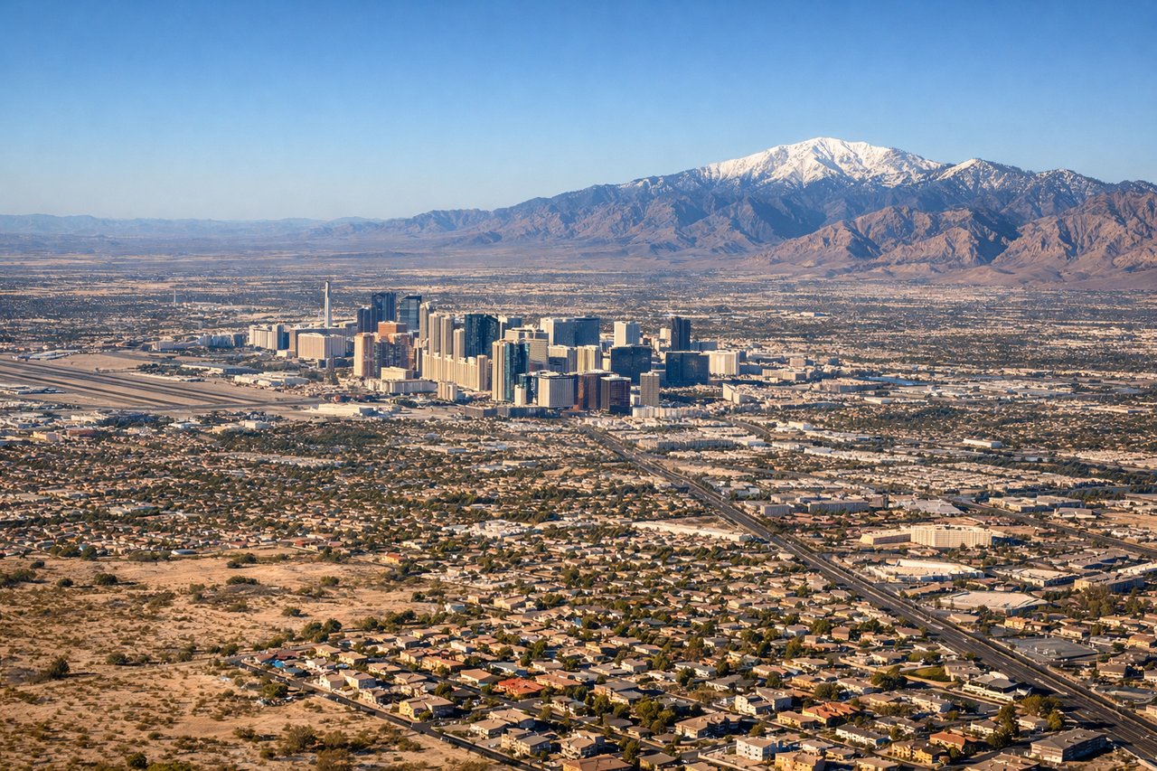
Landing at LAS
RIGHTRight side (north/northeast approach) offers views of the Las Vegas Valley floor, the Spring Mountains to the west, and the urban sprawl of Las Vegas and Henderson. Left side (south/southwest approach) crosses the Mojave Desert with fewer distinctive landmarks before reaching the Strip.
Will your flight be in sunlight?
Pick a date and time in the Sun Map to watch the sun move across your whole flight.
About This Route
Which side of the plane should I sit on flying from Greenville-Spartanburg International Airport (GSP) to Mc Carran International (LAS)?
Sit on the Right side of the plane for the best views on flights from Greenville/Greer/Spartanburg to Las Vegas. Right side scores higher due to the Blue Ridge Mountains visible during departure and the Spring Mountains plus Las Vegas Valley visible during approach. The route offers more terrain variety and recognizable landmarks. Left side is dominated by flatter terrain and open desert with fewer distinctive visual features.
What can I see during takeoff from Greenville-Spartanburg International Airport in Greenville/Greer/Spartanburg?
During takeoff from Greenville-Spartanburg International Airport (GSP), sit on the Right side for the best views. Right side captures the Piedmont terrain and initial climb over the foothills of the Blue Ridge Mountains, which rise gradually to the northwest. Left side departs over relatively flat terrain toward the Atlantic coastal plain. Notable sights include: Blue Ridge Mountains (distant northwest), Greenville urban area, Saluda River valley.
What can I see when landing at Mc Carran International in Las Vegas?
When landing at Mc Carran International (LAS), sit on the Right side for the best views. Right side (north/northeast approach) offers views of the Las Vegas Valley floor, the Spring Mountains to the west, and the urban sprawl of Las Vegas and Henderson. Left side (south/southwest approach) crosses the Mojave Desert with fewer distinctive landmarks before reaching the Strip. Notable sights include: Spring Mountains, Las Vegas Valley floor, Henderson urban area, Lake Mead (distant north).
How long is the flight from Greenville/Greer/Spartanburg to Las Vegas?
The flight from Greenville-Spartanburg International Airport (GSP) to Mc Carran International (LAS) takes about 4 hours 15 minutes. The shortest flight path between them is 1,846 miles (2,970 km); winds and air traffic control usually add a few percent.
What does the Greenville/Greer/Spartanburg to Las Vegas flight path pass over?
Tennessee River valley, Cumberland Plateau, Mississippi River crossing near Memphis, Arkansas River valley, Oklahoma panhandle, Texas Panhandle, New Mexico high desert, Arizona plateau approaching Nevada border