The right side delivers the most spectacular single moment of the flight — the Mont Blanc massif and Lake Geneva on departure — which is hard to beat. During the cruise over Turkey, the Anatolian plateau, and the Zagros Mountains of Iran, both sides offer similar terrain. The left side wins on landing, but the Alpine departure view on the right is the highlight of the journey.
Flown GVA to DXB? Did we get it right?
Flight Path
Geneva to Dubai is 3,057 miles (4,920 km), a flight of about 6 hours 30 minutes.
After the Alps, the route crosses northern Italy briefly, then the Adriatic or eastern Mediterranean depending on routing. Over Turkey you see the Anatolian plateau, a vast semi-arid highland. The Taurus Mountains appear in southern Turkey. The route then crosses northern Syria or Iraq, followed by the Zagros Mountain folds of western Iran — parallel ridgelines clearly visible from altitude. Final descent is over the flat Arabian Peninsula and the Persian Gulf coast.
Great circle distance and headings ›


Phase by phase
Takeoff from GVA
RIGHTGeneva Cointrin typically departs on runway 23 heading southwest, then aircraft turn southeast toward the Alps. The right side gives you a direct view across Lake Geneva toward Mont Blanc and the Chamonix massif as you climb out. Left side faces northwest toward the Jura hills, which are far less dramatic.
Landing at DXB
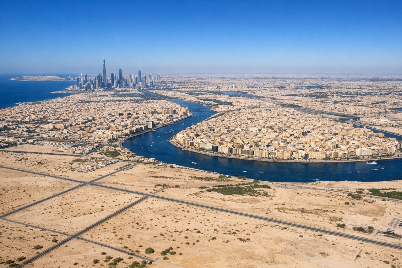
LEFTDubai International's primary arrival runway 30L/30R brings aircraft in from the southeast over the Gulf, turning over the city. The left side faces north and northwest, giving you the Dubai skyline including Downtown Dubai, the Creek, and the Palm Jumeirah peninsula clearly visible during the approach. Right side faces south toward desert.
Will your flight be in sunlight?
Pick a date and time in the Sun Map to watch the sun move across your whole flight.
About This Route
Which side of the plane should I sit on flying from Geneva Cointrin (GVA) to Dubai International (DXB)?
Sit on the Right side of the plane for the best views on flights from Geneva to Dubai. The right side delivers the most spectacular single moment of the flight — the Mont Blanc massif and Lake Geneva on departure — which is hard to beat. During the cruise over Turkey, the Anatolian plateau, and the Zagros Mountains of Iran, both sides offer similar terrain. The left side wins on landing, but the Alpine departure view on the right is the highlight of the journey.
What can I see during takeoff from Geneva Cointrin in Geneva?
During takeoff from Geneva Cointrin (GVA), sit on the Right side for the best views. Geneva Cointrin typically departs on runway 23 heading southwest, then aircraft turn southeast toward the Alps. The right side gives you a direct view across Lake Geneva toward Mont Blanc and the Chamonix massif as you climb out. Left side faces northwest toward the Jura hills, which are far less dramatic. Notable sights include: Lake Geneva (Lac Léman) stretching east toward Lausanne, Mont Blanc massif (4,808m) to the southeast, the Chamonix valley below the snowfields, the Arve river valley cutting through the Alps.
What can I see when landing at Dubai International in Dubai?
When landing at Dubai International (DXB), sit on the Left side for the best views. Dubai International's primary arrival runway 30L/30R brings aircraft in from the southeast over the Gulf, turning over the city. The left side faces north and northwest, giving you the Dubai skyline including Downtown Dubai, the Creek, and the Palm Jumeirah peninsula clearly visible during the approach. Right side faces south toward desert. Notable sights include: Palm Jumeirah peninsula in the Gulf, Downtown Dubai skyline with Burj Khalifa, Dubai Creek and Deira district, the geometric grid of Dubai Marina.
How long is the flight from Geneva to Dubai?
The flight from Geneva Cointrin (GVA) to Dubai International (DXB) takes about 6 hours 30 minutes. The shortest flight path between them is 3,057 miles (4,920 km); winds and air traffic control usually add a few percent.
What does the Geneva to Dubai flight path pass over?
After the Alps, the route crosses northern Italy briefly, then the Adriatic or eastern Mediterranean depending on routing. Over Turkey you see the Anatolian plateau, a vast semi-arid highland. The Taurus Mountains appear in southern Turkey. The route then crosses northern Syria or Iraq, followed by the Zagros Mountain folds of western Iran — parallel ridgelines clearly visible from altitude. Final descent is over the flat Arabian Peninsula and the Persian Gulf coast.