Right side scores higher due to superior landing approach scenery (Dutch polders and IJsselmeer) and more dramatic takeoff views (Red River Delta and Gulf of Tonkin). The landing sequence alone provides distinctive, recognizable landmarks. Left side is dominated by 5+ hours of open North Sea with minimal visual interest, capping its maximum score at 2.0 per constraints.
Flown HAN to AMS? Did we get it right?
Flight Path
Hanoi to Amsterdam is 5,513 miles (8,872 km), a flight of about 11 hours 15 minutes.
Overflying central Asia: Hindu Kush mountains (Afghanistan-Pakistan border region), Pamir plateau, Caspian Sea's eastern shore, Caucasus Mountains, Black Sea, and the Balkans. The route typically crosses high-altitude terrain over Afghanistan and Tajikistan, then descends across the Caspian and into Eastern Europe. Major cities visible along the route include Kabul (distant), and later Tbilisi (Georgia) and Budapest (Hungary) during the European approach phase.
Great circle distance and headings ›


Phase by phase
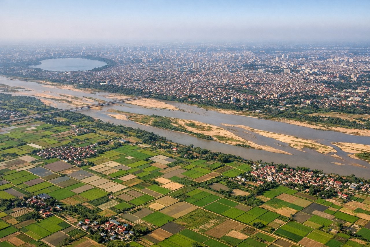
Takeoff from HAN
RIGHTRight side captures Hanoi's Red River Delta and coastal approach during departure. The delta's intricate waterways, rice paddies, and Haiphong harbor are visible during climb-out heading northwest. Left side shows inland plains with minimal terrain variation.
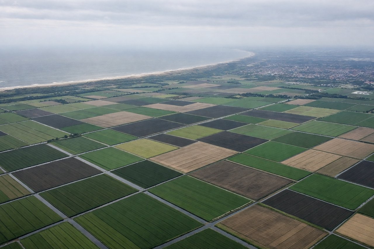
Landing at AMS
RIGHTRight side offers superior approach scenery into Amsterdam. The descent crosses the North Sea coast, then reveals the Dutch polder landscape with its characteristic canal networks, windmills, and the IJsselmeer lake. Left side shows only open North Sea for the final 90 minutes.
Will your flight be in sunlight?
Pick a date and time in the Sun Map to watch the sun move across your whole flight.
About This Route
Which side of the plane should I sit on flying from Noibai International (HAN) to Schiphol (AMS)?
Sit on the Right side of the plane for the best views on flights from Hanoi to Amsterdam. Right side scores higher due to superior landing approach scenery (Dutch polders and IJsselmeer) and more dramatic takeoff views (Red River Delta and Gulf of Tonkin). The landing sequence alone provides distinctive, recognizable landmarks. Left side is dominated by 5+ hours of open North Sea with minimal visual interest, capping its maximum score at 2.0 per constraints.
What can I see during takeoff from Noibai International in Hanoi?
During takeoff from Noibai International (HAN), sit on the Right side for the best views. Right side captures Hanoi's Red River Delta and coastal approach during departure. The delta's intricate waterways, rice paddies, and Haiphong harbor are visible during climb-out heading northwest. Left side shows inland plains with minimal terrain variation. Notable sights include: Red River Delta with its distinctive braided waterways, Haiphong harbor and coastal industrial zones, Gulf of Tonkin coastline, inland agricultural plains fading to the northwest.
What can I see when landing at Schiphol in Amsterdam?
When landing at Schiphol (AMS), sit on the Right side for the best views. Right side offers superior approach scenery into Amsterdam. The descent crosses the North Sea coast, then reveals the Dutch polder landscape with its characteristic canal networks, windmills, and the IJsselmeer lake. Left side shows only open North Sea for the final 90 minutes. Notable sights include: North Sea coastline and dike systems, IJsselmeer lake with its distinctive shape, Dutch polder grid pattern with canals and small towns, Amsterdam city sprawl and harbor approaches.
How long is the flight from Hanoi to Amsterdam?
The flight from Noibai International (HAN) to Schiphol (AMS) takes about 11 hours 15 minutes. The shortest flight path between them is 5,513 miles (8,872 km); winds and air traffic control usually add a few percent.
What does the Hanoi to Amsterdam flight path pass over?
Overflying central Asia: Hindu Kush mountains (Afghanistan-Pakistan border region), Pamir plateau, Caspian Sea's eastern shore, Caucasus Mountains, Black Sea, and the Balkans. The route typically crosses high-altitude terrain over Afghanistan and Tajikistan, then descends across the Caspian and into Eastern Europe. Major cities visible along the route include Kabul (distant), and later Tbilisi (Georgia) and Budapest (Hungary) during the European approach phase.