Takeoff views from the right are significantly superior—the Red River Delta and Tam Dao Mountains provide distinctive geography. Landing from the left is excellent but the takeoff advantage outweighs it for overall route interest.
Flown HAN to KIX? Did we get it right?
Flight Path
Hanoi to Osaka is 2,006 miles (3,229 km), a flight of about 4 hours 25 minutes.
The flight crosses the East China Sea at cruise altitude (typically 33,000-35,000 feet). At midpoint, the Tsushima Strait becomes visible—the narrow waterway separating Japan from South Korea. The Goto Islands (off Nagasaki Prefecture) and Kyushu's northern coast appear roughly 90 minutes into the flight. The route then tracks northeast toward the Kobe/Osaka region, with the Seto Inland Sea becoming visible during descent. Visibility of these features depends heavily on weather; clear days reveal the Japanese coastline's complexity, while haze or cloud cover obscures detail.
Great circle distance and headings ›Phase by phase
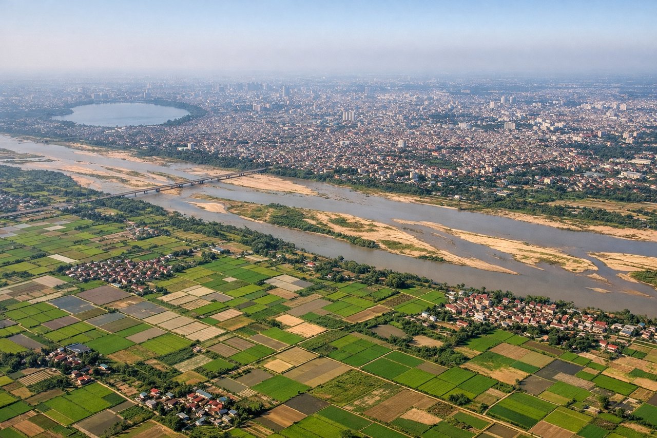
Takeoff from HAN
RIGHTNoibai typically departs to the northeast (runways 01L/01R). Right-side seats face the Red River Delta's intricate waterway network and the Tam Dao Mountains rising inland. Left seats see only flat delta terrain and urban sprawl.
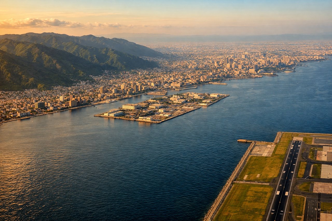
Landing at KIX
LEFTKansai typically lands from the southwest (runways 06L/06R). Left-side seats descend over Osaka Bay with views of the Kii Peninsula's forested mountains and the Harima Strait. Right seats see only the artificial island and industrial zones.
Will your flight be in sunlight?
Pick a date and time in the Sun Map to watch the sun move across your whole flight.
About This Route
Which side of the plane should I sit on flying from Noibai International (HAN) to Kansai International (KIX)?
Sit on the Right side of the plane for the best views on flights from Hanoi to Osaka. Takeoff views from the right are significantly superior—the Red River Delta and Tam Dao Mountains provide distinctive geography. Landing from the left is excellent but the takeoff advantage outweighs it for overall route interest.
What can I see during takeoff from Noibai International in Hanoi?
During takeoff from Noibai International (HAN), sit on the Right side for the best views. Noibai typically departs to the northeast (runways 01L/01R). Right-side seats face the Red River Delta's intricate waterway network and the Tam Dao Mountains rising inland. Left seats see only flat delta terrain and urban sprawl. Notable sights include: Red River (winding through the delta below), Tam Dao Mountains (northeast, appearing as a low ridge on the horizon), Hanoi's urban grid (directly beneath during initial climb), Gulf of Tonkin (visible to the east as a distant water body).
What can I see when landing at Kansai International in Osaka?
When landing at Kansai International (KIX), sit on the Left side for the best views. Kansai typically lands from the southwest (runways 06L/06R). Left-side seats descend over Osaka Bay with views of the Kii Peninsula's forested mountains and the Harima Strait. Right seats see only the artificial island and industrial zones. Notable sights include: Osaka Bay (the entire water body beneath during descent), Kii Peninsula (mountainous terrain to the south, forested and distinctive), Harima Strait (to the west, separating Honshu from Awaji Island), Awaji Island (visible as a landmass in the strait).
How long is the flight from Hanoi to Osaka?
The flight from Noibai International (HAN) to Kansai International (KIX) takes about 4 hours 25 minutes. The shortest flight path between them is 2,006 miles (3,229 km); winds and air traffic control usually add a few percent.
What does the Hanoi to Osaka flight path pass over?
The flight crosses the East China Sea at cruise altitude (typically 33,000-35,000 feet). At midpoint, the Tsushima Strait becomes visible—the narrow waterway separating Japan from South Korea. The Goto Islands (off Nagasaki Prefecture) and Kyushu's northern coast appear roughly 90 minutes into the flight. The route then tracks northeast toward the Kobe/Osaka region, with the Seto Inland Sea becoming visible during descent. Visibility of these features depends heavily on weather; clear days reveal the Japanese coastline's complexity, while haze or cloud cover obscures detail.