Hangzhou to Taipei is 360 miles (579 km), a flight of about 1 hour 20 minutes.
The left side wins narrowly thanks to a more consistently scenic profile — the estuary and bay views on departure plus a decent look at Taiwan's coastline on arrival, whereas the right side is mostly open water until the final approach.
Flight Path
Taiwan Strait, open water with occasional fishing vessel traffic, no land visible at cruise midpoint
Great circle distance and headings ›Phase by phase
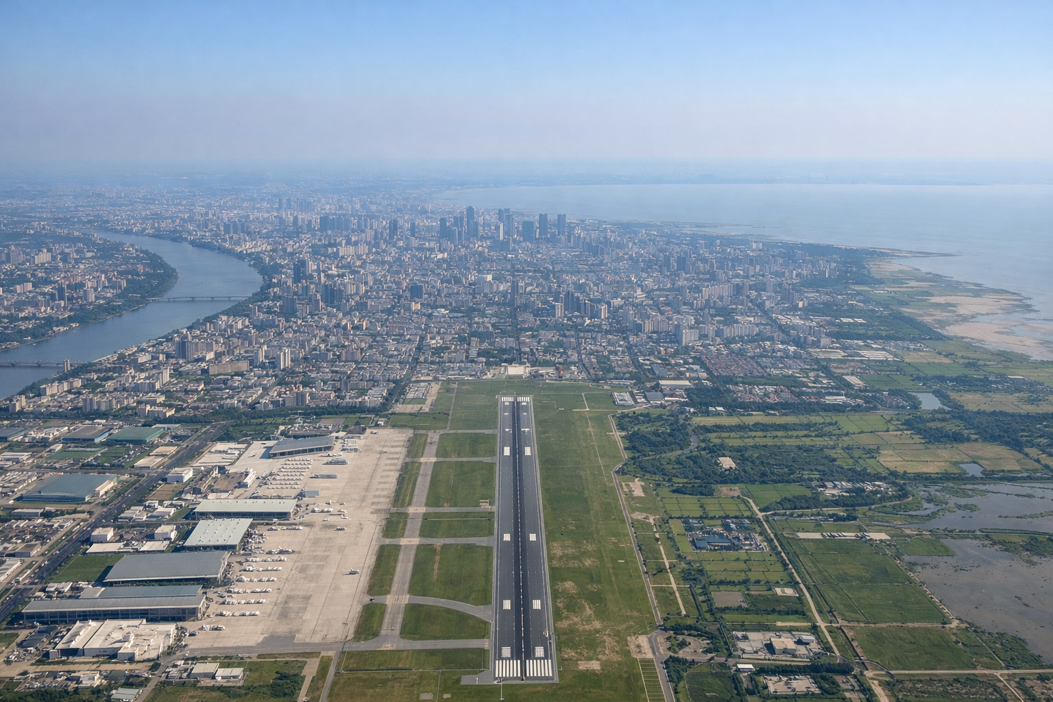
Takeoff from HGH
LEFTDeparting HGH southbound, the left side offers views over Hangzhou Bay and the Qiantang River estuary, with the city of Hangzhou and its reservoir-dotted hills receding behind. The coastline and bay waters give a nice contrast of land and water right after takeoff.
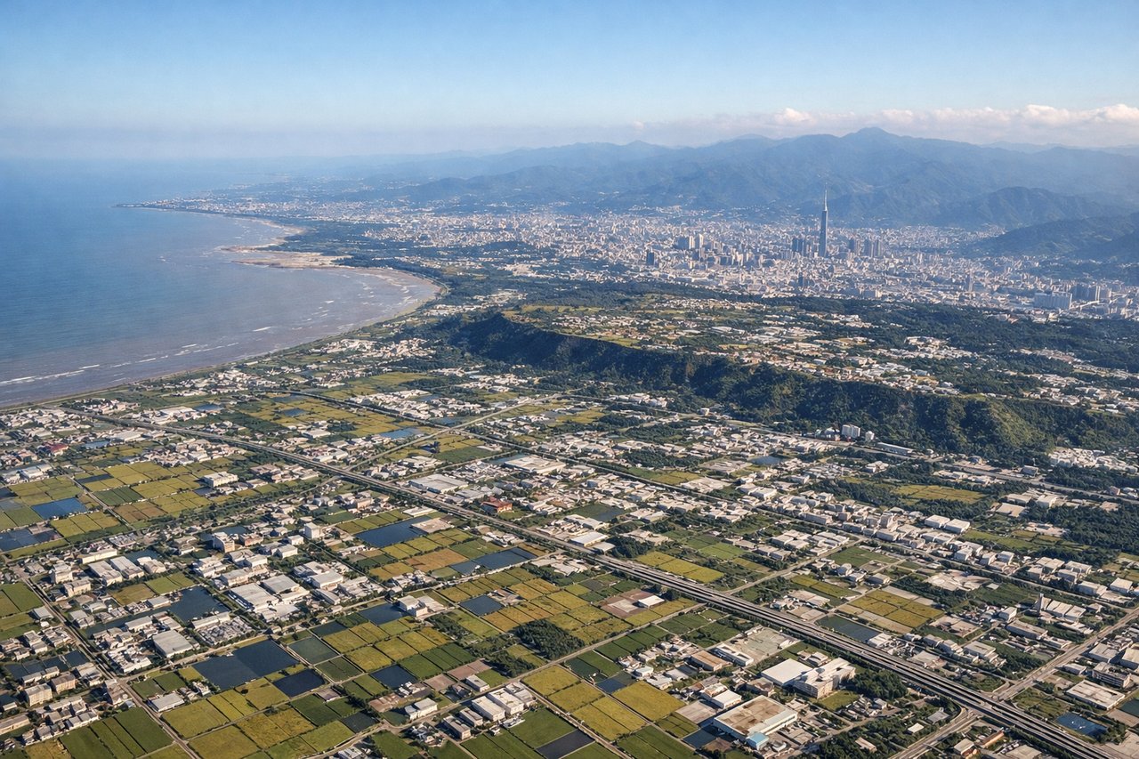
Landing at TPE
RIGHTOn approach into TPE from the north, the right side reveals the rugged coastline of northern Taiwan and the volcanic peaks of the Datun mountain range near Yangmingshan, followed by the Taipei Basin. This is far more dramatic than the flatter Taoyuan plain visible on the left during final approach.
Will your flight be in sunlight?
Pick a date and time in the Sun Map to watch the sun move across your whole flight.
About This Route
Which side of the plane should I sit on flying from Xiaoshan (HGH) to Chiang Kai Shek International (TPE)?
Sit on the Left side of the plane for the best views on flights from Hangzhou to Taipei. The left side wins narrowly thanks to a more consistently scenic profile — the estuary and bay views on departure plus a decent look at Taiwan's coastline on arrival, whereas the right side is mostly open water until the final approach.
What can I see during takeoff from Xiaoshan in Hangzhou?
During takeoff from Xiaoshan (HGH), sit on the Left side for the best views. Departing HGH southbound, the left side offers views over Hangzhou Bay and the Qiantang River estuary, with the city of Hangzhou and its reservoir-dotted hills receding behind. The coastline and bay waters give a nice contrast of land and water right after takeoff. Notable sights include: Qiantang River estuary, Hangzhou Bay, Hangzhou city outskirts, coastal wetlands.
What can I see when landing at Chiang Kai Shek International in Taipei?
When landing at Chiang Kai Shek International (TPE), sit on the Right side for the best views. On approach into TPE from the north, the right side reveals the rugged coastline of northern Taiwan and the volcanic peaks of the Datun mountain range near Yangmingshan, followed by the Taipei Basin. This is far more dramatic than the flatter Taoyuan plain visible on the left during final approach. Notable sights include: Datun volcanic range, Yangmingshan National Park, northern Taiwan coastline, Taipei Basin edge.
How long is the flight from Hangzhou to Taipei?
The flight from Xiaoshan (HGH) to Chiang Kai Shek International (TPE) takes about 1 hour 20 minutes. The shortest flight path between them is 360 miles (579 km); winds and air traffic control usually add a few percent.
What does the Hangzhou to Taipei flight path pass over?
Taiwan Strait, open water with occasional fishing vessel traffic, no land visible at cruise midpoint