Hakodate to Tokyo is 433 miles (697 km), a flight of about 1 hour 10 minutes.
Left side wins at both ends of the flight. During the crossing of Honshu's northern Tohoku region, the left side also faces the Pacific coastline and the Kitakami Mountains in the distance, while the right faces inland toward the Ou Mountains. Left is the clear choice for the full journey.
Flight Path
The flight crosses the Tsugaru Strait shortly after departure, then tracks south over the Tohoku region of northern Honshu. The Kitakami Mountains run roughly parallel to the left side of the aircraft. The Ou Mountain Range (including Iwate-san at 2,038m) is visible to the right in the interior. The Sendai Plain and Sendai city are visible below around the midpoint. Further south, the flight passes over Fukushima Prefecture before descending toward the Kanto Plain and Tokyo Bay.
Great circle distance and headings ›Phase by phase
Takeoff from HKD
LEFTHakodate Airport's primary runway 12/30 means southbound departures head roughly southeast, putting the left (east) side facing Hakodate Bay and the distinctive Hakodate Peninsula. The left side gives you the iconic narrow isthmus connecting the Hakodate headland to the mainland, with the bay on one side and Tsugaru Strait on the other — one of the most recognizable geographic shapes in Japan from the air.
Landing at HND
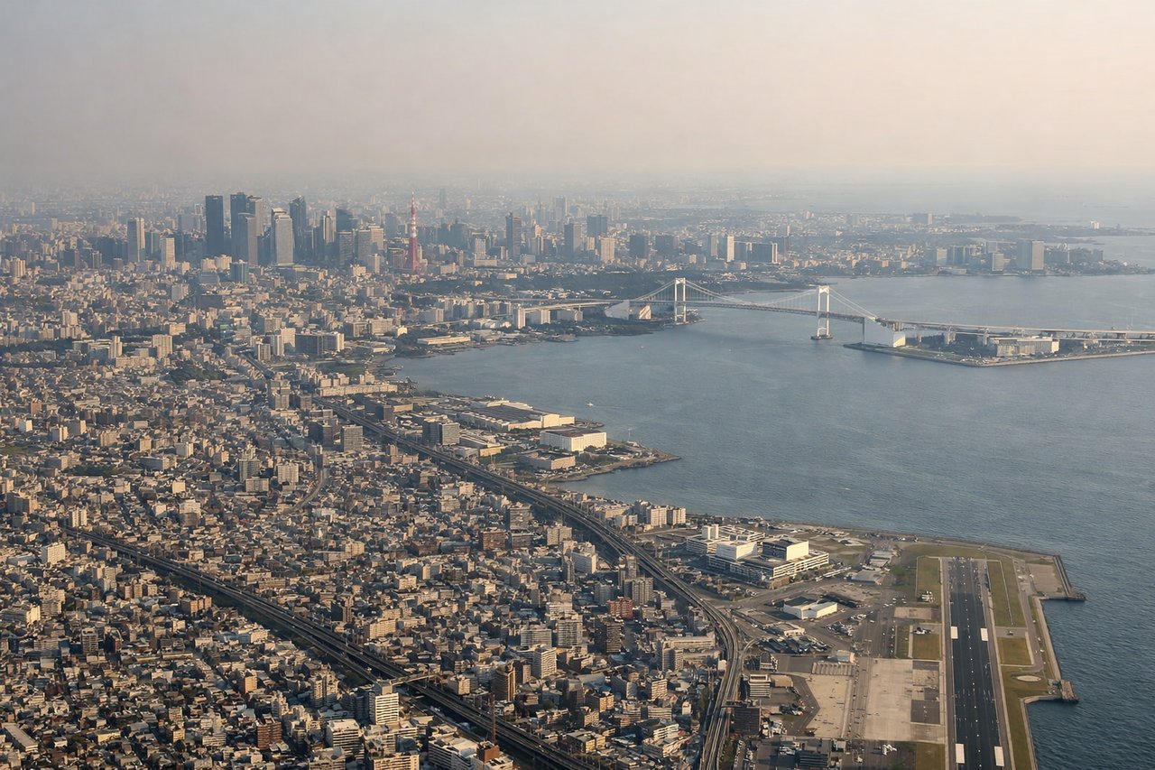
LEFTHaneda primarily uses runways 34L/34R for northerly arrivals or 16L/16R for southerly approaches. On the common southbound approach over Tokyo Bay, the left side faces west toward central Tokyo — giving views of the Tokyo skyline, Tokyo Tower, and the dense urban grid of the world's largest city. The right side faces east over the open bay.
Landmarks on this routeAll landmarks →
Will your flight be in sunlight?
Pick a date and time in the Sun Map to watch the sun move across your whole flight.
About This Route
Which side of the plane should I sit on flying from Hakodate (HKD) to Tokyo International (HND)?
Sit on the Left side of the plane for the best views on flights from Hakodate to Tokyo. Left side wins at both ends of the flight. During the crossing of Honshu's northern Tohoku region, the left side also faces the Pacific coastline and the Kitakami Mountains in the distance, while the right faces inland toward the Ou Mountains. Left is the clear choice for the full journey.
What can I see during takeoff from Hakodate in Hakodate?
During takeoff from Hakodate (HKD), sit on the Left side for the best views. Hakodate Airport's primary runway 12/30 means southbound departures head roughly southeast, putting the left (east) side facing Hakodate Bay and the distinctive Hakodate Peninsula. The left side gives you the iconic narrow isthmus connecting the Hakodate headland to the mainland, with the bay on one side and Tsugaru Strait on the other — one of the most recognizable geographic shapes in Japan from the air. Notable sights include: Hakodate Bay, Hakodate headland and isthmus, Tsugaru Strait, Mount Hakodate (334m, visible as the prominent hill at the peninsula tip).
What can I see when landing at Tokyo International in Tokyo?
When landing at Tokyo International (HND), sit on the Left side for the best views. Haneda primarily uses runways 34L/34R for northerly arrivals or 16L/16R for southerly approaches. On the common southbound approach over Tokyo Bay, the left side faces west toward central Tokyo — giving views of the Tokyo skyline, Tokyo Tower, and the dense urban grid of the world's largest city. The right side faces east over the open bay. Notable sights include: Tokyo Bay, central Tokyo skyline, Tokyo Tower, Yokohama waterfront and Minato Mirai district visible to the southwest.
How long is the flight from Hakodate to Tokyo?
The flight from Hakodate (HKD) to Tokyo International (HND) takes about 1 hour 10 minutes. The shortest flight path between them is 433 miles (697 km); winds and air traffic control usually add a few percent.
What does the Hakodate to Tokyo flight path pass over?
The flight crosses the Tsugaru Strait shortly after departure, then tracks south over the Tohoku region of northern Honshu. The Kitakami Mountains run roughly parallel to the left side of the aircraft. The Ou Mountain Range (including Iwate-san at 2,038m) is visible to the right in the interior. The Sendai Plain and Sendai city are visible below around the midpoint. Further south, the flight passes over Fukushima Prefecture before descending toward the Kanto Plain and Tokyo Bay.