Right side edges ahead due to superior takeoff scenery from Hakodate. The harbor, strait, and volcanic island provide more visual interest during departure than the landing approach offers on either side. While landing views are comparable on both sides, the takeoff experience from the right side is notably more engaging. This is a marginal difference on a short, relatively flat route.
Flown HKD to ITM? Did we get it right?
Flight Path
Hakodate to Osaka is 564 miles (908 km), a flight of about 1 hour 15 minutes.
Tsugaru Strait (northern waters), Honshu's northern coastline, Akita Prefecture inland plains, Niigata Prefecture mountains (distant, west), Sea of Japan coastal features, transition to Kansai region with increasing urban density approaching Osaka
Great circle distance and headings ›Phase by phase
Takeoff from HKD
RIGHTRight side captures Hakodate's harbor and coastal geography during initial climb. The city sits on a peninsula with Tsugaru Strait visible to the north, providing immediate urban and maritime context. Left side climbs over inland terrain with less distinctive features.
Landing at ITM
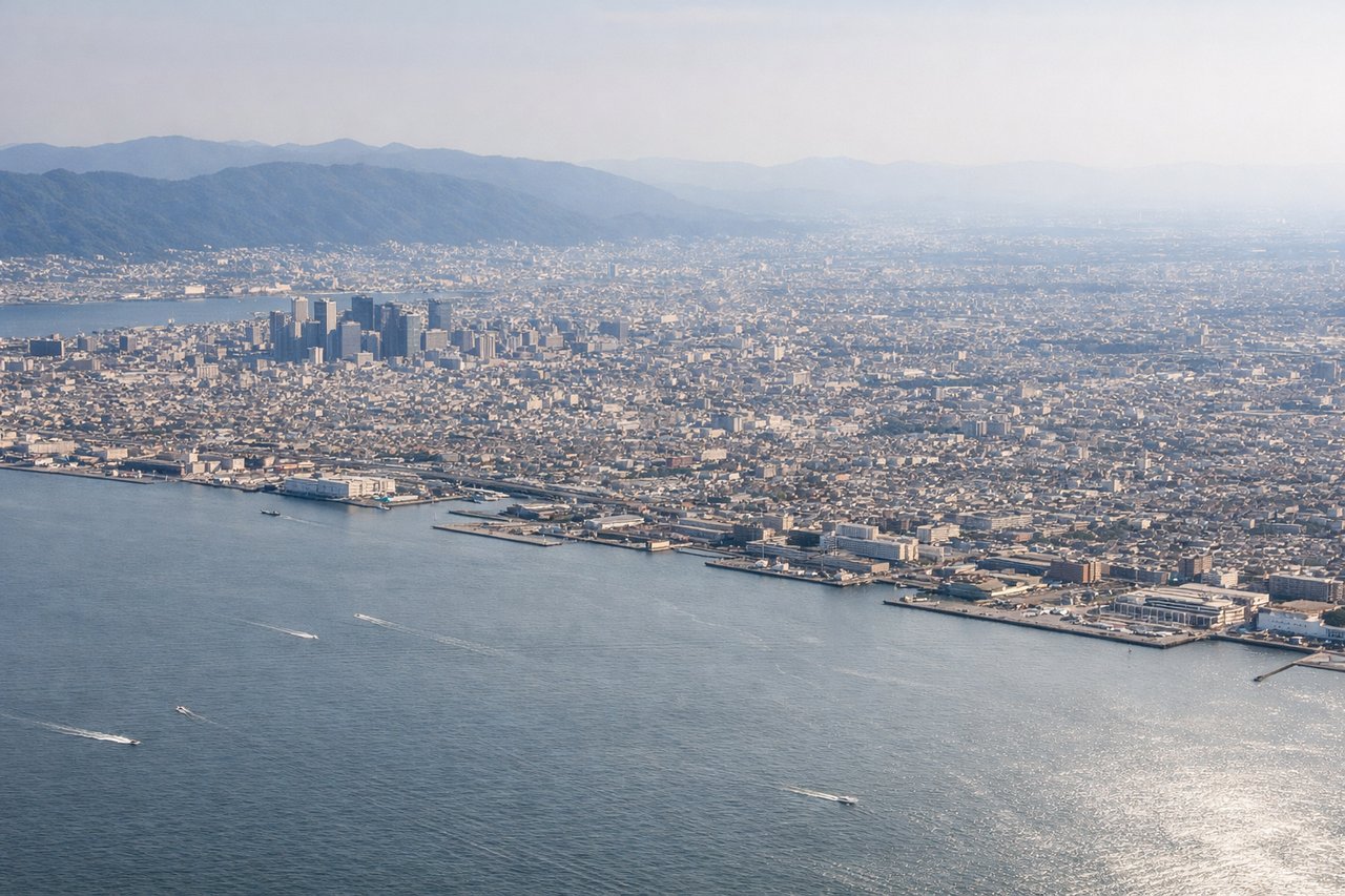
LEFTLeft side offers superior approach scenery into Osaka International. The descent path typically brings views of Osaka Bay, the Kobe-Osaka urban corridor, and the Yodo River delta. Right side faces inland terrain with less dramatic features during final approach.
Will your flight be in sunlight?
Pick a date and time in the Sun Map to watch the sun move across your whole flight.
About This Route
Which side of the plane should I sit on flying from Hakodate (HKD) to Osaka International (ITM)?
Sit on the Right side of the plane for the best views on flights from Hakodate to Osaka. Right side edges ahead due to superior takeoff scenery from Hakodate. The harbor, strait, and volcanic island provide more visual interest during departure than the landing approach offers on either side. While landing views are comparable on both sides, the takeoff experience from the right side is notably more engaging. This is a marginal difference on a short, relatively flat route.
What can I see during takeoff from Hakodate in Hakodate?
During takeoff from Hakodate (HKD), sit on the Right side for the best views. Right side captures Hakodate's harbor and coastal geography during initial climb. The city sits on a peninsula with Tsugaru Strait visible to the north, providing immediate urban and maritime context. Left side climbs over inland terrain with less distinctive features. Notable sights include: Hakodate Bay, Tsugaru Strait (northern horizon), Hakodate city waterfront, Oshima volcanic island (distant, northeast).
What can I see when landing at Osaka International in Osaka?
When landing at Osaka International (ITM), sit on the Left side for the best views. Left side offers superior approach scenery into Osaka International. The descent path typically brings views of Osaka Bay, the Kobe-Osaka urban corridor, and the Yodo River delta. Right side faces inland terrain with less dramatic features during final approach. Notable sights include: Osaka Bay, Kobe city skyline (western shore), Yodo River delta, Osaka urban sprawl.
How long is the flight from Hakodate to Osaka?
The flight from Hakodate (HKD) to Osaka International (ITM) takes about 1 hour 15 minutes. The shortest flight path between them is 564 miles (908 km); winds and air traffic control usually add a few percent.
What does the Hakodate to Osaka flight path pass over?
Tsugaru Strait (northern waters), Honshu's northern coastline, Akita Prefecture inland plains, Niigata Prefecture mountains (distant, west), Sea of Japan coastal features, transition to Kansai region with increasing urban density approaching Osaka