Right side provides superior scenery for the majority of the flight. Takeoff offers immediate dramatic urban and harbor views, and throughout the flight over Asia and Central Asia, right-side windows face the more interesting terrain including mountain ranges and major river valleys along the typical northwesterly routing.
Flown HKG to ARN? Did we get it right?
Flight Path
Hong Kong to Stockholm is 5,100 miles (8,207 km), a flight of about 11 hours 15 minutes.
The flight path crosses the Himalayas and Hindu Kush mountain ranges (visible from altitude as massive snow-capped peaks), the Caspian Sea's eastern shore, and the steppes of Kazakhstan and Russia. Over Central Asia, the Tian Shan and Altai mountain ranges appear as significant ridgelines. The route then crosses the West Siberian Plain before entering European Russia, where the Ural Mountains mark the Asia-Europe boundary. The final segment crosses the Russian platform and enters Scandinavia, with the Scandinavian Peninsula's forested terrain and numerous lakes becoming visible in the descent phase.
Great circle distance and headings ›


Phase by phase
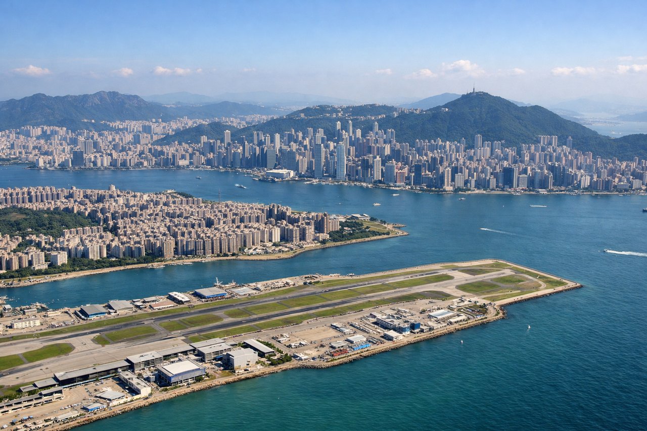
Takeoff from HKG
RIGHTRight side captures Victoria Harbour and Hong Kong Island's skyline immediately after departure, with the Kowloon Peninsula visible across the water. The aircraft climbs northwestward, so right windows show the urban landscape and water features most directly.
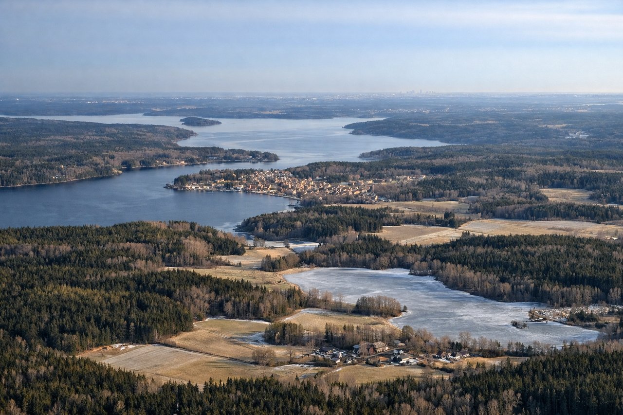
Landing at ARN
LEFTLeft side offers the best views during approach to Arlanda. The aircraft descends from the northwest over the Stockholm archipelago, and left windows show Mälaren Lake, the archipelago's islands, and Stockholm's city center spread across the landscape before final approach.
Will your flight be in sunlight?
Pick a date and time in the Sun Map to watch the sun move across your whole flight.
About This Route
Which side of the plane should I sit on flying from Hong Kong International (HKG) to Arlanda (ARN)?
Sit on the Right side of the plane for the best views on flights from Hong Kong to Stockholm. Right side provides superior scenery for the majority of the flight. Takeoff offers immediate dramatic urban and harbor views, and throughout the flight over Asia and Central Asia, right-side windows face the more interesting terrain including mountain ranges and major river valleys along the typical northwesterly routing.
What can I see during takeoff from Hong Kong International in Hong Kong?
During takeoff from Hong Kong International (HKG), sit on the Right side for the best views. Right side captures Victoria Harbour and Hong Kong Island's skyline immediately after departure, with the Kowloon Peninsula visible across the water. The aircraft climbs northwestward, so right windows show the urban landscape and water features most directly. Notable sights include: Victoria Harbour, Hong Kong Island skyline, Kowloon Peninsula, New Territories coastline.
What can I see when landing at Arlanda in Stockholm?
When landing at Arlanda (ARN), sit on the Left side for the best views. Left side offers the best views during approach to Arlanda. The aircraft descends from the northwest over the Stockholm archipelago, and left windows show Mälaren Lake, the archipelago's islands, and Stockholm's city center spread across the landscape before final approach. Notable sights include: Mälaren Lake, Stockholm archipelago islands, Stockholm city center, Arlanda approach corridor over water.
How long is the flight from Hong Kong to Stockholm?
The flight from Hong Kong International (HKG) to Arlanda (ARN) takes about 11 hours 15 minutes. The shortest flight path between them is 5,100 miles (8,207 km); winds and air traffic control usually add a few percent.
What does the Hong Kong to Stockholm flight path pass over?
The flight path crosses the Himalayas and Hindu Kush mountain ranges (visible from altitude as massive snow-capped peaks), the Caspian Sea's eastern shore, and the steppes of Kazakhstan and Russia. Over Central Asia, the Tian Shan and Altai mountain ranges appear as significant ridgelines. The route then crosses the West Siberian Plain before entering European Russia, where the Ural Mountains mark the Asia-Europe boundary. The final segment crosses the Russian platform and enters Scandinavia, with the Scandinavian Peninsula's forested terrain and numerous lakes becoming visible in the descent phase.