The left side wins on both ends of the flight: Hong Kong's harbor and hills during departure, and Taiwan's Central Mountain Range on approach into Kaohsiung, while the right side is dominated by open water for most of the short route.
Flown HKG to KHH? Did we get it right?
Flight Path
Hong Kong to Kaohsiung is 411 miles (662 km), a flight of about 1 hour 25 minutes.
Taiwan Strait open water, with the Penghu Islands occasionally visible below on clear days along the flight path
Great circle distance and headings ›Phase by phase
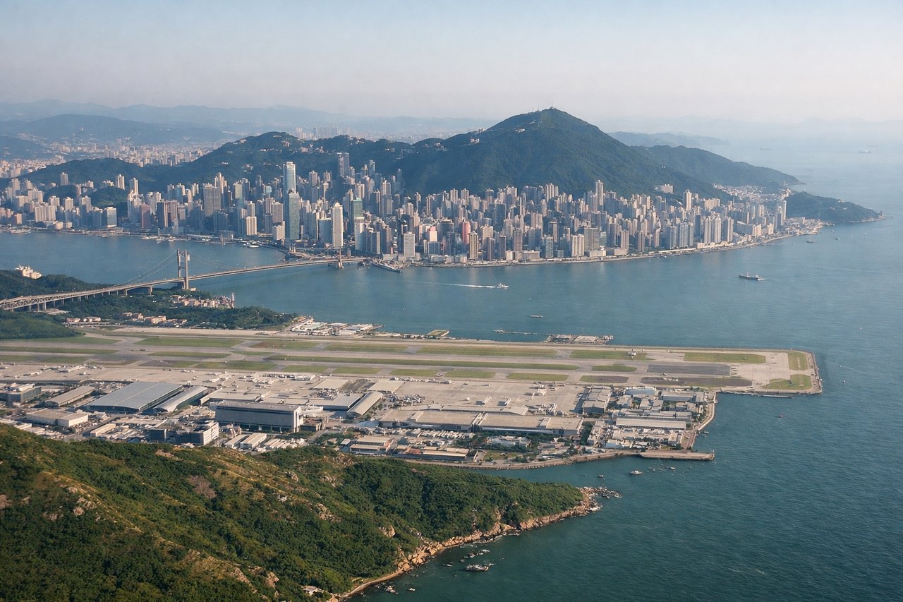
Takeoff from HKG
LEFTDeparting HKG toward the northeast (typical winter runway 07 configuration), the left side offers views of Hong Kong Island's skyline, Victoria Harbour, and the mountainous terrain of the New Territories as the aircraft climbs out over the Pearl River Delta. The right side mostly shows open water toward the South China Sea.
Landing at KHH
LEFTOn approach to KHH from the west, the left side faces north toward Taiwan's Central Mountain Range, whose green ridgelines rise sharply behind the coastal plain as the aircraft descends. The right side shows only the flat Taiwan Strait and featureless coastline south of Kaohsiung.
Will your flight be in sunlight?
Pick a date and time in the Sun Map to watch the sun move across your whole flight.
About This Route
Which side of the plane should I sit on flying from Hong Kong International (HKG) to Kaohsiung International (KHH)?
Sit on the Left side of the plane for the best views on flights from Hong Kong to Kaohsiung. The left side wins on both ends of the flight: Hong Kong's harbor and hills during departure, and Taiwan's Central Mountain Range on approach into Kaohsiung, while the right side is dominated by open water for most of the short route.
What can I see during takeoff from Hong Kong International in Hong Kong?
During takeoff from Hong Kong International (HKG), sit on the Left side for the best views. Departing HKG toward the northeast (typical winter runway 07 configuration), the left side offers views of Hong Kong Island's skyline, Victoria Harbour, and the mountainous terrain of the New Territories as the aircraft climbs out over the Pearl River Delta. The right side mostly shows open water toward the South China Sea. Notable sights include: Victoria Harbour, Hong Kong Island skyline, Lantau Island, New Territories hills.
What can I see when landing at Kaohsiung International in Kaohsiung?
When landing at Kaohsiung International (KHH), sit on the Left side for the best views. On approach to KHH from the west, the left side faces north toward Taiwan's Central Mountain Range, whose green ridgelines rise sharply behind the coastal plain as the aircraft descends. The right side shows only the flat Taiwan Strait and featureless coastline south of Kaohsiung. Notable sights include: Central Mountain Range foothills, Kaohsiung's coastal plain, Love River delta area, Kaohsiung harbor.
How long is the flight from Hong Kong to Kaohsiung?
The flight from Hong Kong International (HKG) to Kaohsiung International (KHH) takes about 1 hour 25 minutes. The shortest flight path between them is 411 miles (662 km); winds and air traffic control usually add a few percent.
What does the Hong Kong to Kaohsiung flight path pass over?
Taiwan Strait open water, with the Penghu Islands occasionally visible below on clear days along the flight path