While takeoff on the left offers dramatic Hong Kong harbor views, the landing approach on the right provides the more visually rewarding experience with Lake Ontario, the Toronto Islands, and the downtown skyline. The landing view is more consistently scenic throughout the descent.
Flown HKG to YTZ? Did we get it right?
Flight Path
Hong Kong to Toronto is 7,803 miles (12,558 km), a flight of about 15 hours 45 minutes.
The flight path crosses the North Pacific, passing north of Japan and the Aleutian Islands. Passengers may glimpse the Aleutian chain during daylight hours depending on seasonal timing. The route then crosses western Canada over British Columbia's mountainous terrain and the Canadian Rockies before descending into Toronto. Over the Pacific, the curvature of Earth becomes apparent at cruising altitude, and aurora displays are possible during northern route segments in winter months, though not guaranteed.
Great circle distance and headings ›

Phase by phase
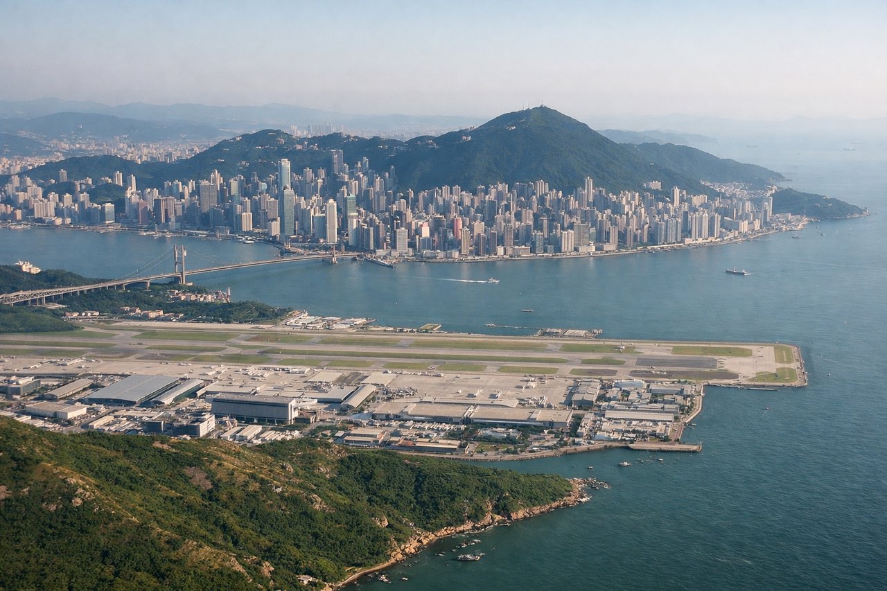
Takeoff from HKG
LEFTLeft side captures Victoria Harbour and Kowloon Peninsula immediately after departure, with the dramatic backdrop of the New Territories mountains. Right side faces inland toward the airport's industrial zones.
Landing at YTZ
RIGHTRight side provides views of Lake Ontario's shoreline and Toronto's downtown core during final approach. Left side faces toward the western suburbs and industrial areas north of the airport.
Will your flight be in sunlight?
Pick a date and time in the Sun Map to watch the sun move across your whole flight.
About This Route
Which side of the plane should I sit on flying from Hong Kong International (HKG) to City Centre (YTZ)?
Sit on the Right side of the plane for the best views on flights from Hong Kong to Toronto. While takeoff on the left offers dramatic Hong Kong harbor views, the landing approach on the right provides the more visually rewarding experience with Lake Ontario, the Toronto Islands, and the downtown skyline. The landing view is more consistently scenic throughout the descent.
What can I see during takeoff from Hong Kong International in Hong Kong?
During takeoff from Hong Kong International (HKG), sit on the Left side for the best views. Left side captures Victoria Harbour and Kowloon Peninsula immediately after departure, with the dramatic backdrop of the New Territories mountains. Right side faces inland toward the airport's industrial zones. Notable sights include: Victoria Harbour, Kowloon Peninsula skyline, New Territories mountain ridges, Hong Kong Island's northern coastline.
What can I see when landing at City Centre in Toronto?
When landing at City Centre (YTZ), sit on the Right side for the best views. Right side provides views of Lake Ontario's shoreline and Toronto's downtown core during final approach. Left side faces toward the western suburbs and industrial areas north of the airport. Notable sights include: Lake Ontario, Toronto Islands, downtown Toronto skyline, Scarborough Bluffs.
How long is the flight from Hong Kong to Toronto?
The flight from Hong Kong International (HKG) to City Centre (YTZ) takes about 15 hours 45 minutes. The shortest flight path between them is 7,803 miles (12,558 km); winds and air traffic control usually add a few percent.
What does the Hong Kong to Toronto flight path pass over?
The flight path crosses the North Pacific, passing north of Japan and the Aleutian Islands. Passengers may glimpse the Aleutian chain during daylight hours depending on seasonal timing. The route then crosses western Canada over British Columbia's mountainous terrain and the Canadian Rockies before descending into Toronto. Over the Pacific, the curvature of Earth becomes apparent at cruising altitude, and aurora displays are possible during northern route segments in winter months, though not guaranteed.