Tokyo to Spokane is 4,974 miles (8,005 km), a flight of about 11 hours.
This transpacific route offers distinct viewing opportunities on each end. Right seats dominate the Tokyo departure with Tokyo Bay and the Kanto Plain. Left seats win on approach to Spokane with the Columbia River and Palouse terrain. The long overwater and remote terrain middle section offers minimal distinctive landmarks from either side.
Flight Path
The flight path crosses the North Pacific, passing north of the Hawaiian Islands (not visible on standard routing). Over the Pacific, you'll see only open ocean and occasional cloud formations. Approaching North America, the flight passes over the Aleutian Islands region (far north, rarely visible), then over British Columbia's interior mountains and valleys before descending into the Inland Northwest. The Rocky Mountains and Cascade Range are too far south of the direct great-circle route to be prominently visible, though on very clear days distant peaks may appear on the horizon during the final descent phase over Washington state.
Great circle distance and headings ›


Phase by phase
Takeoff from HND
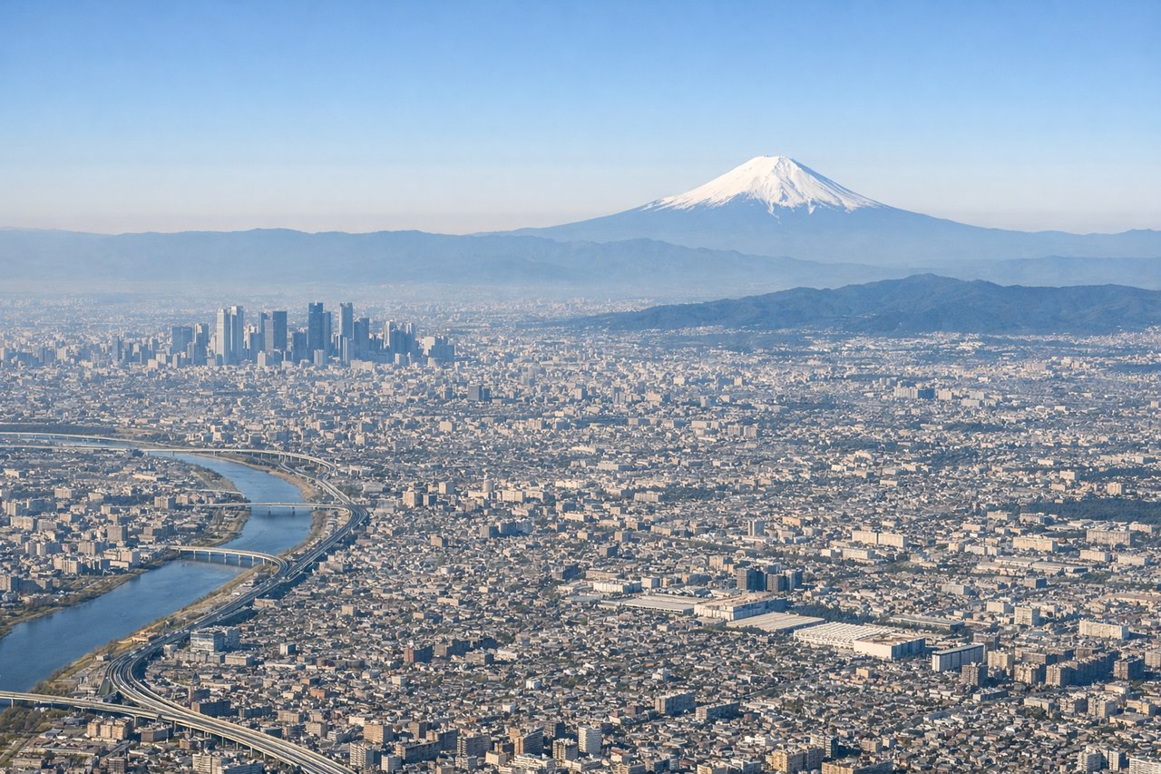
RIGHTRight-side seats offer views of Tokyo Bay and the Kanto Plain as the aircraft climbs northeastward from Haneda. You'll see the bay's distinctive shape, surrounding urban sprawl, and the transition to rural areas inland.
Landing at GEG
LEFTLeft-side seats provide views of the Columbia River, the Blue Mountains, and the Palouse region as you descend into Spokane from the northwest. The river's winding path and surrounding high desert terrain are distinctive and photogenic.
Landmarks on this routeAll landmarks →
Will your flight be in sunlight?
Pick a date and time in the Sun Map to watch the sun move across your whole flight.
About This Route
Which side of the plane should I sit on flying from Tokyo International (HND) to Spokane International (GEG)?
Sit on the Right for takeoff, Left for landing side of the plane for the best views on flights from Tokyo to Spokane. This transpacific route offers distinct viewing opportunities on each end. Right seats dominate the Tokyo departure with Tokyo Bay and the Kanto Plain. Left seats win on approach to Spokane with the Columbia River and Palouse terrain. The long overwater and remote terrain middle section offers minimal distinctive landmarks from either side.
What can I see during takeoff from Tokyo International in Tokyo?
During takeoff from Tokyo International (HND), sit on the Right side for the best views. Right-side seats offer views of Tokyo Bay and the Kanto Plain as the aircraft climbs northeastward from Haneda. You'll see the bay's distinctive shape, surrounding urban sprawl, and the transition to rural areas inland. Notable sights include: Tokyo Bay, Kanto Plain urban grid, Mount Fuji (visible on clear days to the southwest, though not directly on departure path), Boso Peninsula across the bay.
What can I see when landing at Spokane International in Spokane?
When landing at Spokane International (GEG), sit on the Left side for the best views. Left-side seats provide views of the Columbia River, the Blue Mountains, and the Palouse region as you descend into Spokane from the northwest. The river's winding path and surrounding high desert terrain are distinctive and photogenic. Notable sights include: Columbia River, Blue Mountains (eastern Oregon/Washington border), Palouse Hills rolling terrain, Spokane city grid and surrounding lakes.
How long is the flight from Tokyo to Spokane?
The flight from Tokyo International (HND) to Spokane International (GEG) takes about 11 hours. The shortest flight path between them is 4,974 miles (8,005 km); winds and air traffic control usually add a few percent.
What does the Tokyo to Spokane flight path pass over?
The flight path crosses the North Pacific, passing north of the Hawaiian Islands (not visible on standard routing). Over the Pacific, you'll see only open ocean and occasional cloud formations. Approaching North America, the flight passes over the Aleutian Islands region (far north, rarely visible), then over British Columbia's interior mountains and valleys before descending into the Inland Northwest. The Rocky Mountains and Cascade Range are too far south of the direct great-circle route to be prominently visible, though on very clear days distant peaks may appear on the horizon during the final descent phase over Washington state.