The right side wins overall. The Tokyo Bay departure view is genuinely spectacular and hard to beat for urban geography. Over the open East China Sea the views are similar on both sides, but on descent into Taoyuan the right side still offers coastal Taiwan views, and the left side advantage on landing is modest. The takeoff experience tips it to the right.
Flown HND to TPE? Did we get it right?
Flight Path
Tokyo to Taipei is 1,319 miles (2,122 km), a flight of about 3 hours 20 minutes.
The flight tracks southwest over the East China Sea, passing well east of the Ryukyu Islands chain (Okinawa visible as a distant landmass on clear days from the right side at cruise altitude). The route crosses open ocean for the majority of the flight before the northeastern coast of Taiwan appears on descent. No significant overland segments between Japan and Taiwan.
Great circle distance and headings ›

Phase by phase
Takeoff from HND
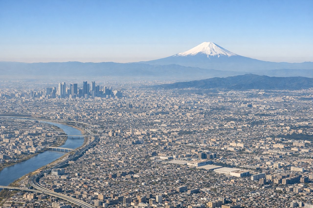
RIGHTHaneda's primary departure runway 34R sends aircraft northward before turning southwest, and the right side gives you a clear view over Tokyo Bay and the dense urban grid of central Tokyo including the waterfront districts. You'll see the bay's geometry and the city sprawl extending toward Yokohama.
Landing at TPE
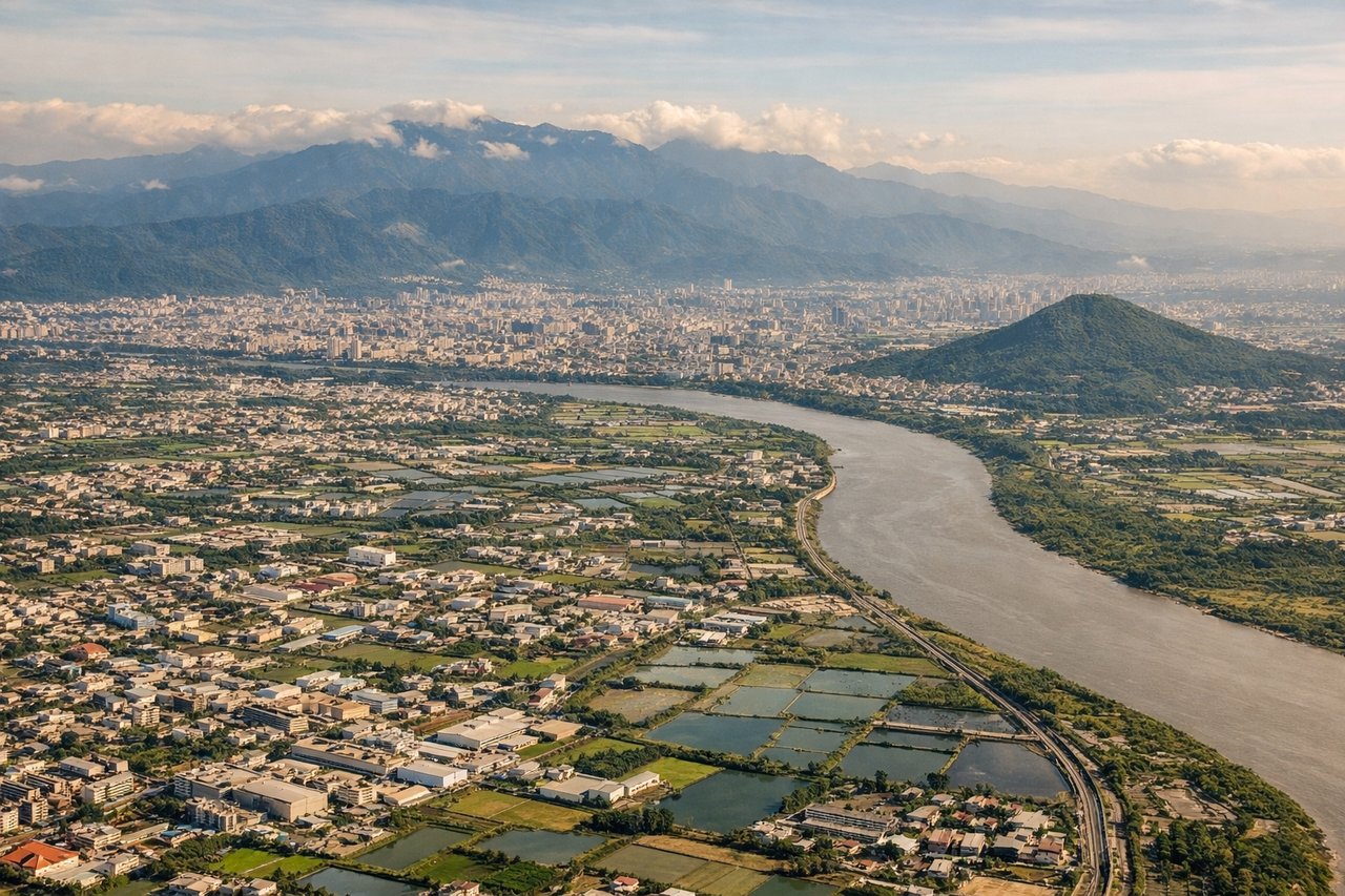
LEFTTaoyuan Airport typically uses runways oriented roughly 06/24. On approach from the northeast, aircraft descend over the Taiwan Strait coastal plain, and the left side faces north toward Taipei's basin and the surrounding mountains including Yangmingshan. You get a clear look at the Taipei metropolitan area and the green volcanic hills framing it.
Will your flight be in sunlight?
Pick a date and time in the Sun Map to watch the sun move across your whole flight.
About This Route
Which side of the plane should I sit on flying from Tokyo International (HND) to Chiang Kai Shek International (TPE)?
Sit on the Right side of the plane for the best views on flights from Tokyo to Taipei. The right side wins overall. The Tokyo Bay departure view is genuinely spectacular and hard to beat for urban geography. Over the open East China Sea the views are similar on both sides, but on descent into Taoyuan the right side still offers coastal Taiwan views, and the left side advantage on landing is modest. The takeoff experience tips it to the right.
What can I see during takeoff from Tokyo International in Tokyo?
During takeoff from Tokyo International (HND), sit on the Right side for the best views. Haneda's primary departure runway 34R sends aircraft northward before turning southwest, and the right side gives you a clear view over Tokyo Bay and the dense urban grid of central Tokyo including the waterfront districts. You'll see the bay's geometry and the city sprawl extending toward Yokohama. Notable sights include: Tokyo Bay, Yokohama port and waterfront, Tokyo's waterfront reclaimed islands (Odaiba area), Kawasaki industrial zone along the bay shore.
What can I see when landing at Chiang Kai Shek International in Taipei?
When landing at Chiang Kai Shek International (TPE), sit on the Left side for the best views. Taoyuan Airport typically uses runways oriented roughly 06/24. On approach from the northeast, aircraft descend over the Taiwan Strait coastal plain, and the left side faces north toward Taipei's basin and the surrounding mountains including Yangmingshan. You get a clear look at the Taipei metropolitan area and the green volcanic hills framing it. Notable sights include: Taipei Basin urban area, Yangmingshan volcanic hills north of Taipei, Tamsui River estuary on the coast, Taiwan Strait coastline.
How long is the flight from Tokyo to Taipei?
The flight from Tokyo International (HND) to Chiang Kai Shek International (TPE) takes about 3 hours 20 minutes. The shortest flight path between them is 1,319 miles (2,122 km); winds and air traffic control usually add a few percent.
What does the Tokyo to Taipei flight path pass over?
The flight tracks southwest over the East China Sea, passing well east of the Ryukyu Islands chain (Okinawa visible as a distant landmass on clear days from the right side at cruise altitude). The route crosses open ocean for the majority of the flight before the northeastern coast of Taiwan appears on descent. No significant overland segments between Japan and Taiwan.