Both sides bookend a long ocean crossing with strong scenery, but the right side's Waikiki/Diamond Head departure plus Mount St. Helens and Mount Adams visible on arrival edge out the left side's North Shore departure, even though the left side gets the standout Mount Hood view on landing.
Flown HNL to PDX? Did we get it right?
Flight Path
Honolulu to Portland is 2,603 miles (4,188 km), a flight of about 5 hours 30 minutes.
The majority of the route crosses open North Pacific Ocean with no land visible for several hours; near the end of cruise, the aircraft may pass within sight of the Oregon/Washington coastline before beginning descent toward the Columbia River region.
Great circle distance and headings ›

Phase by phase
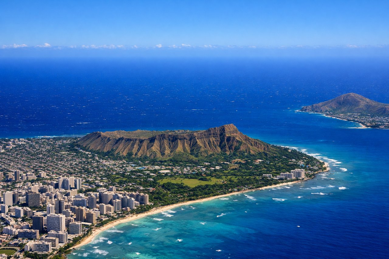
Takeoff from HNL
RIGHTDeparting the Reef Runway, the aircraft climbs east over the ocean before banking north toward the mainland, putting Diamond Head crater, Waikiki Beach, and the Honolulu skyline on the right side as they slide past below. It's a classic, unmistakable Hawaii send-off.
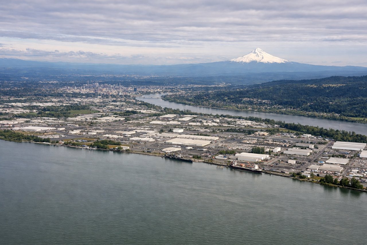
Landing at PDX
LEFTOn the westerly approach into PDX's runway 28, the flight path often tracks down the Columbia River corridor, putting the massive snow-capped cone of Mount Hood squarely on the left side as the plane descends toward Portland. It's one of the more dramatic mountain views of any mainland US approach.
Will your flight be in sunlight?
Pick a date and time in the Sun Map to watch the sun move across your whole flight.
About This Route
Which side of the plane should I sit on flying from Honolulu International (HNL) to Portland International (PDX)?
Sit on the Right side of the plane for the best views on flights from Honolulu to Portland. Both sides bookend a long ocean crossing with strong scenery, but the right side's Waikiki/Diamond Head departure plus Mount St. Helens and Mount Adams visible on arrival edge out the left side's North Shore departure, even though the left side gets the standout Mount Hood view on landing.
What can I see during takeoff from Honolulu International in Honolulu?
During takeoff from Honolulu International (HNL), sit on the Right side for the best views. Departing the Reef Runway, the aircraft climbs east over the ocean before banking north toward the mainland, putting Diamond Head crater, Waikiki Beach, and the Honolulu skyline on the right side as they slide past below. It's a classic, unmistakable Hawaii send-off. Notable sights include: Diamond Head crater, Waikiki Beach, Honolulu downtown skyline, Pearl Harbor.
What can I see when landing at Portland International in Portland?
When landing at Portland International (PDX), sit on the Left side for the best views. On the westerly approach into PDX's runway 28, the flight path often tracks down the Columbia River corridor, putting the massive snow-capped cone of Mount Hood squarely on the left side as the plane descends toward Portland. It's one of the more dramatic mountain views of any mainland US approach. Notable sights include: Mount Hood, Willamette River, Portland downtown skyline, Columbia River.
How long is the flight from Honolulu to Portland?
The flight from Honolulu International (HNL) to Portland International (PDX) takes about 5 hours 30 minutes. The shortest flight path between them is 2,603 miles (4,188 km); winds and air traffic control usually add a few percent.
What does the Honolulu to Portland flight path pass over?
The majority of the route crosses open North Pacific Ocean with no land visible for several hours; near the end of cruise, the aircraft may pass within sight of the Oregon/Washington coastline before beginning descent toward the Columbia River region.