Homer to Seattle is 1,445 miles (2,326 km), a flight of about 3 hours 25 minutes.
The right side delivers the best views at both ends of the flight — Kachemak Bay and the Kenai Mountains on departure, and Puget Sound with the Seattle skyline on arrival. Along the cruise portion heading southeast over British Columbia, the right side also tends to face southwest toward the Coast Mountains and Vancouver Island coastline.
Flight Path
The flight tracks southeast over the Gulf of Alaska coastline, then crosses the Alaska-BC border over the Coast Mountains. Over British Columbia you'll see the heavily glaciated Saint Elias and Coast Mountain ranges, the Inside Passage fjords and islands, and eventually the Fraser River delta and Vancouver area before descending into Seattle.
Great circle distance and headings ›Phase by phase
Takeoff from HOM
RIGHTDeparting Homer, aircraft typically head northeast or east. The right side gives you a direct view across Kachemak Bay toward the Kenai Mountains and the dramatic glaciated peaks of the Harding Icefield area. You'll also see the Homer Spit extending into the bay below.
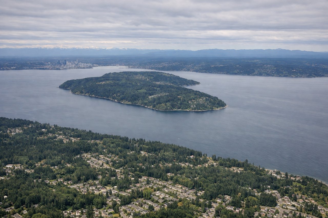
Landing at SEA
RIGHTOn approach to SeaTac from the north, aircraft typically land on runways 16L/16R heading south. The right side faces west, giving you clear views of Puget Sound, the Olympic Peninsula, and Elliott Bay with downtown Seattle visible to the northwest. The left side gets the Cascades but the urban and water scenery on the right is more dramatic on final.
Landmarks on this routeAll landmarks →
Will your flight be in sunlight?
Pick a date and time in the Sun Map to watch the sun move across your whole flight.
About This Route
Which side of the plane should I sit on flying from Homer (HOM) to Seattle Tacoma International (SEA)?
Sit on the Right side of the plane for the best views on flights from Homer to Seattle. The right side delivers the best views at both ends of the flight — Kachemak Bay and the Kenai Mountains on departure, and Puget Sound with the Seattle skyline on arrival. Along the cruise portion heading southeast over British Columbia, the right side also tends to face southwest toward the Coast Mountains and Vancouver Island coastline.
What can I see during takeoff from Homer in Homer?
During takeoff from Homer (HOM), sit on the Right side for the best views. Departing Homer, aircraft typically head northeast or east. The right side gives you a direct view across Kachemak Bay toward the Kenai Mountains and the dramatic glaciated peaks of the Harding Icefield area. You'll also see the Homer Spit extending into the bay below. Notable sights include: Kachemak Bay, Homer Spit, Kenai Mountains, Harding Icefield glaciers.
What can I see when landing at Seattle Tacoma International in Seattle?
When landing at Seattle Tacoma International (SEA), sit on the Right side for the best views. On approach to SeaTac from the north, aircraft typically land on runways 16L/16R heading south. The right side faces west, giving you clear views of Puget Sound, the Olympic Peninsula, and Elliott Bay with downtown Seattle visible to the northwest. The left side gets the Cascades but the urban and water scenery on the right is more dramatic on final. Notable sights include: Puget Sound, Elliott Bay, downtown Seattle skyline, Olympic Mountains.
How long is the flight from Homer to Seattle?
The flight from Homer (HOM) to Seattle Tacoma International (SEA) takes about 3 hours 25 minutes. The shortest flight path between them is 1,445 miles (2,326 km); winds and air traffic control usually add a few percent.
What does the Homer to Seattle flight path pass over?
The flight tracks southeast over the Gulf of Alaska coastline, then crosses the Alaska-BC border over the Coast Mountains. Over British Columbia you'll see the heavily glaciated Saint Elias and Coast Mountain ranges, the Inside Passage fjords and islands, and eventually the Fraser River delta and Vancouver area before descending into Seattle.