Seattle to Homer is 1,445 miles (2,326 km), a flight of about 3 hours 15 minutes.
While the left offers excellent Cascade and Rainier views during departure, the right side dominates the longer approach into Homer with sustained views of Kachemak Bay, coastal terrain, and glacier-carved valleys that define the destination region.
Flight Path
The flight path crosses the Gulf of Alaska at altitude. Notable midpoint geography includes the Inside Passage region (visible if flying slightly west), the Alaska Panhandle's coastal mountains, and the transition from temperate Pacific Northwest forests to subarctic terrain. At cruising altitude, the Chugach Mountains become visible as the aircraft approaches southcentral Alaska, with Cook Inlet appearing as a large water body before descent toward the Kenai Peninsula.
Great circle distance and headings ›Phase by phase
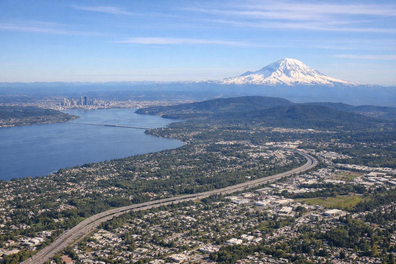
Takeoff from SEA
LEFTLeft side offers immediate views of the Cascade Range and Mount Rainier as the aircraft climbs northward out of Seattle. The right side faces Puget Sound and the Olympic Mountains, but the Cascades dominate the left perspective during the initial climb.
Landing at HOM
RIGHTRight side provides the best views during descent into Homer. The aircraft approaches from the southeast, and the right window frames Kachemak Bay, the Kenai Peninsula's coastal geography, and the final approach over water toward the runway.
Will your flight be in sunlight?
Pick a date and time in the Sun Map to watch the sun move across your whole flight.
About This Route
Which side of the plane should I sit on flying from Seattle Tacoma International (SEA) to Homer (HOM)?
Sit on the Right side of the plane for the best views on flights from Seattle to Homer. While the left offers excellent Cascade and Rainier views during departure, the right side dominates the longer approach into Homer with sustained views of Kachemak Bay, coastal terrain, and glacier-carved valleys that define the destination region.
What can I see during takeoff from Seattle Tacoma International in Seattle?
During takeoff from Seattle Tacoma International (SEA), sit on the Left side for the best views. Left side offers immediate views of the Cascade Range and Mount Rainier as the aircraft climbs northward out of Seattle. The right side faces Puget Sound and the Olympic Mountains, but the Cascades dominate the left perspective during the initial climb. Notable sights include: Mount Rainier (14,411 ft, ~50 miles southeast), Cascade Range, Lake Union, Puget Sound.
What can I see when landing at Homer in Homer?
When landing at Homer (HOM), sit on the Right side for the best views. Right side provides the best views during descent into Homer. The aircraft approaches from the southeast, and the right window frames Kachemak Bay, the Kenai Peninsula's coastal geography, and the final approach over water toward the runway. Notable sights include: Kachemak Bay, Kenai Peninsula coastline, Grewingk Glacier (visible on clear days), Cook Inlet.
How long is the flight from Seattle to Homer?
The flight from Seattle Tacoma International (SEA) to Homer (HOM) takes about 3 hours 15 minutes. The shortest flight path between them is 1,445 miles (2,326 km); winds and air traffic control usually add a few percent.
What does the Seattle to Homer flight path pass over?
The flight path crosses the Gulf of Alaska at altitude. Notable midpoint geography includes the Inside Passage region (visible if flying slightly west), the Alaska Panhandle's coastal mountains, and the transition from temperate Pacific Northwest forests to subarctic terrain. At cruising altitude, the Chugach Mountains become visible as the aircraft approaches southcentral Alaska, with Cook Inlet appearing as a large water body before descent toward the Kenai Peninsula.