While takeoff favors the right side (Galveston Bay industrial scenery), the landing experience on the left side is significantly more dramatic and visually rewarding. The Blue Ridge Mountains foothills and Shenandoah Valley provide genuine terrain variety and recognizable geographic features that dominate the final descent. The overall flight balances flat Texas terrain with Appalachian scenery, but the landing sequence tips the advantage to the left side. Both sides score equally at 2.5 due to the route's limited dramatic terrain—this is a relatively flat-to-rolling corridor with no major mountain crossings or coastal drama. The left side edges ahead for the superior landing experience.
Flown HOU to IAD? Did we get it right?
Flight Path
Houston to Washington is 1,200 miles (1,931 km), a flight of about 3 hours.
The flight path crosses the Mississippi River valley (near Memphis or St. Louis depending on routing), the Cumberland Plateau in Tennessee/Kentucky, and the Appalachian foothills. Cruise altitude typically 35,000-37,000 feet provides distant views of these features but no dramatic close-range scenery. The terrain gradually transitions from flat Gulf Coast plains through rolling Ozark/Appalachian foothills to the Piedmont region of Virginia.
Great circle distance and headings ›Phase by phase
Takeoff from HOU
RIGHTDeparting HOU typically uses runway 13R heading southeast, which banks right over Galveston Bay and the industrial Houston Ship Channel. Right-side passengers see the bay's water, refineries, and coastal marshland during initial climb. Left-side passengers see inland Houston sprawl and flat terrain with minimal visual interest.
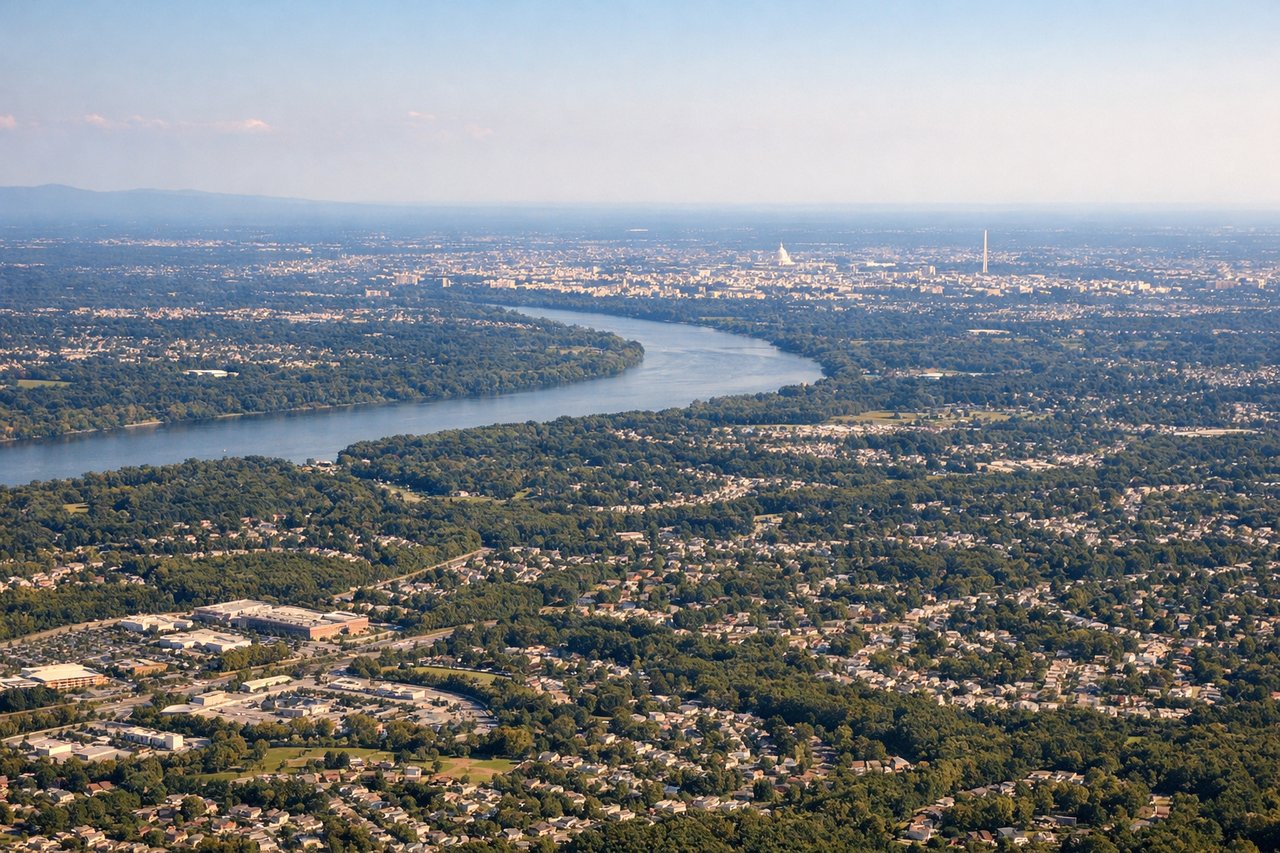
Landing at IAD
LEFTArriving at IAD typically uses runway 01 (northbound) or 19 (southbound) depending on season. Northbound arrivals (winter/spring) descend from the south over the Piedmont region, offering views of the Blue Ridge Mountains foothills and the Shenandoah Valley. Southbound arrivals (summer/fall) descend over similar terrain. Left-side passengers on northbound approaches see the Blue Ridge escarpment and forested valleys. Right-side passengers see flatter terrain and suburban sprawl.
Will your flight be in sunlight?
Pick a date and time in the Sun Map to watch the sun move across your whole flight.
About This Route
Which side of the plane should I sit on flying from William P Hobby (HOU) to Washington Dulles International (IAD)?
Sit on the Left side of the plane for the best views on flights from Houston to Washington. While takeoff favors the right side (Galveston Bay industrial scenery), the landing experience on the left side is significantly more dramatic and visually rewarding. The Blue Ridge Mountains foothills and Shenandoah Valley provide genuine terrain variety and recognizable geographic features that dominate the final descent. The overall flight balances flat Texas terrain with Appalachian scenery, but the landing sequence tips the advantage to the left side. Both sides score equally at 2.5 due to the route's limited dramatic terrain—this is a relatively flat-to-rolling corridor with no major mountain crossings or coastal drama. The left side edges ahead for the superior landing experience.
What can I see during takeoff from William P Hobby in Houston?
During takeoff from William P Hobby (HOU), sit on the Right side for the best views. Departing HOU typically uses runway 13R heading southeast, which banks right over Galveston Bay and the industrial Houston Ship Channel. Right-side passengers see the bay's water, refineries, and coastal marshland during initial climb. Left-side passengers see inland Houston sprawl and flat terrain with minimal visual interest. Notable sights include: Galveston Bay, Houston Ship Channel, Galveston Island (distant), industrial refineries along the channel.
What can I see when landing at Washington Dulles International in Washington?
When landing at Washington Dulles International (IAD), sit on the Left side for the best views. Arriving at IAD typically uses runway 01 (northbound) or 19 (southbound) depending on season. Northbound arrivals (winter/spring) descend from the south over the Piedmont region, offering views of the Blue Ridge Mountains foothills and the Shenandoah Valley. Southbound arrivals (summer/fall) descend over similar terrain. Left-side passengers on northbound approaches see the Blue Ridge escarpment and forested valleys. Right-side passengers see flatter terrain and suburban sprawl. Notable sights include: Blue Ridge Mountains foothills, Shenandoah Valley, Potomac River, Washington DC skyline (distant).
How long is the flight from Houston to Washington?
The flight from William P Hobby (HOU) to Washington Dulles International (IAD) takes about 3 hours. The shortest flight path between them is 1,200 miles (1,931 km); winds and air traffic control usually add a few percent.
What does the Houston to Washington flight path pass over?
The flight path crosses the Mississippi River valley (near Memphis or St. Louis depending on routing), the Cumberland Plateau in Tennessee/Kentucky, and the Appalachian foothills. Cruise altitude typically 35,000-37,000 feet provides distant views of these features but no dramatic close-range scenery. The terrain gradually transitions from flat Gulf Coast plains through rolling Ozark/Appalachian foothills to the Piedmont region of Virginia.