Both sides spend the vast majority of this ultra-long flight over open ocean, capping the ceiling for either side, but the right side captures the two genuinely scenic bookends of the journey: the Ethiopian highland terrain on departure and Auckland's volcanic harbour scenery on arrival, giving it a modest edge over the plainer Sudanese lowlands and Manukau-side approach on the left.
Flown HUE to AKL? Did we get it right?
Flight Path
Akwi to Auckland is 9,396 miles (15,122 km), a flight of about 17 hours 45 minutes.
After crossing the Horn of Africa near the Somali coast, the route runs almost entirely over open water — first the Indian Ocean, then the Southern Ocean south of Western Australia, passing near the latitude of northern Tasmania before crossing the Tasman Sea into New Zealand's North Island.
Great circle distance and headings ›


Phase by phase
Takeoff from HUE
RIGHTDeparting Humera and turning onto the southeast track toward the Indian Ocean, the right side looks across the rising Tigray escarpment, with the Tekeze River valley and the foothills leading up toward Lake Tana and the Simien Mountains. The left side instead faces the flat, featureless plains toward the Sudan-Eritrea border.
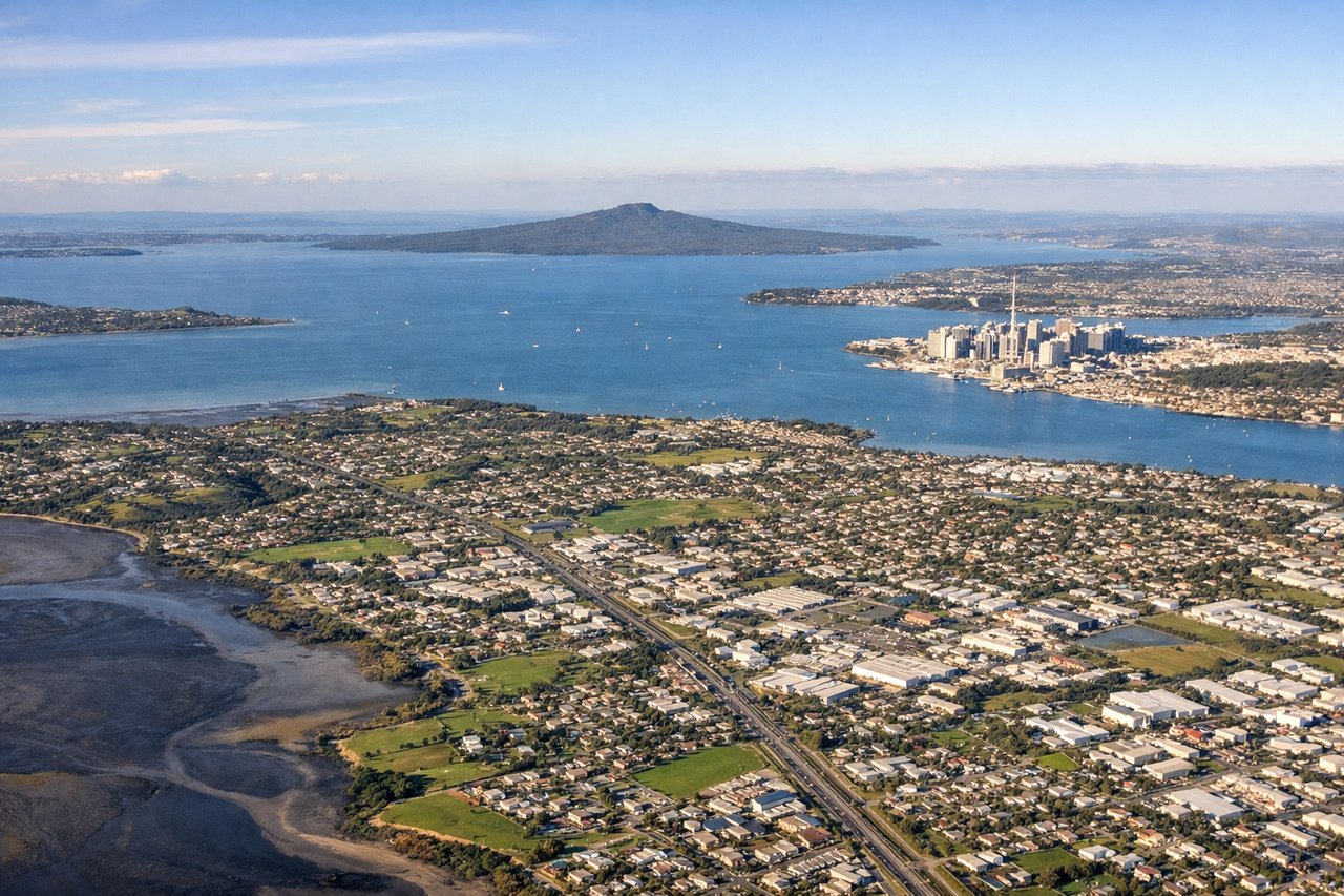
Landing at AKL
RIGHTOn approach to Auckland's runway 23L from the northeast, the right side faces northwest over the Waitemata Harbour, giving a clear view of Rangitoto Island's volcanic cone, the city skyline, and the Hauraki Gulf islands. The left side instead overlooks the flatter Manukau Harbour and southern suburbs, with less visual drama.
Will your flight be in sunlight?
Pick a date and time in the Sun Map to watch the sun move across your whole flight.
About This Route
Which side of the plane should I sit on flying from Humera Airport (HUE) to Auckland International (AKL)?
Sit on the Right side of the plane for the best views on flights from Akwi to Auckland. Both sides spend the vast majority of this ultra-long flight over open ocean, capping the ceiling for either side, but the right side captures the two genuinely scenic bookends of the journey: the Ethiopian highland terrain on departure and Auckland's volcanic harbour scenery on arrival, giving it a modest edge over the plainer Sudanese lowlands and Manukau-side approach on the left.
What can I see during takeoff from Humera Airport in Akwi?
During takeoff from Humera Airport (HUE), sit on the Right side for the best views. Departing Humera and turning onto the southeast track toward the Indian Ocean, the right side looks across the rising Tigray escarpment, with the Tekeze River valley and the foothills leading up toward Lake Tana and the Simien Mountains. The left side instead faces the flat, featureless plains toward the Sudan-Eritrea border. Notable sights include: Tekeze River valley, Tigray highland escarpment, Simien Mountains foothills, Lake Tana plateau edge.
What can I see when landing at Auckland International in Auckland?
When landing at Auckland International (AKL), sit on the Right side for the best views. On approach to Auckland's runway 23L from the northeast, the right side faces northwest over the Waitemata Harbour, giving a clear view of Rangitoto Island's volcanic cone, the city skyline, and the Hauraki Gulf islands. The left side instead overlooks the flatter Manukau Harbour and southern suburbs, with less visual drama. Notable sights include: Rangitoto Island, Waitemata Harbour, Auckland Sky Tower skyline, Hauraki Gulf islands.
How long is the flight from Akwi to Auckland?
The flight from Humera Airport (HUE) to Auckland International (AKL) takes about 17 hours 45 minutes. The shortest flight path between them is 9,396 miles (15,122 km); winds and air traffic control usually add a few percent.
What does the Akwi to Auckland flight path pass over?
After crossing the Horn of Africa near the Somali coast, the route runs almost entirely over open water — first the Indian Ocean, then the Southern Ocean south of Western Australia, passing near the latitude of northern Tasmania before crossing the Tasman Sea into New Zealand's North Island.