Humberside to Amsterdam is 230 miles (370 km), a flight of about 1 hour 15 minutes.
While takeoff offers good North Sea and estuary views on the right, the landing descent provides more extensive and distinctive scenery. The approach to Amsterdam crosses the iconic Dutch polder landscape and major water bodies, which are visually more striking and geographically significant than the departure views.
Flight Path
North Sea crossing with occasional oil and gas platforms visible at altitude; the Dogger Bank fishing grounds; transition from English to Dutch airspace marked by the continental shelf; approach over the Wadden Sea islands and North Holland coastal region
Great circle distance and headings ›Phase by phase
Takeoff from HUY
RIGHTRight-side seats offer views of the Humber Estuary and the Yorkshire coastline as you climb out. The aircraft typically departs eastbound over water, giving right-side passengers a clear view of the tidal mudflats and the North Sea coast stretching south toward Lincolnshire.
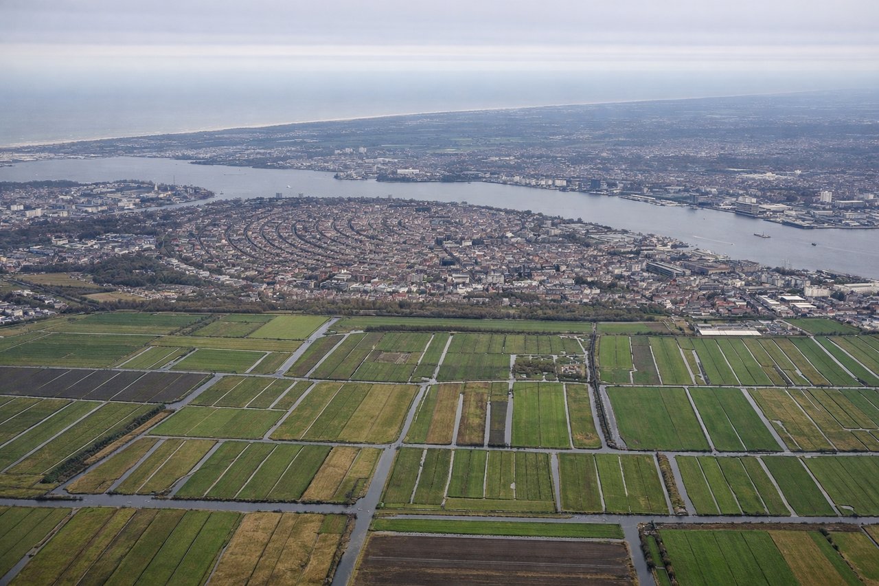
Landing at AMS
LEFTLeft-side seats provide excellent views during the descent into Amsterdam. As you approach from the northwest, left-side passengers see the Dutch coastline, the North Sea dikes, and the flat polder landscape characteristic of the Netherlands. You'll also see the IJsselmeer lake and the approach path over the Flevoland region.
Landmarks on this routeAll landmarks →
Will your flight be in sunlight?
Pick a date and time in the Sun Map to watch the sun move across your whole flight.
About This Route
Which side of the plane should I sit on flying from Humberside (HUY) to Schiphol (AMS)?
Sit on the Left side of the plane for the best views on flights from Humberside to Amsterdam. While takeoff offers good North Sea and estuary views on the right, the landing descent provides more extensive and distinctive scenery. The approach to Amsterdam crosses the iconic Dutch polder landscape and major water bodies, which are visually more striking and geographically significant than the departure views.
What can I see during takeoff from Humberside in Humberside?
During takeoff from Humberside (HUY), sit on the Right side for the best views. Right-side seats offer views of the Humber Estuary and the Yorkshire coastline as you climb out. The aircraft typically departs eastbound over water, giving right-side passengers a clear view of the tidal mudflats and the North Sea coast stretching south toward Lincolnshire. Notable sights include: Humber Estuary, North Sea coastline, Lincolnshire Fens, Spurn Head peninsula.
What can I see when landing at Schiphol in Amsterdam?
When landing at Schiphol (AMS), sit on the Left side for the best views. Left-side seats provide excellent views during the descent into Amsterdam. As you approach from the northwest, left-side passengers see the Dutch coastline, the North Sea dikes, and the flat polder landscape characteristic of the Netherlands. You'll also see the IJsselmeer lake and the approach path over the Flevoland region. Notable sights include: IJsselmeer lake, North Holland coastline, Flevoland polders, Markermeer.
How long is the flight from Humberside to Amsterdam?
The flight from Humberside (HUY) to Schiphol (AMS) takes about 1 hour 15 minutes. The shortest flight path between them is 230 miles (370 km); winds and air traffic control usually add a few percent.
What does the Humberside to Amsterdam flight path pass over?
North Sea crossing with occasional oil and gas platforms visible at altitude; the Dogger Bank fishing grounds; transition from English to Dutch airspace marked by the continental shelf; approach over the Wadden Sea islands and North Holland coastal region