Amsterdam to Humberside is 230 miles (370 km), a flight of about 55 minutes.
The left side offers the most distinctive features of this short hop: Amsterdam's skyline on departure and the Humber Estuary's coastal geography on arrival, while the right side spends most of the flight over featureless North Sea water.
Flight Path
Open North Sea with no landmasses visible, occasional shipping traffic near Dutch and British continental shelf waters
Great circle distance and headings ›Phase by phase
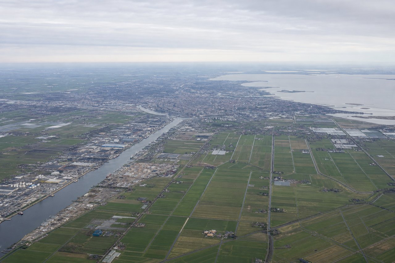
Takeoff from AMS
LEFTDeparting Schiphol's Polderbaan southbound before turning northwest toward the UK, left-side passengers get a good look at Amsterdam's city center, the IJsselmeer's edge, and the geometric Dutch polder patchwork before the coast recedes. The right side mostly shows flat farmland with fewer distinguishing features during the turn.
Landing at HUY
LEFTOn approach to Humberside's runway 20 from the northeast, the aircraft crosses the Lincolnshire coastline and the wide mouth of the Humber Estuary. Left-side passengers see the estuary's sandy spit at Spurn Point and the river widening toward Hull, giving a distinct geographic landmark rarely matched on the opposite side.
Landmarks on this routeAll landmarks →
Will your flight be in sunlight?
Pick a date and time in the Sun Map to watch the sun move across your whole flight.
About This Route
Which side of the plane should I sit on flying from Schiphol (AMS) to Humberside (HUY)?
Sit on the Left side of the plane for the best views on flights from Amsterdam to Humberside. The left side offers the most distinctive features of this short hop: Amsterdam's skyline on departure and the Humber Estuary's coastal geography on arrival, while the right side spends most of the flight over featureless North Sea water.
What can I see during takeoff from Schiphol in Amsterdam?
During takeoff from Schiphol (AMS), sit on the Left side for the best views. Departing Schiphol's Polderbaan southbound before turning northwest toward the UK, left-side passengers get a good look at Amsterdam's city center, the IJsselmeer's edge, and the geometric Dutch polder patchwork before the coast recedes. The right side mostly shows flat farmland with fewer distinguishing features during the turn. Notable sights include: Amsterdam city skyline, IJsselmeer shoreline, Dutch polder farmland grid, Schiphol's runway complex.
What can I see when landing at Humberside in Humberside?
When landing at Humberside (HUY), sit on the Left side for the best views. On approach to Humberside's runway 20 from the northeast, the aircraft crosses the Lincolnshire coastline and the wide mouth of the Humber Estuary. Left-side passengers see the estuary's sandy spit at Spurn Point and the river widening toward Hull, giving a distinct geographic landmark rarely matched on the opposite side. Notable sights include: Humber Estuary mouth, Spurn Point sandbar, Lincolnshire coastline, patchwork farmland near Humberside.
How long is the flight from Amsterdam to Humberside?
The flight from Schiphol (AMS) to Humberside (HUY) takes about 55 minutes. The shortest flight path between them is 230 miles (370 km); winds and air traffic control usually add a few percent.
What does the Amsterdam to Humberside flight path pass over?
Open North Sea with no landmasses visible, occasional shipping traffic near Dutch and British continental shelf waters