Wichita to Vancouver is 1,515 miles (2,439 km), a flight of about 4 hours.
While takeoff offers some interest, the landing view over the North Shore Mountains and Burrard Inlet is significantly more dramatic and memorable. The left side captures the defining geography of the Vancouver approach.
Flight Path
The flight path crosses the Canadian Prairies (Saskatchewan and Alberta) with minimal elevation change—flat agricultural and grassland terrain for roughly 1,500 miles. The Rocky Mountains appear on the horizon around the Alberta-British Columbia border (approximately 2.5 hours into flight), with peaks becoming increasingly prominent as the aircraft descends toward Vancouver. The Columbia River valley and interior British Columbia's forested terrain become visible in the final hour of flight. No major bodies of water are crossed until approaching the Pacific coastal region.
Great circle distance and headings ›.jpg?width=600)
.jpg?width=600)

Phase by phase
Takeoff from IAB
RIGHTMcConnell AFB typically departs eastbound (Runway 01L/01R). Right-side seats face north initially, capturing the Arkansas River valley and the transition from Wichita's urban grid to the Great Plains. Left seats look south toward flat agricultural land with minimal visual interest.
Landing at YVR
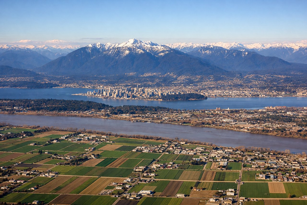
LEFTVancouver typically lands on Runway 26L/26R (westbound approach). Left-side seats on descent provide excellent views of the North Shore Mountains, Burrard Inlet, and the approach over the Strait of Georgia. Right seats face south toward suburban sprawl with less dramatic scenery.
Landmarks on this routeAll landmarks →
Will your flight be in sunlight?
Pick a date and time in the Sun Map to watch the sun move across your whole flight.
About This Route
Which side of the plane should I sit on flying from Mc Connell Afb (IAB) to Vancouver International (YVR)?
Sit on the Left side of the plane for the best views on flights from Wichita to Vancouver. While takeoff offers some interest, the landing view over the North Shore Mountains and Burrard Inlet is significantly more dramatic and memorable. The left side captures the defining geography of the Vancouver approach.
What can I see during takeoff from Mc Connell Afb in Wichita?
During takeoff from Mc Connell Afb (IAB), sit on the Right side for the best views. McConnell AFB typically departs eastbound (Runway 01L/01R). Right-side seats face north initially, capturing the Arkansas River valley and the transition from Wichita's urban grid to the Great Plains. Left seats look south toward flat agricultural land with minimal visual interest. Notable sights include: Arkansas River (visible as a thin ribbon running northeast through Wichita), Wichita city grid (geometric street pattern), Sedgwick County's patchwork of wheat and corn fields extending to the horizon, occasional grain elevators dotting the landscape.
What can I see when landing at Vancouver International in Vancouver?
When landing at Vancouver International (YVR), sit on the Left side for the best views. Vancouver typically lands on Runway 26L/26R (westbound approach). Left-side seats on descent provide excellent views of the North Shore Mountains, Burrard Inlet, and the approach over the Strait of Georgia. Right seats face south toward suburban sprawl with less dramatic scenery. Notable sights include: North Shore Mountains (Coast Range peaks including The Lions, Grouse Mountain), Burrard Inlet (the water body separating Vancouver from North Vancouver), Strait of Georgia (visible as open water to the west during approach), Vancouver's downtown core and harbor (visible as urban density on the peninsula).
How long is the flight from Wichita to Vancouver?
The flight from Mc Connell Afb (IAB) to Vancouver International (YVR) takes about 4 hours. The shortest flight path between them is 1,515 miles (2,439 km); winds and air traffic control usually add a few percent.
What does the Wichita to Vancouver flight path pass over?
The flight path crosses the Canadian Prairies (Saskatchewan and Alberta) with minimal elevation change—flat agricultural and grassland terrain for roughly 1,500 miles. The Rocky Mountains appear on the horizon around the Alberta-British Columbia border (approximately 2.5 hours into flight), with peaks becoming increasingly prominent as the aircraft descends toward Vancouver. The Columbia River valley and interior British Columbia's forested terrain become visible in the final hour of flight. No major bodies of water are crossed until approaching the Pacific coastal region.