Vancouver to Wichita is 1,515 miles (2,439 km), a flight of about 3 hours 35 minutes.
Left side scores higher due to the dramatic Vancouver departure over coastal mountains and the Georgia Strait, which provides significant scenic value during takeoff. Although the landing approach on the right side offers some urban and river features, the takeoff experience on the left—with the North Shore Mountains and Cascade Range—outweighs the relatively flat and monotonous cruise segment and modest landing scenery. The flight path crosses the Cascade Range, Rocky Mountains, and Great Plains, but most of this occurs at cruise altitude where neither side has a decisive advantage; the left side's superior departure experience tips the overall score.
Flight Path
Cascade Range (Mount Rainier visible on clear days), Columbia River valley, Blue Mountains of Oregon, Snake River Plain, Wallowa Mountains, Bitterroot Range, Northern Rockies (Flathead region), Missouri River breaks, Great Plains transition zone near the Montana-Wyoming border, High Plains of eastern Wyoming and Colorado, transition to Kansas prairie
Great circle distance and headings ›
.jpg?width=600)
.jpg?width=600)
Phase by phase
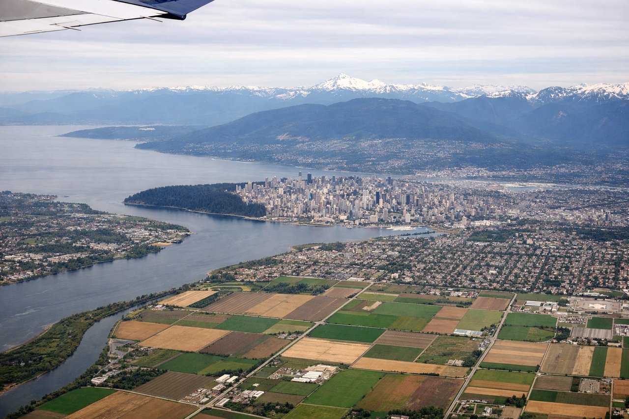
Takeoff from YVR
LEFTLeft side captures Vancouver's dramatic departure over the North Shore Mountains and the Georgia Strait coastline. The Cascade Range and peaks around Squamish are visible during initial climb, providing immediate terrain interest absent on the right side's inland view.
Landing at IAB
RIGHTRight side offers better views during approach to McConnell AFB. The descent path over central Kansas provides views of the Arkansas River valley and Wichita's urban sprawl, whereas the left side shows only flat prairie and agricultural grid patterns with minimal visual interest.
Landmarks on this routeAll landmarks →
Will your flight be in sunlight?
Pick a date and time in the Sun Map to watch the sun move across your whole flight.
About This Route
Which side of the plane should I sit on flying from Vancouver International (YVR) to Mc Connell Afb (IAB)?
Sit on the Left side of the plane for the best views on flights from Vancouver to Wichita. Left side scores higher due to the dramatic Vancouver departure over coastal mountains and the Georgia Strait, which provides significant scenic value during takeoff. Although the landing approach on the right side offers some urban and river features, the takeoff experience on the left—with the North Shore Mountains and Cascade Range—outweighs the relatively flat and monotonous cruise segment and modest landing scenery. The flight path crosses the Cascade Range, Rocky Mountains, and Great Plains, but most of this occurs at cruise altitude where neither side has a decisive advantage; the left side's superior departure experience tips the overall score.
What can I see during takeoff from Vancouver International in Vancouver?
During takeoff from Vancouver International (YVR), sit on the Left side for the best views. Left side captures Vancouver's dramatic departure over the North Shore Mountains and the Georgia Strait coastline. The Cascade Range and peaks around Squamish are visible during initial climb, providing immediate terrain interest absent on the right side's inland view. Notable sights include: North Shore Mountains (Grouse, Seymour peaks), Georgia Strait, Squamish Valley, Vancouver harbor and downtown skyline.
What can I see when landing at Mc Connell Afb in Wichita?
When landing at Mc Connell Afb (IAB), sit on the Right side for the best views. Right side offers better views during approach to McConnell AFB. The descent path over central Kansas provides views of the Arkansas River valley and Wichita's urban sprawl, whereas the left side shows only flat prairie and agricultural grid patterns with minimal visual interest. Notable sights include: Arkansas River valley, Wichita city lights and urban grid, McConnell AFB runways, Kansas agricultural plains.
How long is the flight from Vancouver to Wichita?
The flight from Vancouver International (YVR) to Mc Connell Afb (IAB) takes about 3 hours 35 minutes. The shortest flight path between them is 1,515 miles (2,439 km); winds and air traffic control usually add a few percent.
What does the Vancouver to Wichita flight path pass over?
Cascade Range (Mount Rainier visible on clear days), Columbia River valley, Blue Mountains of Oregon, Snake River Plain, Wallowa Mountains, Bitterroot Range, Northern Rockies (Flathead region), Missouri River breaks, Great Plains transition zone near the Montana-Wyoming border, High Plains of eastern Wyoming and Colorado, transition to Kansas prairie