Left side wins both ends of the flight. During cruise at 30,000 feet over Ohio, the left side also looks south toward Columbus and the Scioto River valley, while the right side sees mostly flat agricultural terrain. The Detroit River and Lake Erie views on approach are the highlight of the flight.
Flown IAD to DTW? Did we get it right?
Flight Path
Washington to Detroit is 383 miles (616 km), a flight of about 1 hour 25 minutes.
The flight crosses the Appalachian foothills of western Maryland and West Virginia briefly before flattening into the Ohio agricultural plain. The Ohio River valley is visible near Wheeling WV/OH border area. Central Ohio is dominated by flat farmland with the Scioto and Muskingum river systems visible as dark ribbons. No significant terrain changes until the Detroit metro area.
Great circle distance and headings ›Phase by phase
Takeoff from IAD
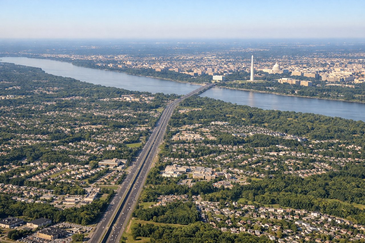
LEFTDulles primarily uses runways 1L/1R (heading north) or 19L/19R (heading south). On a northbound departure toward Detroit, the left side gives you a clear view east toward the DC metro area, including the Potomac River corridor and the distant Capitol/Mall area. On a southbound departure with a left turn out, you still pick up the Potomac and Loudoun County terrain.
Landing at DTW
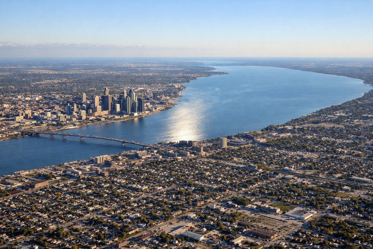
LEFTDTW primarily uses runways 21L/21R (southwest) or 3L/3R (northeast). On approach from the southeast heading southwest, the left side looks southeast over the Detroit River and Lake Erie's western tip. On a northeast approach, the left side tracks over the southern Detroit suburbs and the Detroit River waterway separating the US and Canada.
Will your flight be in sunlight?
Pick a date and time in the Sun Map to watch the sun move across your whole flight.
About This Route
Which side of the plane should I sit on flying from Washington Dulles International (IAD) to Detroit Metro Wayne Co (DTW)?
Sit on the Left side of the plane for the best views on flights from Washington to Detroit. Left side wins both ends of the flight. During cruise at 30,000 feet over Ohio, the left side also looks south toward Columbus and the Scioto River valley, while the right side sees mostly flat agricultural terrain. The Detroit River and Lake Erie views on approach are the highlight of the flight.
What can I see during takeoff from Washington Dulles International in Washington?
During takeoff from Washington Dulles International (IAD), sit on the Left side for the best views. Dulles primarily uses runways 1L/1R (heading north) or 19L/19R (heading south). On a northbound departure toward Detroit, the left side gives you a clear view east toward the DC metro area, including the Potomac River corridor and the distant Capitol/Mall area. On a southbound departure with a left turn out, you still pick up the Potomac and Loudoun County terrain. Notable sights include: Potomac River winding southeast toward DC, Dulles Access Road corridor, Blue Ridge Mountains to the west on the horizon, Loudoun County reservoir system.
What can I see when landing at Detroit Metro Wayne Co in Detroit?
When landing at Detroit Metro Wayne Co (DTW), sit on the Left side for the best views. DTW primarily uses runways 21L/21R (southwest) or 3L/3R (northeast). On approach from the southeast heading southwest, the left side looks southeast over the Detroit River and Lake Erie's western tip. On a northeast approach, the left side tracks over the southern Detroit suburbs and the Detroit River waterway separating the US and Canada. Notable sights include: Detroit River separating Detroit from Windsor Ontario, western tip of Lake Erie on the horizon, Toledo metro area faintly visible to the south, suburban Detroit grid street pattern.
How long is the flight from Washington to Detroit?
The flight from Washington Dulles International (IAD) to Detroit Metro Wayne Co (DTW) takes about 1 hour 25 minutes. The shortest flight path between them is 383 miles (616 km); winds and air traffic control usually add a few percent.
What does the Washington to Detroit flight path pass over?
The flight crosses the Appalachian foothills of western Maryland and West Virginia briefly before flattening into the Ohio agricultural plain. The Ohio River valley is visible near Wheeling WV/OH border area. Central Ohio is dominated by flat farmland with the Scioto and Muskingum river systems visible as dark ribbons. No significant terrain changes until the Detroit metro area.