Houston to Ketapang is 9,879 miles (15,899 km), a flight of about 20 hours.
The left side wins overall for the dramatic Houston departure views including the Ship Channel and Galveston Bay. The transpacific routing over the Pacific offers little to see at cruise altitude on either side, and the Kalimantan arrival views are modest on both sides given the flat jungle terrain.
Flight Path
The routing typically crosses the Gulf of Mexico, then the Pacific Ocean over open water for roughly 7,000 miles with no significant visible landmarks at cruise altitude. Depending on the connection, you may cross the Philippine Sea, the South China Sea, and the Malay Peninsula. On the Kalimantan segment, the Borneo coastline and lowland river systems of West Kalimantan become visible on descent.
Great circle distance and headings ›.jpg?width=600)
.jpg?width=600)


Phase by phase
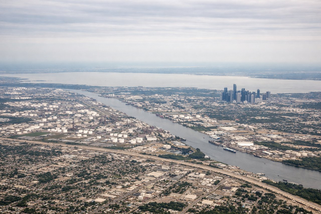
Takeoff from IAH
LEFTIAH's primary departure runways (15L/R heading southeast, or 27 heading west) mean a left-side seat gives you the Houston downtown skyline to the south and the sprawling Ship Channel industrial complex. On a southeast departure, the left side tracks over the urban core and Galveston Bay.
Landing at KTG
RIGHTKetapang's runway 13/31 means arrivals typically come in from the northwest over the Kapuas River delta and coastal lowlands of West Kalimantan. A right-side seat on approach gives you the Pawan River winding through jungle toward the coast and the town of Ketapang itself.
Landmarks on this routeAll landmarks →
Will your flight be in sunlight?
Pick a date and time in the Sun Map to watch the sun move across your whole flight.
About This Route
Which side of the plane should I sit on flying from George Bush Intcntl Houston (IAH) to Rahadi Usman (KTG)?
Sit on the Left side of the plane for the best views on flights from Houston to Ketapang. The left side wins overall for the dramatic Houston departure views including the Ship Channel and Galveston Bay. The transpacific routing over the Pacific offers little to see at cruise altitude on either side, and the Kalimantan arrival views are modest on both sides given the flat jungle terrain.
What can I see during takeoff from George Bush Intcntl Houston in Houston?
During takeoff from George Bush Intcntl Houston (IAH), sit on the Left side for the best views. IAH's primary departure runways (15L/R heading southeast, or 27 heading west) mean a left-side seat gives you the Houston downtown skyline to the south and the sprawling Ship Channel industrial complex. On a southeast departure, the left side tracks over the urban core and Galveston Bay. Notable sights include: Houston downtown skyline, Galveston Bay, Houston Ship Channel refineries, Lake Houston to the northeast.
What can I see when landing at Rahadi Usman in Ketapang?
When landing at Rahadi Usman (KTG), sit on the Right side for the best views. Ketapang's runway 13/31 means arrivals typically come in from the northwest over the Kapuas River delta and coastal lowlands of West Kalimantan. A right-side seat on approach gives you the Pawan River winding through jungle toward the coast and the town of Ketapang itself. Notable sights include: Pawan River and its jungle meanders, Ketapang town and coastal lowlands, South China Sea coastline, lowland rainforest of West Kalimantan.
How long is the flight from Houston to Ketapang?
The flight from George Bush Intcntl Houston (IAH) to Rahadi Usman (KTG) takes about 20 hours. The shortest flight path between them is 9,879 miles (15,899 km); winds and air traffic control usually add a few percent.
What does the Houston to Ketapang flight path pass over?
The routing typically crosses the Gulf of Mexico, then the Pacific Ocean over open water for roughly 7,000 miles with no significant visible landmarks at cruise altitude. Depending on the connection, you may cross the Philippine Sea, the South China Sea, and the Malay Peninsula. On the Kalimantan segment, the Borneo coastline and lowland river systems of West Kalimantan become visible on descent.