The right side wins on the strength of the cruise and landing phases: passengers get views toward the Grand Canyon region, Lake Mead, and Las Vegas before crossing the Sierra Nevada, then a classic San Francisco Bay and Golden Gate Bridge approach. The left side's desert and Central Valley views are pleasant but less varied and lack a comparable landing payoff.
Flight Path
Guadalupe Mountains and White Sands near the Texas-New Mexico border, the Sonoran and Mojave Deserts, Lake Mead and the Colorado River near Las Vegas, and the Sierra Nevada range before descending into California's Central Valley
Great circle distance and headings ›.jpg?width=600)


.jpeg?width=600)


Phase by phase
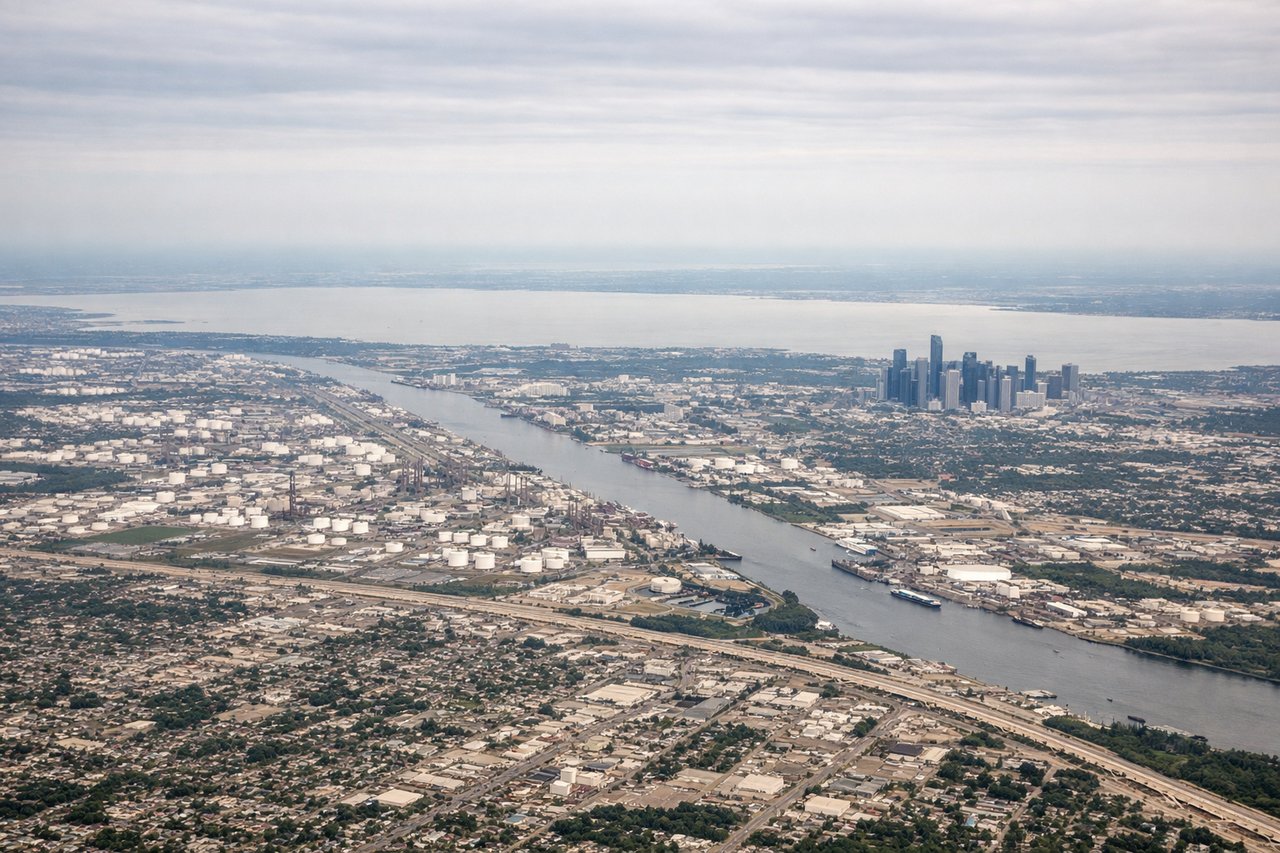
Takeoff from IAH
LEFTIAH departures toward the west typically climb out south of the field before turning onto course, giving a brief look at the downtown Houston skyline and Buffalo Bayou corridor. The right side only sees flat pine woods and suburban sprawl north of the airport with nothing distinctive.

Landing at SFO
RIGHTArrivals into SFO from the east typically fly the final approach on a westbound heading, putting San Francisco and the Golden Gate to the north of the flight path. Right-side passengers get a clear view of the city skyline, the Bay, and the bridges just before touchdown, while the left side faces open bay water and San Mateo suburbs.
Landmarks on this routeAll landmarks →
Will your flight be in sunlight?
See exactly which side of the plane gets sun and shade at your departure time.
About This Route
Which side of the plane should I sit on flying from George Bush Intcntl Houston (IAH) to San Francisco International (SFO)?
Sit on the Right side of the plane for the best views on flights from Houston to San Francisco. The right side wins on the strength of the cruise and landing phases: passengers get views toward the Grand Canyon region, Lake Mead, and Las Vegas before crossing the Sierra Nevada, then a classic San Francisco Bay and Golden Gate Bridge approach. The left side's desert and Central Valley views are pleasant but less varied and lack a comparable landing payoff.
What can I see during takeoff from George Bush Intcntl Houston in Houston?
During takeoff from George Bush Intcntl Houston (IAH), sit on the Left side for the best views. IAH departures toward the west typically climb out south of the field before turning onto course, giving a brief look at the downtown Houston skyline and Buffalo Bayou corridor. The right side only sees flat pine woods and suburban sprawl north of the airport with nothing distinctive. Notable sights include: Downtown Houston skyline, Buffalo Bayou, Addicks/Barker Reservoirs, northwest Houston suburbs.
What can I see when landing at San Francisco International in San Francisco?
When landing at San Francisco International (SFO), sit on the Right side for the best views. Arrivals into SFO from the east typically fly the final approach on a westbound heading, putting San Francisco and the Golden Gate to the north of the flight path. Right-side passengers get a clear view of the city skyline, the Bay, and the bridges just before touchdown, while the left side faces open bay water and San Mateo suburbs. Notable sights include: San Francisco skyline, Golden Gate Bridge, Bay Bridge, Marin Headlands.
How long is the flight from Houston to San Francisco?
The flight from George Bush Intcntl Houston (IAH) to San Francisco International (SFO) takes 4h 05m.
What does the Houston to San Francisco flight path pass over?
Guadalupe Mountains and White Sands near the Texas-New Mexico border, the Sonoran and Mojave Deserts, Lake Mead and the Colorado River near Las Vegas, and the Sierra Nevada range before descending into California's Central Valley