Houston to Shreveport is 192 miles (309 km), a flight of about 45 minutes.
While both sides score equally at 1.5 due to the short 45-minute flight over flat terrain with minimal dramatic features, the left side during takeoff offers slightly more visual interest with Houston's industrial infrastructure and Ship Channel visible during climb-out. The landing approach on either side is equally unremarkable, making the takeoff experience the deciding factor.
Flight Path
The flight path crosses flat to gently rolling terrain of southeast Texas and northeast Louisiana, passing over pine forests, agricultural land, and scattered small towns. The Red River forms the approximate midpoint boundary between Texas and Louisiana. No significant mountains, canyons, or dramatic geological features are visible along this route. The landscape remains consistently low-elevation with forest and farmland dominating throughout.
Great circle distance and headings ›Phase by phase
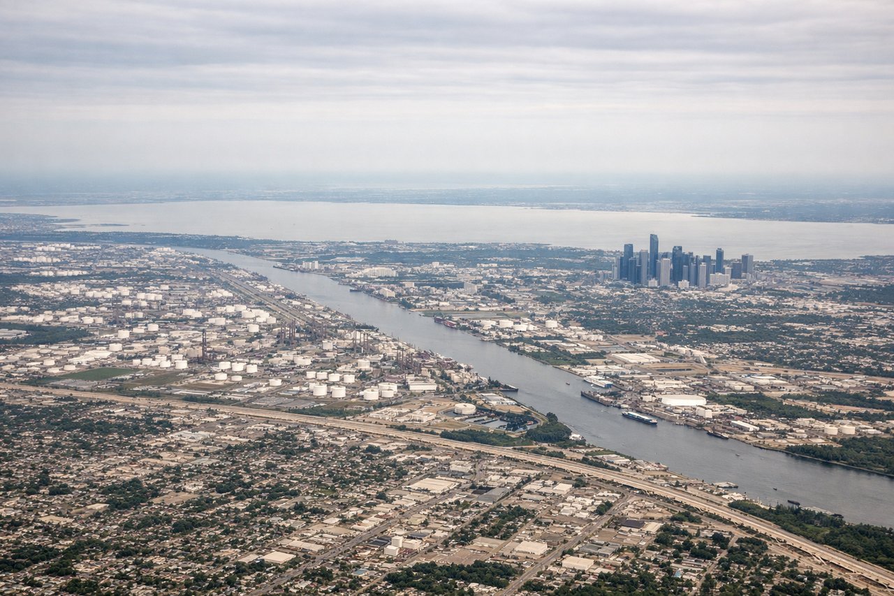
Takeoff from IAH
LEFTLeft side captures Houston's urban sprawl and industrial corridor during climb-out, including refineries and the Ship Channel. Right side offers only flat suburban development with minimal visual interest.
Landing at SHV
RIGHTRight side during approach to SHV provides views of the Red River valley and surrounding pine forests characteristic of northeast Louisiana. Left side remains flat agricultural land with minimal visual distinction.
Will your flight be in sunlight?
Pick a date and time in the Sun Map to watch the sun move across your whole flight.
About This Route
Which side of the plane should I sit on flying from George Bush Intcntl Houston (IAH) to Shreveport Rgnl (SHV)?
Sit on the Left side of the plane for the best views on flights from Houston to Shreveport. While both sides score equally at 1.5 due to the short 45-minute flight over flat terrain with minimal dramatic features, the left side during takeoff offers slightly more visual interest with Houston's industrial infrastructure and Ship Channel visible during climb-out. The landing approach on either side is equally unremarkable, making the takeoff experience the deciding factor.
What can I see during takeoff from George Bush Intcntl Houston in Houston?
During takeoff from George Bush Intcntl Houston (IAH), sit on the Left side for the best views. Left side captures Houston's urban sprawl and industrial corridor during climb-out, including refineries and the Ship Channel. Right side offers only flat suburban development with minimal visual interest. Notable sights include: Houston Ship Channel, petrochemical refineries along the channel, suburban sprawl extending northeast, flat coastal plain.
What can I see when landing at Shreveport Rgnl in Shreveport?
When landing at Shreveport Rgnl (SHV), sit on the Right side for the best views. Right side during approach to SHV provides views of the Red River valley and surrounding pine forests characteristic of northeast Louisiana. Left side remains flat agricultural land with minimal visual distinction. Notable sights include: Red River valley, pine forest canopy, Shreveport urban area, agricultural fields.
How long is the flight from Houston to Shreveport?
The flight from George Bush Intcntl Houston (IAH) to Shreveport Rgnl (SHV) takes about 45 minutes. The shortest flight path between them is 192 miles (309 km); winds and air traffic control usually add a few percent.
What does the Houston to Shreveport flight path pass over?
The flight path crosses flat to gently rolling terrain of southeast Texas and northeast Louisiana, passing over pine forests, agricultural land, and scattered small towns. The Red River forms the approximate midpoint boundary between Texas and Louisiana. No significant mountains, canyons, or dramatic geological features are visible along this route. The landscape remains consistently low-elevation with forest and farmland dominating throughout.