Shreveport to Houston is 192 miles (309 km), a flight of about 45 minutes.
Both sides score equally low (1.5) because this is a short 45-minute flight over flat terrain with minimal elevation change, no mountains, coastlines, or dramatic landmarks. However, the right side edges ahead slightly during landing approach with better views of Houston's urban sprawl and the Gulf Coastal Plain transition, making it marginally more engaging for the final descent phase.
Flight Path
The flight path crosses the flat Louisiana-Texas border region dominated by pine forests, scattered lakes, and bayou systems. No significant elevation changes or dramatic landmarks occur along the route. The terrain remains consistently flat throughout, with vegetation transitioning from Louisiana pine forests to Texas coastal prairie and developed areas as the aircraft approaches Houston.
Great circle distance and headings ›Phase by phase
Takeoff from SHV
LEFTShreveport Regional Airport sits on the Red River valley with slightly more varied terrain to the west during initial climb. The left side captures the river's oxbow bends and surrounding pine forest patches more directly during departure.
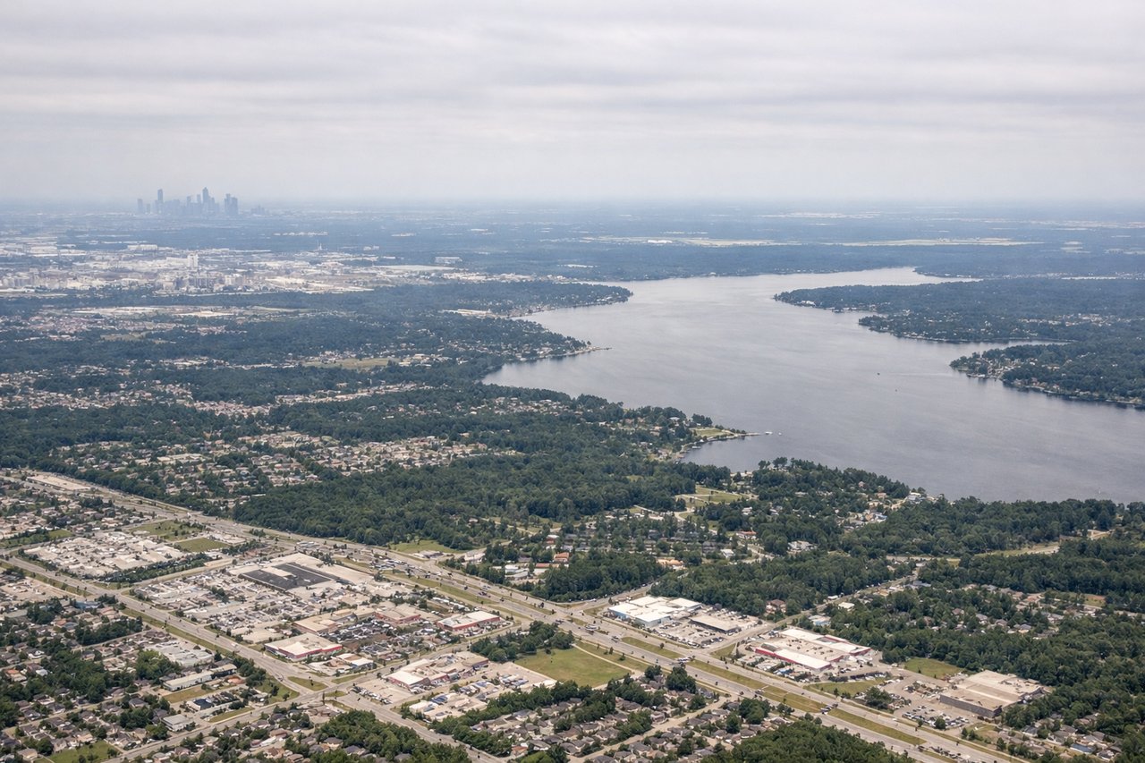
Landing at IAH
RIGHTThe right side during approach to Houston offers views of the greater Houston metropolitan area and the coastal plain's transition zone. Descending from the northeast, the right side captures more of the sprawling city development and the flat terrain characteristic of the Gulf Coast approach.
Will your flight be in sunlight?
Pick a date and time in the Sun Map to watch the sun move across your whole flight.
About This Route
Which side of the plane should I sit on flying from Shreveport Rgnl (SHV) to George Bush Intcntl Houston (IAH)?
Sit on the Right side of the plane for the best views on flights from Shreveport to Houston. Both sides score equally low (1.5) because this is a short 45-minute flight over flat terrain with minimal elevation change, no mountains, coastlines, or dramatic landmarks. However, the right side edges ahead slightly during landing approach with better views of Houston's urban sprawl and the Gulf Coastal Plain transition, making it marginally more engaging for the final descent phase.
What can I see during takeoff from Shreveport Rgnl in Shreveport?
During takeoff from Shreveport Rgnl (SHV), sit on the Left side for the best views. Shreveport Regional Airport sits on the Red River valley with slightly more varied terrain to the west during initial climb. The left side captures the river's oxbow bends and surrounding pine forest patches more directly during departure. Notable sights include: Red River valley, Shreveport urban area, pine forest patches of northwestern Louisiana.
What can I see when landing at George Bush Intcntl Houston in Houston?
When landing at George Bush Intcntl Houston (IAH), sit on the Right side for the best views. The right side during approach to Houston offers views of the greater Houston metropolitan area and the coastal plain's transition zone. Descending from the northeast, the right side captures more of the sprawling city development and the flat terrain characteristic of the Gulf Coast approach. Notable sights include: Houston metropolitan sprawl, Galveston Bay area (distant), flat Gulf Coastal Plain.
How long is the flight from Shreveport to Houston?
The flight from Shreveport Rgnl (SHV) to George Bush Intcntl Houston (IAH) takes about 45 minutes. The shortest flight path between them is 192 miles (309 km); winds and air traffic control usually add a few percent.
What does the Shreveport to Houston flight path pass over?
The flight path crosses the flat Louisiana-Texas border region dominated by pine forests, scattered lakes, and bayou systems. No significant elevation changes or dramatic landmarks occur along the route. The terrain remains consistently flat throughout, with vegetation transitioning from Louisiana pine forests to Texas coastal prairie and developed areas as the aircraft approaches Houston.