This ultra-long westbound great-circle route arcs far north over Canada and Alaska before curving southwest across the North Pacific, so for most of the 18-hour cruise the right side of the aircraft faces this northern arc — offering periodic views of Alaska's coastal ranges, the volcanic Aleutian and Kamchatka peaks, and the Japanese coastline. The left side, facing mostly open Pacific and South China Sea for hours at a stretch, only gets a late boost from the Singapore skyline on arrival.
Flight Path
The route's highest-latitude point (roughly 60°N) lies over the Gulf of Alaska and the Aleutian Islands chain, after which the great circle curves southwest past the volcanic Kamchatka Peninsula, the Kuril Islands, and along the Japanese coast before continuing over the Philippine Sea toward Southeast Asia.
Great circle distance and headings ›.jpg?width=600)
.jpg?width=600)


Phase by phase

Takeoff from IAH
RIGHTDeparting IAH under typical south-southeast wind flow, aircraft climb out to the southeast before turning right onto their northwesterly track toward the Pacific great-circle route. During that turn, the right side sweeps past downtown Houston's skyline and the industrial Ship Channel, while the left side shows only flat, undistinguished suburban sprawl.
Landing at SIN
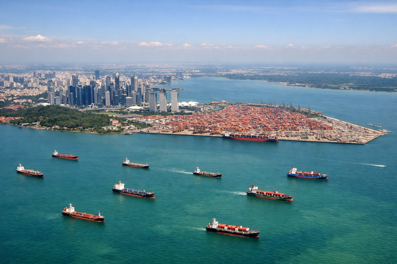
LEFTOn approach to Changi's runway 02 (common during the Northeast Monsoon), aircraft fly north up the Singapore Strait before touchdown. The Marina Bay skyline, Sentosa Island, and the port sit to the west of the flight path, putting Singapore's dense urban core on the left side, while the right side mostly faces open strait and the distant Indonesian Riau islands.
Landmarks on this routeAll landmarks →
Will your flight be in sunlight?
See exactly which side of the plane gets sun and shade at your departure time.
About This Route
Which side of the plane should I sit on flying from George Bush Intcntl Houston (IAH) to Singapore Changi (SIN)?
Sit on the Right side of the plane for the best views on flights from Houston to Singapore. This ultra-long westbound great-circle route arcs far north over Canada and Alaska before curving southwest across the North Pacific, so for most of the 18-hour cruise the right side of the aircraft faces this northern arc — offering periodic views of Alaska's coastal ranges, the volcanic Aleutian and Kamchatka peaks, and the Japanese coastline. The left side, facing mostly open Pacific and South China Sea for hours at a stretch, only gets a late boost from the Singapore skyline on arrival.
What can I see during takeoff from George Bush Intcntl Houston in Houston?
During takeoff from George Bush Intcntl Houston (IAH), sit on the Right side for the best views. Departing IAH under typical south-southeast wind flow, aircraft climb out to the southeast before turning right onto their northwesterly track toward the Pacific great-circle route. During that turn, the right side sweeps past downtown Houston's skyline and the industrial Ship Channel, while the left side shows only flat, undistinguished suburban sprawl. Notable sights include: Downtown Houston skyline, Houston Ship Channel refineries, San Jacinto Monument area, Galveston Bay in the distance.
What can I see when landing at Singapore Changi in Singapore?
When landing at Singapore Changi (SIN), sit on the Left side for the best views. On approach to Changi's runway 02 (common during the Northeast Monsoon), aircraft fly north up the Singapore Strait before touchdown. The Marina Bay skyline, Sentosa Island, and the port sit to the west of the flight path, putting Singapore's dense urban core on the left side, while the right side mostly faces open strait and the distant Indonesian Riau islands. Notable sights include: Marina Bay Sands and CBD skyline, Sentosa Island, container ships in the Singapore Strait, Jurong Island refineries.
How long is the flight from Houston to Singapore?
The flight from George Bush Intcntl Houston (IAH) to Singapore Changi (SIN) takes 18h 15m.
What does the Houston to Singapore flight path pass over?
The route's highest-latitude point (roughly 60°N) lies over the Gulf of Alaska and the Aleutian Islands chain, after which the great circle curves southwest past the volcanic Kamchatka Peninsula, the Kuril Islands, and along the Japanese coast before continuing over the Philippine Sea toward Southeast Asia.