The landing descent offers more dramatic and sustained scenery with the Cascade Range and Willamette Valley. While the takeoff provides local Indianapolis views, the western approach into Eugene delivers superior visual interest across a longer viewing window.
Flown IND to EUG? Did we get it right?
Flight Path
Indianapolis to Eugene is 1,906 miles (3,067 km), a flight of about 4 hours 15 minutes.
Missouri River valley near Kansas City, Flint Hills of Kansas, Colorado Front Range (visible to the south during cruise), Great Plains transition to high desert, Snake River Plain in southern Idaho, Cascade Range foothills in Oregon
Great circle distance and headings ›


Phase by phase
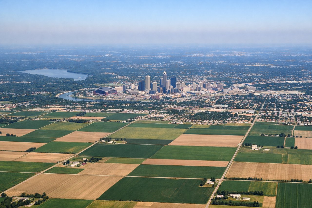
Takeoff from IND
LEFTLeft side offers views of the White River and downtown Indianapolis skyline during initial climb. The river curves distinctly through the city and remains visible for several minutes after departure.
Landing at EUG
RIGHTRight side provides excellent views of the Cascade Range and Willamette Valley during descent into Eugene. The Cascades form a dramatic snow-capped wall to the east, and the valley's patchwork of farms and forests is clearly visible.
Will your flight be in sunlight?
Pick a date and time in the Sun Map to watch the sun move across your whole flight.
About This Route
Which side of the plane should I sit on flying from Indianapolis International (IND) to Eugene Airport (EUG)?
Sit on the Right side of the plane for the best views on flights from Indianapolis to Eugene. The landing descent offers more dramatic and sustained scenery with the Cascade Range and Willamette Valley. While the takeoff provides local Indianapolis views, the western approach into Eugene delivers superior visual interest across a longer viewing window.
What can I see during takeoff from Indianapolis International in Indianapolis?
During takeoff from Indianapolis International (IND), sit on the Left side for the best views. Left side offers views of the White River and downtown Indianapolis skyline during initial climb. The river curves distinctly through the city and remains visible for several minutes after departure. Notable sights include: White River, downtown Indianapolis skyline, Indianapolis Motor Speedway (visible to the northwest), flat central Indiana farmland.
What can I see when landing at Eugene Airport in Eugene?
When landing at Eugene Airport (EUG), sit on the Right side for the best views. Right side provides excellent views of the Cascade Range and Willamette Valley during descent into Eugene. The Cascades form a dramatic snow-capped wall to the east, and the valley's patchwork of farms and forests is clearly visible. Notable sights include: Cascade Range (including Mount Jefferson and Three Sisters peaks), Willamette Valley agricultural pattern, McKenzie River, Eugene urban area.
How long is the flight from Indianapolis to Eugene?
The flight from Indianapolis International (IND) to Eugene Airport (EUG) takes about 4 hours 15 minutes. The shortest flight path between them is 1,906 miles (3,067 km); winds and air traffic control usually add a few percent.
What does the Indianapolis to Eugene flight path pass over?
Missouri River valley near Kansas City, Flint Hills of Kansas, Colorado Front Range (visible to the south during cruise), Great Plains transition to high desert, Snake River Plain in southern Idaho, Cascade Range foothills in Oregon