The takeoff scenery over the Amazon River and rainforest is more visually distinctive and dramatic than the landing approach. While Mount Hood is iconic, the Amazon's scale and unique river morphology offer more sustained scenic interest during climb-out.
Flight Path
The flight path crosses the Andes Mountains (visible around 2.5-3 hours into flight, roughly over southern Peru/northern Bolivia border region). The high plateau and mountain peaks are visible from cruising altitude. After crossing the Andes, the landscape transitions to the western slope of South America—you'll see the Peruvian coastal desert approaching the Pacific coast. The flight then tracks northwestward over the Pacific Ocean for several hours before approaching the North American continent. The Oregon/Washington coastline becomes visible approximately 1 hour before landing, followed by the Cascade Range and Willamette Valley.
Great circle distance and headings ›
.jpg?width=600)


Phase by phase
Takeoff from IQT
RIGHTRight side offers views of the Amazon River's main channel and oxbow lakes as the aircraft climbs northwestward from Iquitos. The river's distinctive meanders and surrounding rainforest canopy are clearly visible during the initial climb phase.
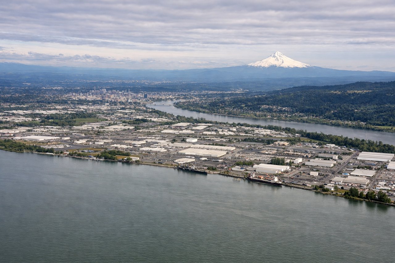
Landing at PDX
LEFTLeft side provides views of the Cascade Range and Mount Hood during descent into Portland. These snow-capped peaks are prominent on clear days and visible from 15,000+ feet during the final approach corridor from the southeast.
Landmarks on this routeAll landmarks →
Will your flight be in sunlight?
See exactly which side of the plane gets sun and shade at your departure time.
About This Route
Which side of the plane should I sit on flying from Coronel Fap Francisco Secada Vignetta (IQT) to Portland International (PDX)?
Sit on the Right side of the plane for the best views on flights from Iquitos to Portland. The takeoff scenery over the Amazon River and rainforest is more visually distinctive and dramatic than the landing approach. While Mount Hood is iconic, the Amazon's scale and unique river morphology offer more sustained scenic interest during climb-out.
What can I see during takeoff from Coronel Fap Francisco Secada Vignetta in Iquitos?
During takeoff from Coronel Fap Francisco Secada Vignetta (IQT), sit on the Right side for the best views. Right side offers views of the Amazon River's main channel and oxbow lakes as the aircraft climbs northwestward from Iquitos. The river's distinctive meanders and surrounding rainforest canopy are clearly visible during the initial climb phase. Notable sights include: Amazon River main channel, oxbow lakes east of Iquitos, Nanay River confluence, rainforest canopy extending to the horizon.
What can I see when landing at Portland International in Portland?
When landing at Portland International (PDX), sit on the Left side for the best views. Left side provides views of the Cascade Range and Mount Hood during descent into Portland. These snow-capped peaks are prominent on clear days and visible from 15,000+ feet during the final approach corridor from the southeast. Notable sights include: Mount Hood (11,240 ft), Cascade Range, Willamette River valley, Portland metro area.
How long is the flight from Iquitos to Portland?
The flight from Coronel Fap Francisco Secada Vignetta (IQT) to Portland International (PDX) takes Approximately 6.5 to 7.5 hours.
What does the Iquitos to Portland flight path pass over?
The flight path crosses the Andes Mountains (visible around 2.5-3 hours into flight, roughly over southern Peru/northern Bolivia border region). The high plateau and mountain peaks are visible from cruising altitude. After crossing the Andes, the landscape transitions to the western slope of South America—you'll see the Peruvian coastal desert approaching the Pacific coast. The flight then tracks northwestward over the Pacific Ocean for several hours before approaching the North American continent. The Oregon/Washington coastline becomes visible approximately 1 hour before landing, followed by the Cascade Range and Willamette Valley.