While takeoff favors the left for Mount Hood views, the landing approach offers more dramatic visual contrast—the Ucayali River and cleared airport against unbroken rainforest is more distinctive than PDX's suburban sprawl. Right seats capture the transition from forest to river to airport.
Flight Path
Flight path crosses the Sierra Madre Occidental (Mexico), descends over the Yucatan Peninsula and Gulf of Mexico approaches, then crosses Central America (Guatemala/Honduras highlands visible), continues over the Isthmus of Panama, and enters South America over Colombia/Ecuador before reaching the Amazon basin. The Amazon River itself becomes visible in the final 90 minutes of approach, appearing as a massive brown ribbon with visible meanders and oxbow lakes in the rainforest canopy.
Great circle distance and headings ›


.jpg?width=600)


Phase by phase
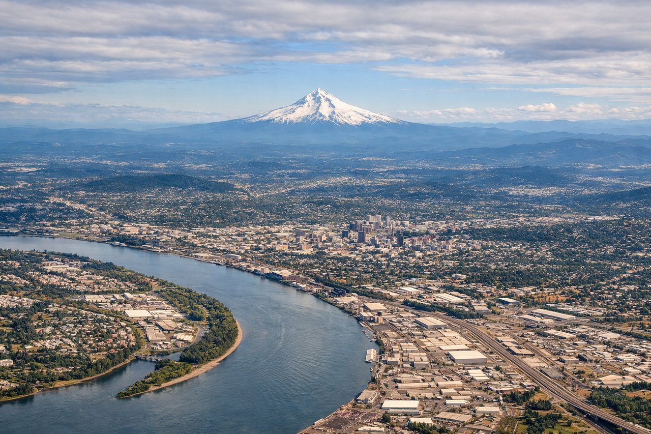
Takeoff from PDX
LEFTPDX typically departs north or northeast. Left seats face toward the Cascade Range and Mount Hood, which dominate the eastern skyline during climb-out. Right seats see the flat Willamette Valley and distant Pacific coastal ranges.
Landing at IQT
RIGHTIQT approaches from the west over the Amazon basin. Right seats face the Ucayali River confluence and the dense rainforest canopy surrounding the airport. Left seats see only uniform green forest. The river's brown water and the cleared airport area are more visually distinctive from the right.
Landmarks on this routeAll landmarks →
Will your flight be in sunlight?
See exactly which side of the plane gets sun and shade at your departure time.
About This Route
Which side of the plane should I sit on flying from Portland International (PDX) to Coronel Fap Francisco Secada Vignetta (IQT)?
Sit on the Right side of the plane for the best views on flights from Portland to Iquitos. While takeoff favors the left for Mount Hood views, the landing approach offers more dramatic visual contrast—the Ucayali River and cleared airport against unbroken rainforest is more distinctive than PDX's suburban sprawl. Right seats capture the transition from forest to river to airport.
What can I see during takeoff from Portland International in Portland?
During takeoff from Portland International (PDX), sit on the Left side for the best views. PDX typically departs north or northeast. Left seats face toward the Cascade Range and Mount Hood, which dominate the eastern skyline during climb-out. Right seats see the flat Willamette Valley and distant Pacific coastal ranges. Notable sights include: Mount Hood (11,240 ft, ~50 miles east), Cascade Range spine, Willamette River valley floor, Portland urban grid.
What can I see when landing at Coronel Fap Francisco Secada Vignetta in Iquitos?
When landing at Coronel Fap Francisco Secada Vignetta (IQT), sit on the Right side for the best views. IQT approaches from the west over the Amazon basin. Right seats face the Ucayali River confluence and the dense rainforest canopy surrounding the airport. Left seats see only uniform green forest. The river's brown water and the cleared airport area are more visually distinctive from the right. Notable sights include: Ucayali River (major tributary, brown water visible through canopy), Amazon rainforest (unbroken green), Iquitos city cleared area, airport runway clearing.
How long is the flight from Portland to Iquitos?
The flight from Portland International (PDX) to Coronel Fap Francisco Secada Vignetta (IQT) takes Approximately 7.5 to 8.5 hours.
What does the Portland to Iquitos flight path pass over?
Flight path crosses the Sierra Madre Occidental (Mexico), descends over the Yucatan Peninsula and Gulf of Mexico approaches, then crosses Central America (Guatemala/Honduras highlands visible), continues over the Isthmus of Panama, and enters South America over Colombia/Ecuador before reaching the Amazon basin. The Amazon River itself becomes visible in the final 90 minutes of approach, appearing as a massive brown ribbon with visible meanders and oxbow lakes in the rainforest canopy.