Iwakuni to Tokyo is 438 miles (705 km), a flight of about 1 hour 25 minutes.
Right side edges ahead due to superior takeoff scenery from Iwakuni—the Seto Inland Sea and its island archipelago provide more visual interest and geographic variety than the inland mountains visible from the left. Landing views are roughly equal, but the takeoff advantage gives right the overall edge on this short 90-minute flight.
Flight Path
Seto Inland Sea with scattered islands (Itsukushima, Omishima, Naoshima visible from altitude), transition from Chugoku Mountains to the Kanto Plain, Osaka Bay and Kobe area to the north, Tokyo Bay entrance with Chiba Peninsula
Great circle distance and headings ›

Phase by phase
Takeoff from IWK
RIGHTRight side captures the Seto Inland Sea and its island archipelago during initial climb-out from Runway 20. The left side faces inland toward the Chugoku Mountains, which are distant and less visually dramatic at low altitude.
Landing at HND
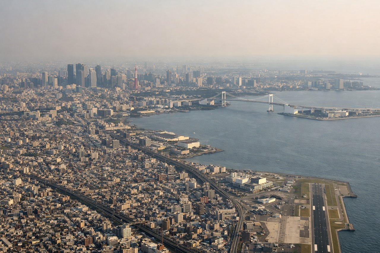
LEFTLeft side (west) offers views of Tokyo Bay's western shoreline, including the Chiba Peninsula and urban Tokyo during approach. Right side (east) faces open bay and the Pacific, offering less distinctive scenery during the final descent into Haneda.
Landmarks on this routeAll landmarks →
Will your flight be in sunlight?
Pick a date and time in the Sun Map to watch the sun move across your whole flight.
About This Route
Which side of the plane should I sit on flying from Iwakuni Kintaikyo Airport (IWK) to Tokyo International (HND)?
Sit on the Right side of the plane for the best views on flights from Iwakuni to Tokyo. Right side edges ahead due to superior takeoff scenery from Iwakuni—the Seto Inland Sea and its island archipelago provide more visual interest and geographic variety than the inland mountains visible from the left. Landing views are roughly equal, but the takeoff advantage gives right the overall edge on this short 90-minute flight.
What can I see during takeoff from Iwakuni Kintaikyo Airport in Iwakuni?
During takeoff from Iwakuni Kintaikyo Airport (IWK), sit on the Right side for the best views. Right side captures the Seto Inland Sea and its island archipelago during initial climb-out from Runway 20. The left side faces inland toward the Chugoku Mountains, which are distant and less visually dramatic at low altitude. Notable sights include: Seto Inland Sea with scattered islands (Itsukushima visible to the southeast), Iwakuni city and the Kintai Bridge below, Chugoku Mountains inland to the northwest.
What can I see when landing at Tokyo International in Tokyo?
When landing at Tokyo International (HND), sit on the Left side for the best views. Left side (west) offers views of Tokyo Bay's western shoreline, including the Chiba Peninsula and urban Tokyo during approach. Right side (east) faces open bay and the Pacific, offering less distinctive scenery during the final descent into Haneda. Notable sights include: Tokyo Bay with Chiba Peninsula, Tokyo's urban sprawl and harbor infrastructure, Haneda Airport runways and taxiways, Rainbow Bridge and Odaiba district.
How long is the flight from Iwakuni to Tokyo?
The flight from Iwakuni Kintaikyo Airport (IWK) to Tokyo International (HND) takes about 1 hour 25 minutes. The shortest flight path between them is 438 miles (705 km); winds and air traffic control usually add a few percent.
What does the Iwakuni to Tokyo flight path pass over?
Seto Inland Sea with scattered islands (Itsukushima, Omishima, Naoshima visible from altitude), transition from Chugoku Mountains to the Kanto Plain, Osaka Bay and Kobe area to the north, Tokyo Bay entrance with Chiba Peninsula