Tokyo to Iwakuni is 438 miles (705 km), a flight of about 1 hour 35 minutes.
Right side scores marginally higher due to the superior takeoff experience from Haneda—the Tokyo Bay departure offers more dramatic urban and water scenery than the landing approach. While both sides are relatively modest in scenic value for a short domestic flight over mostly flat to gently rolling terrain, the right side's view of Tokyo's port infrastructure, central city districts, and the bay during climb-out provides more visual interest and landmark density than the left side's approach to a smaller regional airport.
Flight Path
The flight path crosses the Seto Inland Sea region, passing over or near the Hiroshima Prefecture coastline and numerous small islands characteristic of the inland sea. The terrain transitions from Tokyo's urban sprawl through the Kanto Plain, then over low forested hills and the fragmented island landscape of the Seto Inland Sea as the aircraft descends toward Iwakuni.
Great circle distance and headings ›

Phase by phase
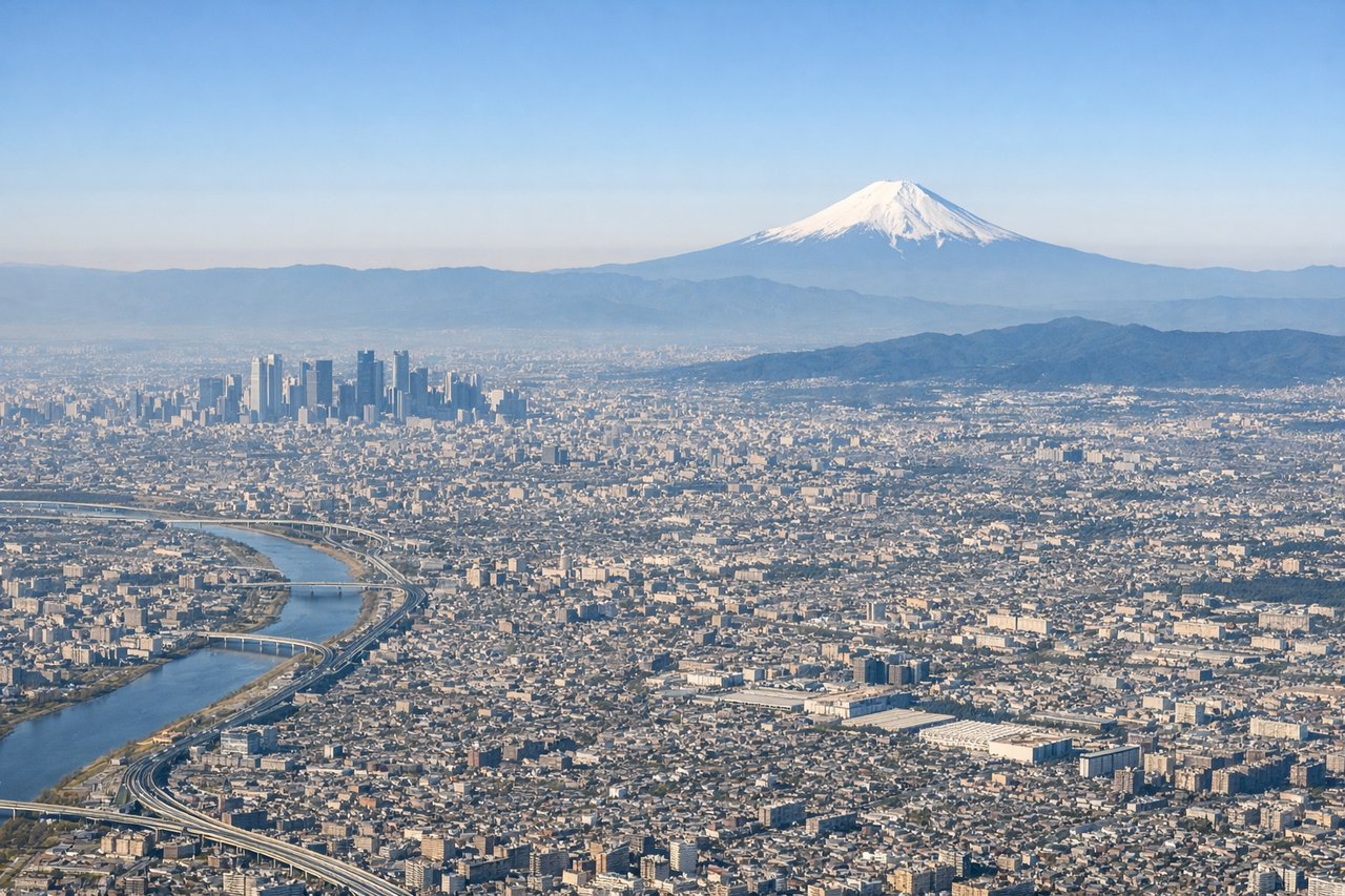
Takeoff from HND
RIGHTRight side captures Tokyo Bay and the urban sprawl of central Tokyo during the initial climb. Haneda's typical south-wind daytime configuration uses runways 34L/34R with approaches from over the bay, meaning departures on 16R or 05 head northwestward over the bay, offering views of the water, port infrastructure, and the city's eastern districts before turning inland.
Landing at IWK
LEFTLeft side offers better views during the descent and approach to Iwakuni. The flight path from Tokyo to Iwakuni heads southwest, and typical approaches to Runway 02 (northbound) or Runway 20 (southbound) at IWK will position the left side to see the Seto Inland Sea, the Iwakuni area, and the surrounding hills as the aircraft descends through 5,000–10,000 feet.
Landmarks on this routeAll landmarks →
Will your flight be in sunlight?
Pick a date and time in the Sun Map to watch the sun move across your whole flight.
About This Route
Which side of the plane should I sit on flying from Tokyo International (HND) to Iwakuni Kintaikyo Airport (IWK)?
Sit on the Right side of the plane for the best views on flights from Tokyo to Iwakuni. Right side scores marginally higher due to the superior takeoff experience from Haneda—the Tokyo Bay departure offers more dramatic urban and water scenery than the landing approach. While both sides are relatively modest in scenic value for a short domestic flight over mostly flat to gently rolling terrain, the right side's view of Tokyo's port infrastructure, central city districts, and the bay during climb-out provides more visual interest and landmark density than the left side's approach to a smaller regional airport.
What can I see during takeoff from Tokyo International in Tokyo?
During takeoff from Tokyo International (HND), sit on the Right side for the best views. Right side captures Tokyo Bay and the urban sprawl of central Tokyo during the initial climb. Haneda's typical south-wind daytime configuration uses runways 34L/34R with approaches from over the bay, meaning departures on 16R or 05 head northwestward over the bay, offering views of the water, port infrastructure, and the city's eastern districts before turning inland. Notable sights include: Tokyo Bay with container terminals and port facilities, Tsukiji and Ginza districts, Rainbow Bridge spanning the bay.
What can I see when landing at Iwakuni Kintaikyo Airport in Iwakuni?
When landing at Iwakuni Kintaikyo Airport (IWK), sit on the Left side for the best views. Left side offers better views during the descent and approach to Iwakuni. The flight path from Tokyo to Iwakuni heads southwest, and typical approaches to Runway 02 (northbound) or Runway 20 (southbound) at IWK will position the left side to see the Seto Inland Sea, the Iwakuni area, and the surrounding hills as the aircraft descends through 5,000–10,000 feet. Notable sights include: Seto Inland Sea with its scattered islands, Iwakuni city and harbor, forested hills surrounding the airport.
How long is the flight from Tokyo to Iwakuni?
The flight from Tokyo International (HND) to Iwakuni Kintaikyo Airport (IWK) takes about 1 hour 35 minutes. The shortest flight path between them is 438 miles (705 km); winds and air traffic control usually add a few percent.
What does the Tokyo to Iwakuni flight path pass over?
The flight path crosses the Seto Inland Sea region, passing over or near the Hiroshima Prefecture coastline and numerous small islands characteristic of the inland sea. The terrain transitions from Tokyo's urban sprawl through the Kanto Plain, then over low forested hills and the fragmented island landscape of the Seto Inland Sea as the aircraft descends toward Iwakuni.