While takeoff favors the right for Chandigarh's geography, the landing view from the left is more dramatic and geographically significant—the Yamuna River and Delhi's urban extent provide stronger visual interest than the approach path from the east.
Flown IXC to DEL? Did we get it right?
Flight Path
Chandigarh to Delhi is 147 miles (237 km), a flight of about 1 hour 10 minutes.
The flight path (roughly 240 km south-southeast) crosses the Indo-Gangetic Plain. Notable midpoint features include the Ambala region (visible as a smaller urban cluster if flying at lower cruise altitudes), agricultural fields of Haryana state, and the gradual transition from Chandigarh's foothill terrain to the flatter Yamuna basin. The Aravalli Hills become increasingly prominent on the left (west) as the aircraft descends toward Delhi. No major water bodies are crossed; the landscape is predominantly agricultural with scattered towns.
Great circle distance and headings ›Phase by phase
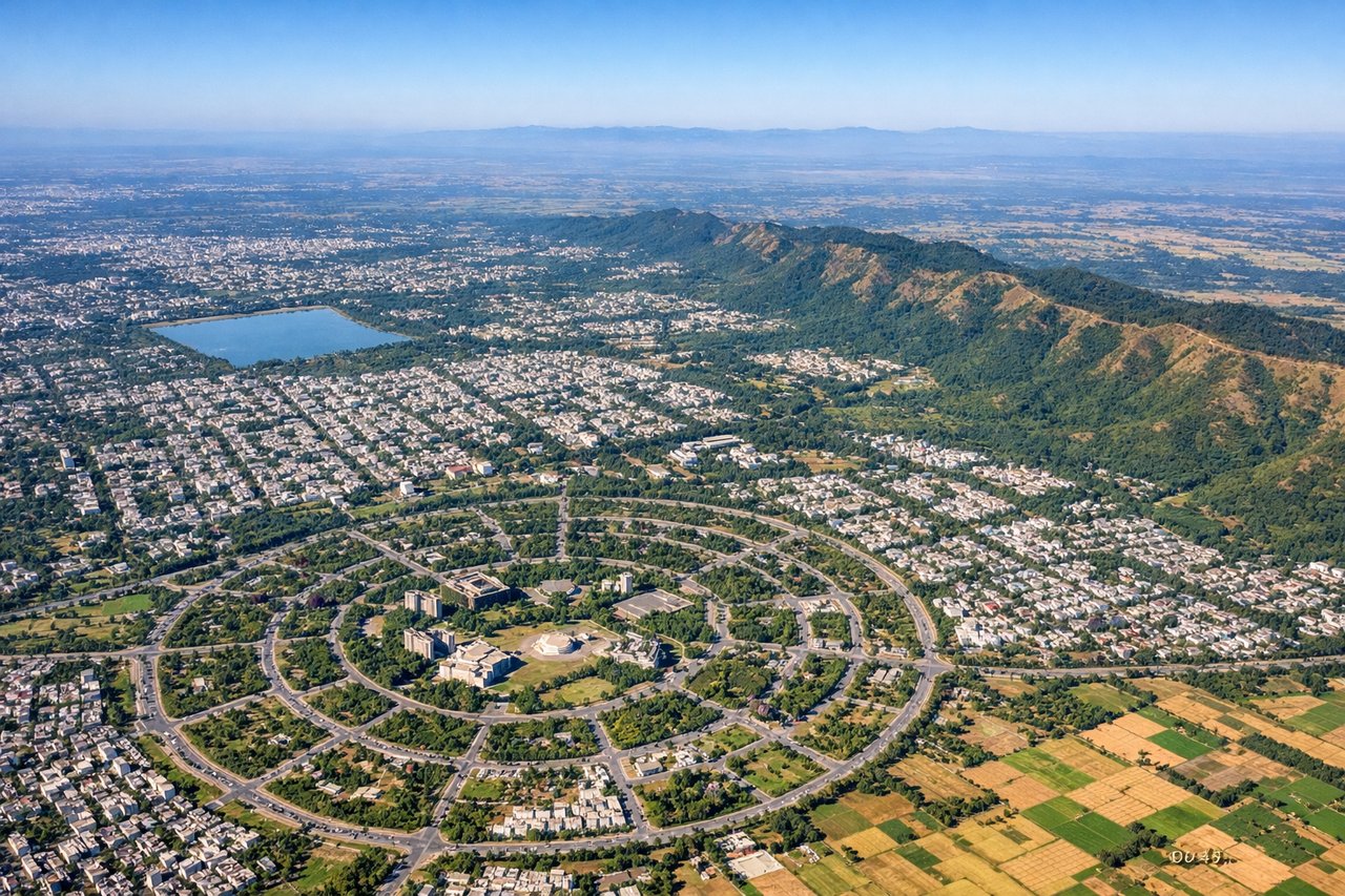
Takeoff from IXC
RIGHTChandigarh typically departs eastbound (runway 24/06 operations favor 06 for morning departures). Right-side seats capture the Shivalik Range foothills immediately north and the planned city grid of Chandigarh itself during climb-out.
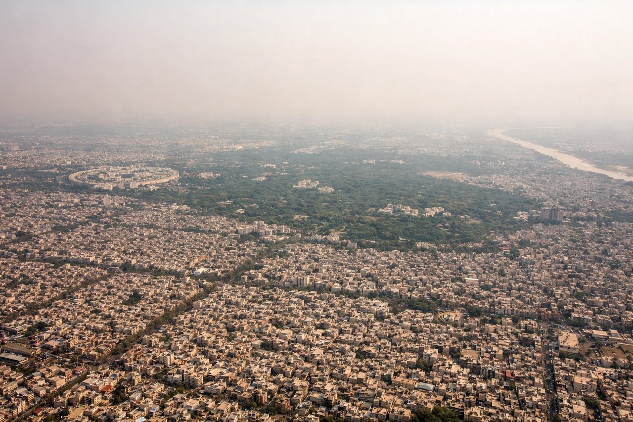
Landing at DEL
LEFTDelhi typically lands on runways 28L/28R (westerly approaches) or 09L/09R (easterly). For westerly approaches, left-side seats provide views of the Yamuna River, Old Delhi's dense urban fabric, and the approach path over the Aravalli foothills. Easterly approaches favor left seats viewing the Yamuna floodplain and New Delhi's grid layout.
Will your flight be in sunlight?
Pick a date and time in the Sun Map to watch the sun move across your whole flight.
About This Route
Which side of the plane should I sit on flying from Chandigarh (IXC) to Indira Gandhi International (DEL)?
Sit on the Left side of the plane for the best views on flights from Chandigarh to Delhi. While takeoff favors the right for Chandigarh's geography, the landing view from the left is more dramatic and geographically significant—the Yamuna River and Delhi's urban extent provide stronger visual interest than the approach path from the east.
What can I see during takeoff from Chandigarh in Chandigarh?
During takeoff from Chandigarh (IXC), sit on the Right side for the best views. Chandigarh typically departs eastbound (runway 24/06 operations favor 06 for morning departures). Right-side seats capture the Shivalik Range foothills immediately north and the planned city grid of Chandigarh itself during climb-out. Notable sights include: Shivalik Range foothills (north), Chandigarh city grid with radial sectors (directly below), Sukhna Lake (visible as small water body within city), Morni Hills (northeast, distant).
What can I see when landing at Indira Gandhi International in Delhi?
When landing at Indira Gandhi International (DEL), sit on the Left side for the best views. Delhi typically lands on runways 28L/28R (westerly approaches) or 09L/09R (easterly). For westerly approaches, left-side seats provide views of the Yamuna River, Old Delhi's dense urban fabric, and the approach path over the Aravalli foothills. Easterly approaches favor left seats viewing the Yamuna floodplain and New Delhi's grid layout. Notable sights include: Yamuna River (serpentine course, major visual reference), Aravalli Hills (southwest, low ridge), Delhi's urban sprawl (dense grid visible), Indira Gandhi International Airport runways (visible during final approach).
How long is the flight from Chandigarh to Delhi?
The flight from Chandigarh (IXC) to Indira Gandhi International (DEL) takes about 1 hour 10 minutes. The shortest flight path between them is 147 miles (237 km); winds and air traffic control usually add a few percent.
What does the Chandigarh to Delhi flight path pass over?
The flight path (roughly 240 km south-southeast) crosses the Indo-Gangetic Plain. Notable midpoint features include the Ambala region (visible as a smaller urban cluster if flying at lower cruise altitudes), agricultural fields of Haryana state, and the gradual transition from Chandigarh's foothill terrain to the flatter Yamuna basin. The Aravalli Hills become increasingly prominent on the left (west) as the aircraft descends toward Delhi. No major water bodies are crossed; the landscape is predominantly agricultural with scattered towns.