Jackson to Denver is 966 miles (1,554 km), a flight of about 2 hours 40 minutes.
While the right side has a slight edge at takeoff for the Pearl River and Barnett Reservoir, the left side delivers the far more dramatic payoff on approach into Denver with the entire Front Range panorama. The left side also picks up the Arkansas River valley and the transition from Great Plains to Rockies during the final descent phase.
Flight Path
The flight crosses northern Louisiana and Arkansas before tracking over the Oklahoma panhandle and into southeastern Colorado. Notable features include the Arkansas River cutting through southeastern Colorado, the flat expanse of the Llano Estacado in the Texas-Oklahoma border region, and the gradual transition from green Mississippi bottomlands to the brown semi-arid high plains of Kansas and Colorado. The Wichita urban area may be visible to the north depending on routing.
Great circle distance and headings ›
.jpg?width=600)
Phase by phase
Takeoff from JAN
RIGHTJackson-Medgar Wiley Evers International typically departs northwest on runway 16/34, meaning a northbound departure puts the Mississippi River and downtown Jackson to the right (east). The Pearl River and Barnett Reservoir are also visible to the right during climb-out.
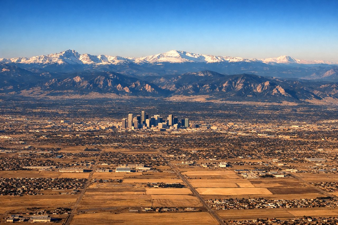
Landing at DEN
LEFTDenver International sits on the plains east of the city, and aircraft typically approach from the east or southeast on runway 16R/34L or similar headings. A westward approach puts the entire Front Range — including the Rocky Mountains, Pikes Peak to the south, and Longs Peak to the north — on the left (south and west) side with dramatic views of Denver's skyline in the foreground.
Landmarks on this routeAll landmarks →
Will your flight be in sunlight?
Pick a date and time in the Sun Map to watch the sun move across your whole flight.
About This Route
Which side of the plane should I sit on flying from Jackson International (JAN) to Denver International (DEN)?
Sit on the Left side of the plane for the best views on flights from Jackson to Denver. While the right side has a slight edge at takeoff for the Pearl River and Barnett Reservoir, the left side delivers the far more dramatic payoff on approach into Denver with the entire Front Range panorama. The left side also picks up the Arkansas River valley and the transition from Great Plains to Rockies during the final descent phase.
What can I see during takeoff from Jackson International in Jackson?
During takeoff from Jackson International (JAN), sit on the Right side for the best views. Jackson-Medgar Wiley Evers International typically departs northwest on runway 16/34, meaning a northbound departure puts the Mississippi River and downtown Jackson to the right (east). The Pearl River and Barnett Reservoir are also visible to the right during climb-out. Notable sights include: Downtown Jackson skyline, Pearl River corridor, Barnett Reservoir, Ross Barnett Reservoir dam structure.
What can I see when landing at Denver International in Denver?
When landing at Denver International (DEN), sit on the Left side for the best views. Denver International sits on the plains east of the city, and aircraft typically approach from the east or southeast on runway 16R/34L or similar headings. A westward approach puts the entire Front Range — including the Rocky Mountains, Pikes Peak to the south, and Longs Peak to the north — on the left (south and west) side with dramatic views of Denver's skyline in the foreground. Notable sights include: Front Range Rocky Mountains, Denver downtown skyline, Pikes Peak (distant south), Longs Peak and Indian Peaks Wilderness.
How long is the flight from Jackson to Denver?
The flight from Jackson International (JAN) to Denver International (DEN) takes about 2 hours 40 minutes. The shortest flight path between them is 966 miles (1,554 km); winds and air traffic control usually add a few percent.
What does the Jackson to Denver flight path pass over?
The flight crosses northern Louisiana and Arkansas before tracking over the Oklahoma panhandle and into southeastern Colorado. Notable features include the Arkansas River cutting through southeastern Colorado, the flat expanse of the Llano Estacado in the Texas-Oklahoma border region, and the gradual transition from green Mississippi bottomlands to the brown semi-arid high plains of Kansas and Colorado. The Wichita urban area may be visible to the north depending on routing.