Jackson to Chicago is 679 miles (1,092 km), a flight of about 1 hour 55 minutes.
The left side wins both ends of this flight — the Pearl River and Jackson on departure, and the unmistakable Chicago skyline against Lake Michigan on approach. The right side offers little more than flat agricultural land throughout.
Flight Path
The flight tracks roughly north-northeast over the flat Mississippi Alluvial Plain, crossing into Tennessee near Memphis with the Mississippi River visible as a major landmark. Continuing north over western Kentucky and southern Illinois, the terrain remains predominantly flat agricultural land — corn and soybean fields in large rectangular parcels. The Ohio River crossing near the Kentucky-Illinois border is a notable feature. As the flight enters Illinois, the flat Illinois prairie dominates with occasional river valleys. No significant elevation changes occur along this entire route — it is one of the flatter flight paths in the continental US.
Great circle distance and headings ›

Phase by phase
Takeoff from JAN
LEFTJackson-Medgar Wiley Evers International typically departs northbound on runway 16/34, meaning a northward climb puts the Pearl River and downtown Jackson to the left (west). The left side gives a clear view over the city grid and the Pearl River winding southward through the metro area.
Landing at ORD
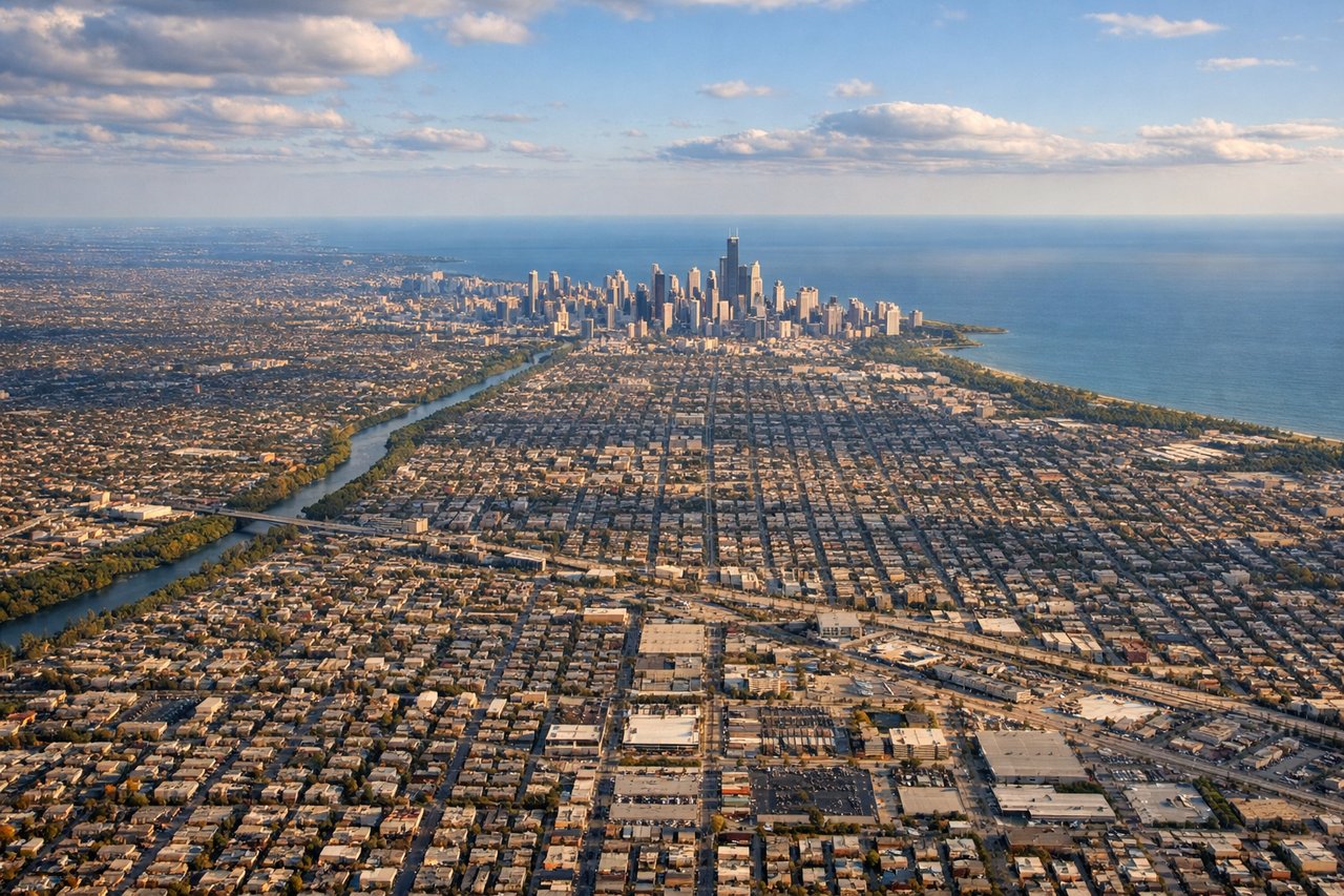
LEFTArriving at O'Hare from the south, aircraft typically approach on runways oriented northeast, putting Lake Michigan and the Chicago lakefront on the left side. The left seat gets the iconic view of the Chicago skyline against the lake, with Grant Park and the Museum Campus clearly identifiable.
Landmarks on this routeAll landmarks →
Will your flight be in sunlight?
Pick a date and time in the Sun Map to watch the sun move across your whole flight.
About This Route
Which side of the plane should I sit on flying from Jackson International (JAN) to Chicago Ohare International (ORD)?
Sit on the Left side of the plane for the best views on flights from Jackson to Chicago. The left side wins both ends of this flight — the Pearl River and Jackson on departure, and the unmistakable Chicago skyline against Lake Michigan on approach. The right side offers little more than flat agricultural land throughout.
What can I see during takeoff from Jackson International in Jackson?
During takeoff from Jackson International (JAN), sit on the Left side for the best views. Jackson-Medgar Wiley Evers International typically departs northbound on runway 16/34, meaning a northward climb puts the Pearl River and downtown Jackson to the left (west). The left side gives a clear view over the city grid and the Pearl River winding southward through the metro area. Notable sights include: Pearl River corridor, downtown Jackson skyline, Ross Barnett Reservoir to the northeast, flat Mississippi Delta agricultural patchwork.
What can I see when landing at Chicago Ohare International in Chicago?
When landing at Chicago Ohare International (ORD), sit on the Left side for the best views. Arriving at O'Hare from the south, aircraft typically approach on runways oriented northeast, putting Lake Michigan and the Chicago lakefront on the left side. The left seat gets the iconic view of the Chicago skyline against the lake, with Grant Park and the Museum Campus clearly identifiable. Notable sights include: Chicago Loop skyline, Lake Michigan shoreline, Grant Park and Museum Campus, O'Hare suburban sprawl of Cook County.
How long is the flight from Jackson to Chicago?
The flight from Jackson International (JAN) to Chicago Ohare International (ORD) takes about 1 hour 55 minutes. The shortest flight path between them is 679 miles (1,092 km); winds and air traffic control usually add a few percent.
What does the Jackson to Chicago flight path pass over?
The flight tracks roughly north-northeast over the flat Mississippi Alluvial Plain, crossing into Tennessee near Memphis with the Mississippi River visible as a major landmark. Continuing north over western Kentucky and southern Illinois, the terrain remains predominantly flat agricultural land — corn and soybean fields in large rectangular parcels. The Ohio River crossing near the Kentucky-Illinois border is a notable feature. As the flight enters Illinois, the flat Illinois prairie dominates with occasional river valleys. No significant elevation changes occur along this entire route — it is one of the flatter flight paths in the continental US.