The right side scores higher due to San Diego's superior landing approach with dramatic coastal geography—the Peninsular Ranges, San Diego Bay, and Mission Bay provide concentrated scenic variety and recognizable landmarks. While Jacksonville's departure offers coastal interest, the westbound cruise across the continental interior (5+ hours of flat terrain, pine forests, and open plains) significantly diminishes the left side's overall appeal. The right side's landing scenery outweighs the left side's modest takeoff advantage.
Flown JAX to SAN? Did we get it right?
Flight Path
Jacksonville to San Diego is 2,085 miles (3,355 km), a flight of about 5 hours 15 minutes.
The flight path crosses the Appalachian foothills (Georgia/Tennessee border), then transitions to the Cumberland Plateau and Mississippi River valley. The Mississippi River itself is visible near Memphis, Tennessee. Beyond that, the route crosses the Great Plains of Oklahoma and Texas—predominantly flat with scattered lakes and rivers. The Caprock Escarpment marks the transition into the Texas Panhandle. As the aircraft approaches New Mexico and Arizona, the terrain gradually rises toward the Colorado Plateau and Rocky Mountain foothills. The Mogollon Rim in Arizona and the transition into the Basin and Range topography of southern Arizona and southern California provide the only significant terrain drama in the cruise phase. Most of the 5+ hour cruise is over relatively flat to gently rolling terrain with minimal dramatic features.
Great circle distance and headings ›

Phase by phase
Takeoff from JAX
LEFTJacksonville's coastal location provides immediate water views and the St. Johns River estuary during climb-out. The left side captures the Atlantic coastline and barrier islands as the aircraft departs northeastward before turning west.
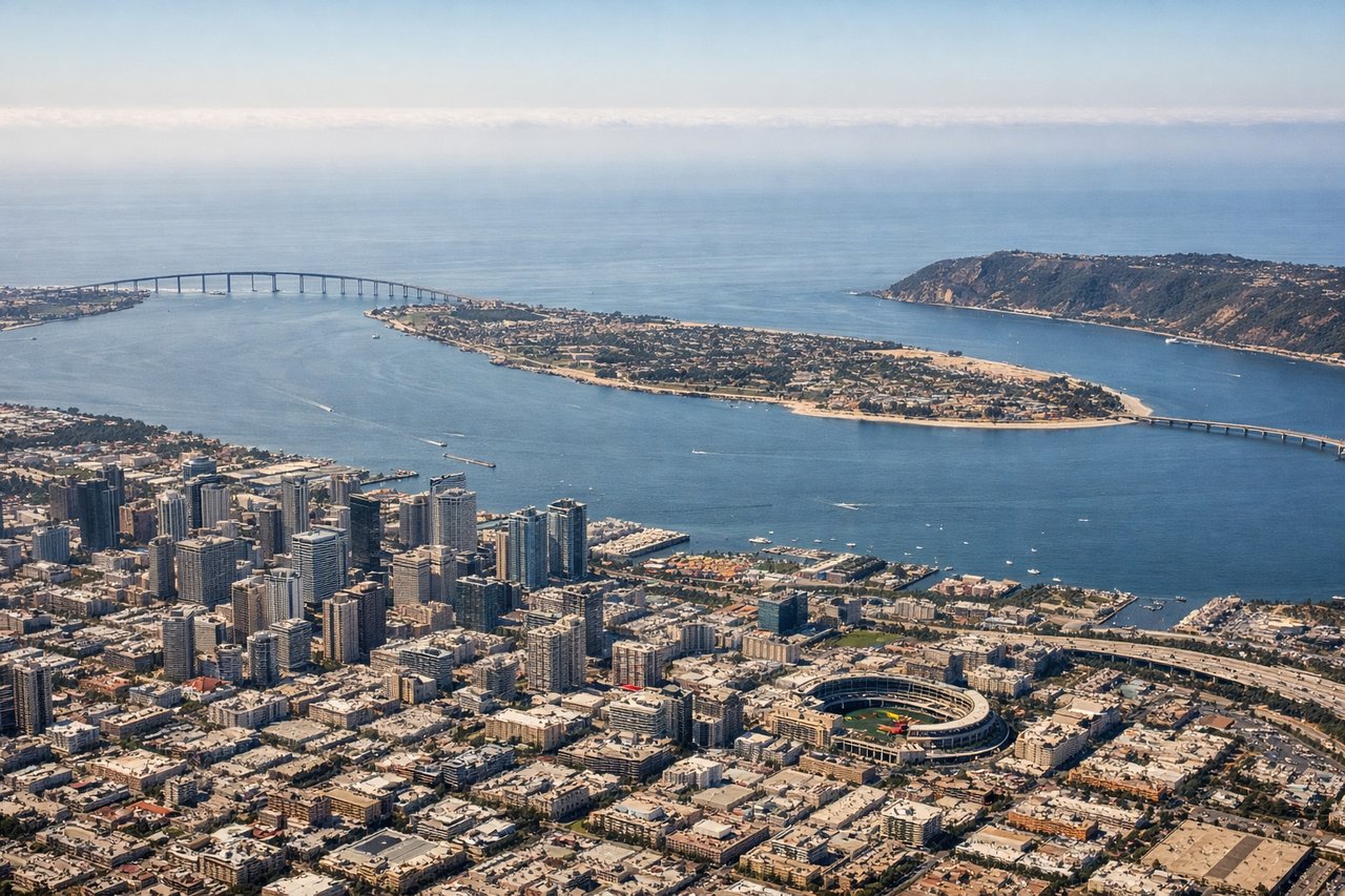
Landing at SAN
RIGHTSan Diego's approach from the east offers dramatic views of the Peninsular Ranges and the San Diego Bay complex. The right side captures the coastal mountains, Mission Bay, and downtown San Diego's waterfront during descent into Lindbergh Field.
Will your flight be in sunlight?
Pick a date and time in the Sun Map to watch the sun move across your whole flight.
About This Route
Which side of the plane should I sit on flying from Jacksonville International (JAX) to San Diego International Lindbergh Fld (SAN)?
Sit on the Right side of the plane for the best views on flights from Jacksonville to San Diego. The right side scores higher due to San Diego's superior landing approach with dramatic coastal geography—the Peninsular Ranges, San Diego Bay, and Mission Bay provide concentrated scenic variety and recognizable landmarks. While Jacksonville's departure offers coastal interest, the westbound cruise across the continental interior (5+ hours of flat terrain, pine forests, and open plains) significantly diminishes the left side's overall appeal. The right side's landing scenery outweighs the left side's modest takeoff advantage.
What can I see during takeoff from Jacksonville International in Jacksonville?
During takeoff from Jacksonville International (JAX), sit on the Left side for the best views. Jacksonville's coastal location provides immediate water views and the St. Johns River estuary during climb-out. The left side captures the Atlantic coastline and barrier islands as the aircraft departs northeastward before turning west. Notable sights include: St. Johns River estuary, Atlantic coastline, Jacksonville Beach barrier islands, Intracoastal Waterway.
What can I see when landing at San Diego International Lindbergh Fld in San Diego?
When landing at San Diego International Lindbergh Fld (SAN), sit on the Right side for the best views. San Diego's approach from the east offers dramatic views of the Peninsular Ranges and the San Diego Bay complex. The right side captures the coastal mountains, Mission Bay, and downtown San Diego's waterfront during descent into Lindbergh Field. Notable sights include: Peninsular Ranges foothills, San Diego Bay, Mission Bay, downtown San Diego waterfront.
How long is the flight from Jacksonville to San Diego?
The flight from Jacksonville International (JAX) to San Diego International Lindbergh Fld (SAN) takes about 5 hours 15 minutes. The shortest flight path between them is 2,085 miles (3,355 km); winds and air traffic control usually add a few percent.
What does the Jacksonville to San Diego flight path pass over?
The flight path crosses the Appalachian foothills (Georgia/Tennessee border), then transitions to the Cumberland Plateau and Mississippi River valley. The Mississippi River itself is visible near Memphis, Tennessee. Beyond that, the route crosses the Great Plains of Oklahoma and Texas—predominantly flat with scattered lakes and rivers. The Caprock Escarpment marks the transition into the Texas Panhandle. As the aircraft approaches New Mexico and Arizona, the terrain gradually rises toward the Colorado Plateau and Rocky Mountain foothills. The Mogollon Rim in Arizona and the transition into the Basin and Range topography of southern Arizona and southern California provide the only significant terrain drama in the cruise phase. Most of the 5+ hour cruise is over relatively flat to gently rolling terrain with minimal dramatic features.