Port St Johns to Delhi is 5,201 miles (8,370 km), a flight of about 9 hours 45 minutes.
The right side wins narrowly because it captures the two most distinctive land features of the trip — the Wild Coast cliffs and river mouth at departure, and the Yamuna River with Delhi's skyline at arrival — while the vast majority of the roughly 9-hour cruise over the Mozambique Channel, western Indian Ocean, and Arabian Sea offers essentially featureless water on both sides, capping the overall scores for both sides fairly low.
Flight Path
Open water of the western Indian Ocean, several hundred kilometers northeast of Madagascar and southwest of the Seychelles, with no land visible in either direction
Great circle distance and headings ›Phase by phase
Takeoff from JOH
RIGHTPort St Johns sits right where the Mzimvubu River meets the Indian Ocean, flanked by the famous sandstone cliffs known as the Gates of St Johns. Whichever runway direction is used, the climb-out and turn onto course expose this dramatic river-mouth and coastline on the ocean-facing side, while the inland side only shows the rolling green hills of the former Transkei.
Landing at DEL
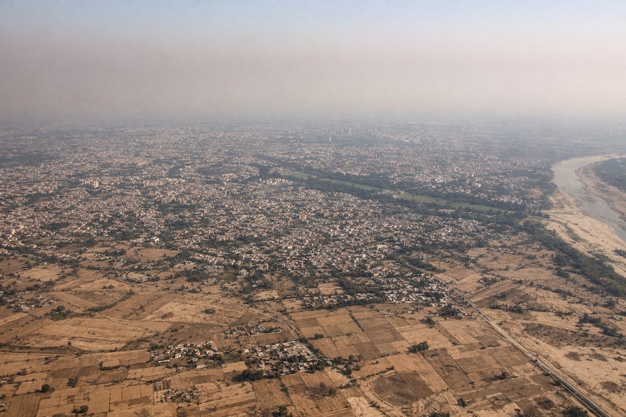
RIGHTOn the approach into Delhi from the southwest, the Yamuna River and the city's dense core become visible on the eastern side of the aircraft, with the low Aravalli ridge (Delhi Ridge) forming a faint line on the horizon. The opposite side mostly shows the flat, featureless farmland of Haryana with no distinguishing terrain.
Will your flight be in sunlight?
Pick a date and time in the Sun Map to watch the sun move across your whole flight.
About This Route
Which side of the plane should I sit on flying from Port St Johns Airport (JOH) to Indira Gandhi International (DEL)?
Sit on the Right side of the plane for the best views on flights from Port St Johns to Delhi. The right side wins narrowly because it captures the two most distinctive land features of the trip — the Wild Coast cliffs and river mouth at departure, and the Yamuna River with Delhi's skyline at arrival — while the vast majority of the roughly 9-hour cruise over the Mozambique Channel, western Indian Ocean, and Arabian Sea offers essentially featureless water on both sides, capping the overall scores for both sides fairly low.
What can I see during takeoff from Port St Johns Airport in Port St Johns?
During takeoff from Port St Johns Airport (JOH), sit on the Right side for the best views. Port St Johns sits right where the Mzimvubu River meets the Indian Ocean, flanked by the famous sandstone cliffs known as the Gates of St Johns. Whichever runway direction is used, the climb-out and turn onto course expose this dramatic river-mouth and coastline on the ocean-facing side, while the inland side only shows the rolling green hills of the former Transkei. Notable sights include: Gates of St Johns cliffs (Mount Thesiger and Mount Sullivan), Mzimvubu River mouth, Wild Coast beaches, Indian Ocean.
What can I see when landing at Indira Gandhi International in Delhi?
When landing at Indira Gandhi International (DEL), sit on the Right side for the best views. On the approach into Delhi from the southwest, the Yamuna River and the city's dense core become visible on the eastern side of the aircraft, with the low Aravalli ridge (Delhi Ridge) forming a faint line on the horizon. The opposite side mostly shows the flat, featureless farmland of Haryana with no distinguishing terrain. Notable sights include: Yamuna River, Delhi urban skyline near Red Fort/India Gate area, Aravalli/Delhi Ridge, patchwork farmland of the Indo-Gangetic plain.
How long is the flight from Port St Johns to Delhi?
The flight from Port St Johns Airport (JOH) to Indira Gandhi International (DEL) takes about 9 hours 45 minutes. The shortest flight path between them is 5,201 miles (8,370 km); winds and air traffic control usually add a few percent.
What does the Port St Johns to Delhi flight path pass over?
Open water of the western Indian Ocean, several hundred kilometers northeast of Madagascar and southwest of the Seychelles, with no land visible in either direction