The left side captures Iceland's volcanic coastal terrain on departure and the Pyrenees-to-Mediterranean transition with Barcelona's skyline on arrival, while the right side is dominated by featureless open Atlantic Ocean for most of the flight.
Flown KEF to BCN? Did we get it right?
Flight Path
Keflavik to Barcelona is 1,852 miles (2,981 km), a flight of about 4 hours 20 minutes.
Mid-Atlantic open ocean south of Ireland, followed by the Bay of Biscay and the French Atlantic coastline before crossing into Spanish airspace near the Pyrenees.
Great circle distance and headings ›


Phase by phase
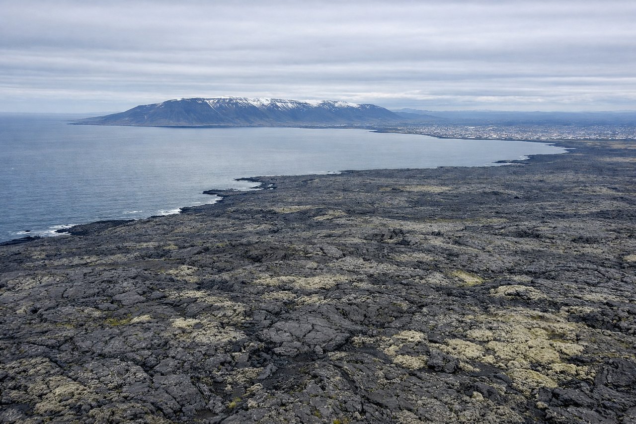
Takeoff from KEF
LEFTDeparting KEF on runway 19 heading south, the left side offers views back over the Reykjanes Peninsula's volcanic fields and jagged coastline before the plane turns out over open water. The right side faces open Atlantic with little to see.
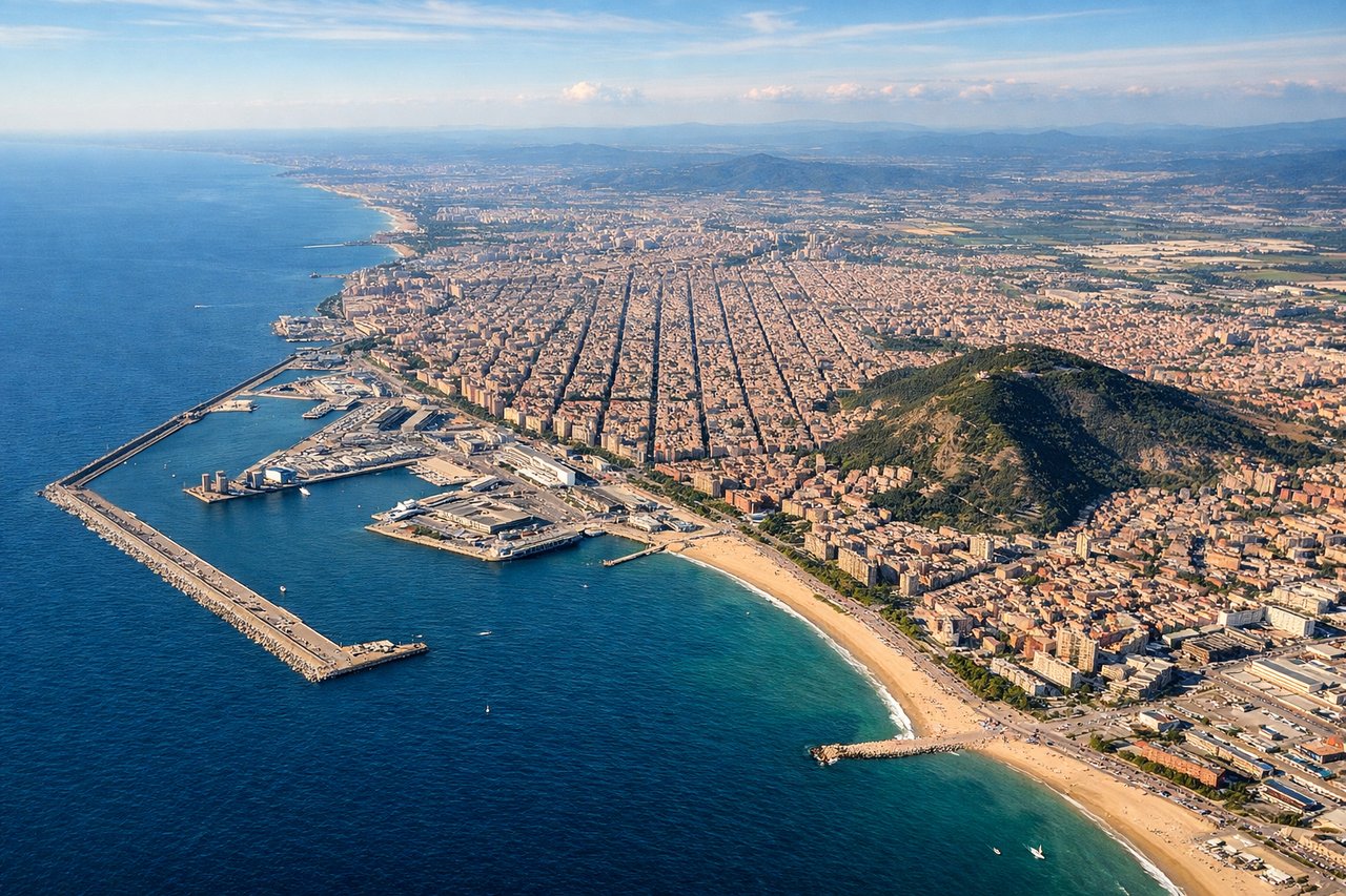
Landing at BCN
LEFTOn approach into BCN from the north, the left side reveals the Pyrenees foothills receding behind and then the Catalan coastline and Barcelona's urban sprawl along the Mediterranean as the aircraft turns toward the runway. The right side mostly shows inland Catalan plains with less visual interest.
Will your flight be in sunlight?
Pick a date and time in the Sun Map to watch the sun move across your whole flight.
About This Route
Which side of the plane should I sit on flying from Keflavik Nas (KEF) to Barcelona (BCN)?
Sit on the Left side of the plane for the best views on flights from Keflavik to Barcelona. The left side captures Iceland's volcanic coastal terrain on departure and the Pyrenees-to-Mediterranean transition with Barcelona's skyline on arrival, while the right side is dominated by featureless open Atlantic Ocean for most of the flight.
What can I see during takeoff from Keflavik Nas in Keflavik?
During takeoff from Keflavik Nas (KEF), sit on the Left side for the best views. Departing KEF on runway 19 heading south, the left side offers views back over the Reykjanes Peninsula's volcanic fields and jagged coastline before the plane turns out over open water. The right side faces open Atlantic with little to see. Notable sights include: Reykjanes Peninsula lava fields, Iceland's southwest coastline, receding North Atlantic coastal cliffs.
What can I see when landing at Barcelona in Barcelona?
When landing at Barcelona (BCN), sit on the Left side for the best views. On approach into BCN from the north, the left side reveals the Pyrenees foothills receding behind and then the Catalan coastline and Barcelona's urban sprawl along the Mediterranean as the aircraft turns toward the runway. The right side mostly shows inland Catalan plains with less visual interest. Notable sights include: Pyrenees foothills, Catalan coastline, Barcelona cityscape and harbor, Mediterranean Sea.
How long is the flight from Keflavik to Barcelona?
The flight from Keflavik Nas (KEF) to Barcelona (BCN) takes about 4 hours 20 minutes. The shortest flight path between them is 1,852 miles (2,981 km); winds and air traffic control usually add a few percent.
What does the Keflavik to Barcelona flight path pass over?
Mid-Atlantic open ocean south of Ireland, followed by the Bay of Biscay and the French Atlantic coastline before crossing into Spanish airspace near the Pyrenees.