The left side strings together Iceland's highlands and Reykjavik at departure with Helsinki's island-studded coastline at arrival, while cruise-phase views on that side also catch the Norwegian coastal mountains near Trondheim that the great-circle route brushes past. The right side spends most of the flight over open Norwegian Sea and Baltic water with comparatively flat, featureless coastline.
Flown KEF to HEL? Did we get it right?
Flight Path
Keflavik to Helsinki is 1,519 miles (2,444 km), a flight of about 3 hours 20 minutes.
Norwegian Sea, the Trondheimsfjord region and Scandinavian mountains near Trondheim, central Swedish forest and lake country, and the Åland archipelago in the Gulf of Bothnia approach to the Baltic Sea
Great circle distance and headings ›


Phase by phase
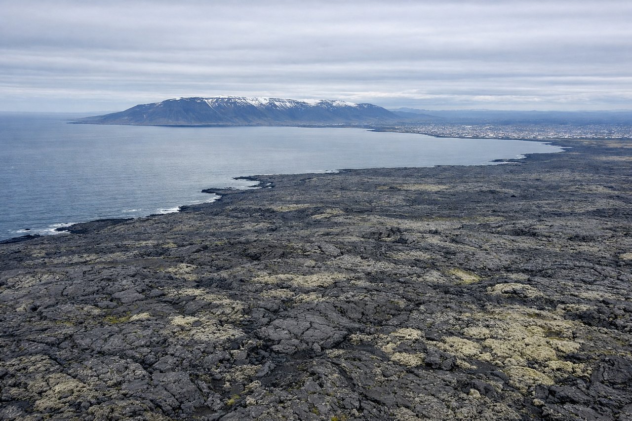
Takeoff from KEF
LEFTDeparting KEF on the ENE track toward Scandinavia, the climb passes just north of the flight path's centerline, putting Reykjavik and Faxaflói Bay in view on the left, with the volcanic cone of Snæfellsjökull sometimes visible across the water on very clear days. The right side mostly shows open ocean and the flatter Reykjanes lava fields receding behind.
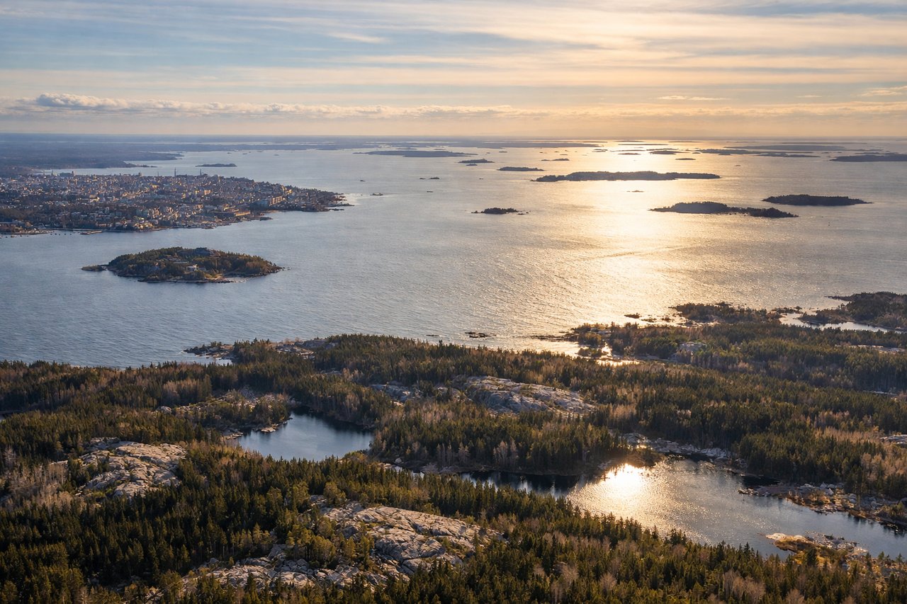
Landing at HEL
LEFTHelsinki-Vantaa's typical southwesterly-flow approach brings arriving aircraft in from the northeast before turning onto final for runway 22, and during that turn the city's coastal archipelago and skyline sit to the south, visible on the left side. The right side instead faces open Baltic water and flatter inland forest with fewer named landmarks.
Will your flight be in sunlight?
Pick a date and time in the Sun Map to watch the sun move across your whole flight.
About This Route
Which side of the plane should I sit on flying from Keflavik Nas (KEF) to Helsinki Vantaa (HEL)?
Sit on the Left side of the plane for the best views on flights from Keflavik to Helsinki. The left side strings together Iceland's highlands and Reykjavik at departure with Helsinki's island-studded coastline at arrival, while cruise-phase views on that side also catch the Norwegian coastal mountains near Trondheim that the great-circle route brushes past. The right side spends most of the flight over open Norwegian Sea and Baltic water with comparatively flat, featureless coastline.
What can I see during takeoff from Keflavik Nas in Keflavik?
During takeoff from Keflavik Nas (KEF), sit on the Left side for the best views. Departing KEF on the ENE track toward Scandinavia, the climb passes just north of the flight path's centerline, putting Reykjavik and Faxaflói Bay in view on the left, with the volcanic cone of Snæfellsjökull sometimes visible across the water on very clear days. The right side mostly shows open ocean and the flatter Reykjanes lava fields receding behind. Notable sights include: Reykjavik skyline, Faxaflói Bay, Snæfellsjökull volcano (distant), Reykjanes lava fields.
What can I see when landing at Helsinki Vantaa in Helsinki?
When landing at Helsinki Vantaa (HEL), sit on the Left side for the best views. Helsinki-Vantaa's typical southwesterly-flow approach brings arriving aircraft in from the northeast before turning onto final for runway 22, and during that turn the city's coastal archipelago and skyline sit to the south, visible on the left side. The right side instead faces open Baltic water and flatter inland forest with fewer named landmarks. Notable sights include: Helsinki archipelago and Suomenlinna fortress island, Helsinki Cathedral's white dome, Gulf of Finland coastline, Töölönlahti waterfront district.
How long is the flight from Keflavik to Helsinki?
The flight from Keflavik Nas (KEF) to Helsinki Vantaa (HEL) takes about 3 hours 20 minutes. The shortest flight path between them is 1,519 miles (2,444 km); winds and air traffic control usually add a few percent.
What does the Keflavik to Helsinki flight path pass over?
Norwegian Sea, the Trondheimsfjord region and Scandinavian mountains near Trondheim, central Swedish forest and lake country, and the Åland archipelago in the Gulf of Bothnia approach to the Baltic Sea