Right-side seats capture the most dramatic scenery on both legs: Osaka Bay and the Kii Peninsula during takeoff, and the Han River's meanders plus Seoul's urban grid during descent. The flight path itself offers limited mid-journey landmarks, making the endpoints the priority.
Flown KIX to SSN? Did we get it right?
Flight Path
Osaka to Seoul East is 500 miles (805 km), a flight of about 2 hours.
The Korea Strait (Tsushima Strait) separates Japan and South Korea; at cruise altitude, the water appears as a dark blue expanse with minimal visible detail. The flight typically passes over or near Jeju Island (visible as a dark landmass if the route tracks slightly south), though most of the mid-flight segment is open water with no significant landmarks.
Great circle distance and headings ›Phase by phase
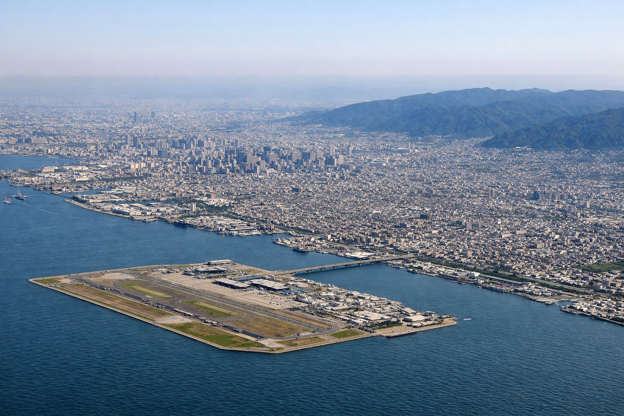
Takeoff from KIX
RIGHTRight-side seats offer views of Osaka Bay and the Kii Peninsula as the aircraft climbs northeastward. The bay's distinctive shape and surrounding urban sprawl are clearly visible during the initial climb-out phase.
Landing at SSN
LEFTLeft-side seats provide excellent views of the Han River, Seoul's urban grid, and the Bukhan Mountains during descent into Gimpo or Incheon. The river's distinctive meanders and the city's geometric street pattern are striking from altitude.
Will your flight be in sunlight?
Pick a date and time in the Sun Map to watch the sun move across your whole flight.
About This Route
Which side of the plane should I sit on flying from Kansai International (KIX) to Seoul Ab (SSN)?
Sit on the Right side of the plane for the best views on flights from Osaka to Seoul East. Right-side seats capture the most dramatic scenery on both legs: Osaka Bay and the Kii Peninsula during takeoff, and the Han River's meanders plus Seoul's urban grid during descent. The flight path itself offers limited mid-journey landmarks, making the endpoints the priority.
What can I see during takeoff from Kansai International in Osaka?
During takeoff from Kansai International (KIX), sit on the Right side for the best views. Right-side seats offer views of Osaka Bay and the Kii Peninsula as the aircraft climbs northeastward. The bay's distinctive shape and surrounding urban sprawl are clearly visible during the initial climb-out phase. Notable sights include: Osaka Bay, Kii Peninsula, Kobe city lights (western shore), Akashi Strait.
What can I see when landing at Seoul Ab in Seoul East?
When landing at Seoul Ab (SSN), sit on the Left side for the best views. Left-side seats provide excellent views of the Han River, Seoul's urban grid, and the Bukhan Mountains during descent into Gimpo or Incheon. The river's distinctive meanders and the city's geometric street pattern are striking from altitude. Notable sights include: Han River, Seoul city grid, Bukhan Mountains (north), Incheon industrial zone (if landing at ICN).
How long is the flight from Osaka to Seoul East?
The flight from Kansai International (KIX) to Seoul Ab (SSN) takes about 2 hours. The shortest flight path between them is 500 miles (805 km); winds and air traffic control usually add a few percent.
What does the Osaka to Seoul East flight path pass over?
The Korea Strait (Tsushima Strait) separates Japan and South Korea; at cruise altitude, the water appears as a dark blue expanse with minimal visible detail. The flight typically passes over or near Jeju Island (visible as a dark landmass if the route tracks slightly south), though most of the mid-flight segment is open water with no significant landmarks.